12 Best California Road Trips for Outdoor Adventure Lovers

If you’re looking for some of the best California road trips the state has to offer – especially road trips that are designed around your love for the outdoors – then look no further! I’ve got you covered.
California is a vast state that is made for exploration, whether you love the mountains, the forests, the beaches, or even the wineries. It’s also a state that caters to the car, making it ideal for road trips.
When I first moved to California from Texas, I was MOST excited about all the adventures and trips I’d get to go on from my new home base. From epic national parks, to weekends away in cozy beach towns, California is one of my favorite places in the US and it is filled to the brim with outdoorsy and adventurous vacation opportunities.

Go hiking, go climbing, go mountain biking, go road biking, go on scenic drives through epic national parks like Yosemite, or explore some of California’s lesser known hidden treasures. Go camping, go fishing, go sailing, go backpacking... California has it all!
This guide will cover a variety of epic road trips all around California. While these road trips feature a lot of outdoor adventures, you can keep things on the chill side too if that’s more your style. We have organized the road trips by region to make it simple to find the right road trip for you!
>>> Check out my road trip gift guide for lots of awesome things to bring to make your time on the road more comfortable & fun!
ABOUT THIS CALIFORNIA ROAD TRIPS GUIDE
This list of California road trips is sorted by location, so you can easily find a road trip in the area you’re looking for:
1. Best Northern California Road Trips - Encompasses everything north of Bakersfield, California.
2. Best Southern California Road Trips - Mainly in the San Diego, Orange County, and Los Angeles area.
3. Best Extended California Road Trips - Covers the span from Southern California to Northern California.
GRAB MY [FREE] OUTDOOR BACKPACKER STARTER KIT
I created the Ultimate Outdoor Backpacker Starter Kit for you (and it's FREE)! This starter kit is filled with 14 pages of my best hiking and backpacking tips to help you learn what it takes to become a safe, confident, and self-sufficient outdoor backpacker!
CALIFORNIA ROAD TRIP IDEAS
California is a massive state, so it’s a good idea to familiarize yourself with the geography before you hit the road. The road trips in this guide cover a lot of ground, but most stick to either the northern or southern half of the state, although a few will take you through a majority of the state.
Use this guide as inspiration for crafting your own unique California road trip ideas.

Here’s a quick list of all the California road trips we cover in this post in order. If there’s a specific California road trip you’re looking for, just jump ahead to the one that interests you most!
San Francisco to Big Sur (150 miles, 2 days)
San Francisco to Yosemite & Sequoia National Parks (365 miles, 7 days)
San Francisco to Mount Shasta (290 miles, 3-5 days)
Sacramento to Eureka (400 miles, 3-10 days)
Death Valley to Bishop (~100 miles, 3 days)
Eastern Sierras (~300 miles, 7 days)
Lake Tahoe to Mount Shasta (250 miles, 5-7 days)
Russian River Valley (35 miles, 2-3 days)
Los Angeles to Palm Springs (~100 miles, 4-5 days)
San Diego to Coachella Valley (500-600 miles, 4-7 days)
San Diego to Monterey (440 miles, 2-3 days)
Pacific Coast Highway (650 miles, 7-10 days)
Each California road trip idea includes an example of a specific itinerary for your California road trip.
Since this is geared toward outdoorsy adventures, you might also find it useful to check out my post about Important Permit & Reservation Deadlines for Popular California Hiking Trails & Campsites before you head off on your road trip.
BEST NORTHERN CALIFORNIA ROAD TRIPS
1. SAN FRANCISCO TO BIG SUR
San Francisco to Big Sur Road Trip Quick Facts
Begin Location: San Francisco
End Location: Big Sur
Total Distance: ~150 miles
Number of Days Required: 2-3 days
Best Time to Go: Spring or Fall
Highlights: Half Moon Bay, Santa Cruz, Butano State Park, Big Basin Redwoods State Park, Monterey
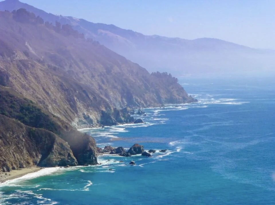
If you're visiting San Francisco but want to spend some time outside the city as well, be sure to include a road trip to Big Sur, California in your itinerary. Not only is Big Sur a fantastic destination in itself, but the drive to get there and the stops along the way are also spectacular.
The total distance from San Francisco is just over 150 miles, but since there is so much to see along the way, you’ll probably want to take at least two to three days for the journey.
Heading out of the city on Highway 1, you'll venture down towards Half Moon Bay and Santa Cruz. Both of these destinations are charming beachside resorts, and you can choose whether you want to visit just one or both towns, perhaps grabbing a bite to eat or taking in the amusements of the boardwalk.
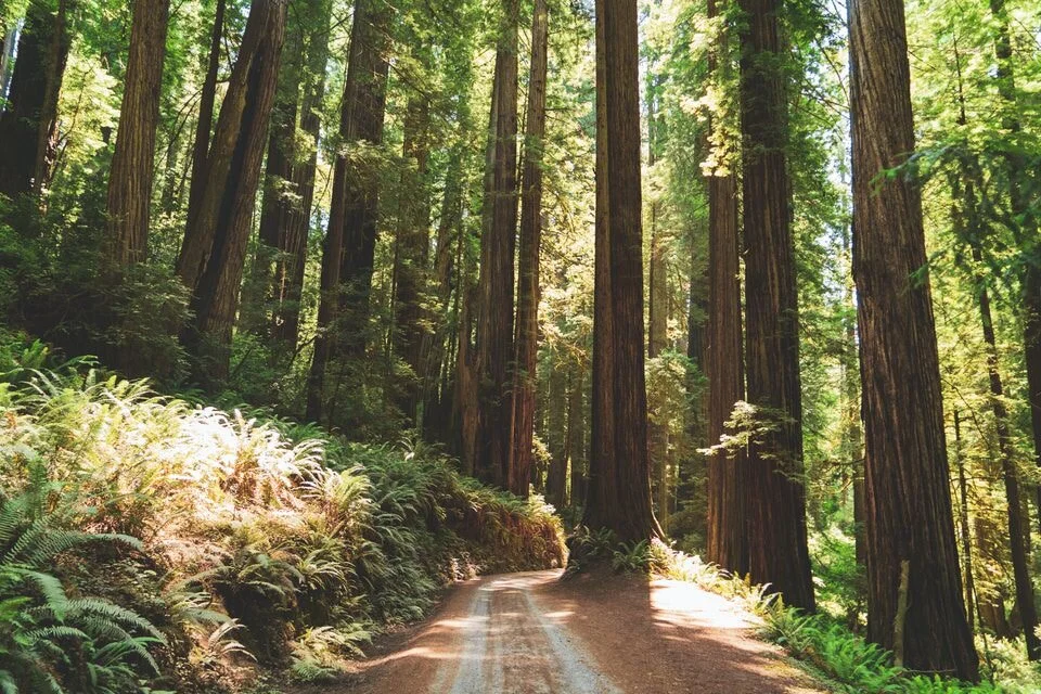
If you fancy something more rural, you can head slightly inland to the Butano State Park and/or Big Basin Redwoods State Park for some walking, mountain biking, or simply admiring the redwoods along the way.
You'll probably then want to stay overnight either in Santa Cruz or a little further up the coast before continuing the rest of your journey the next day.

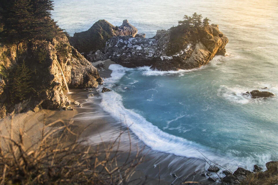
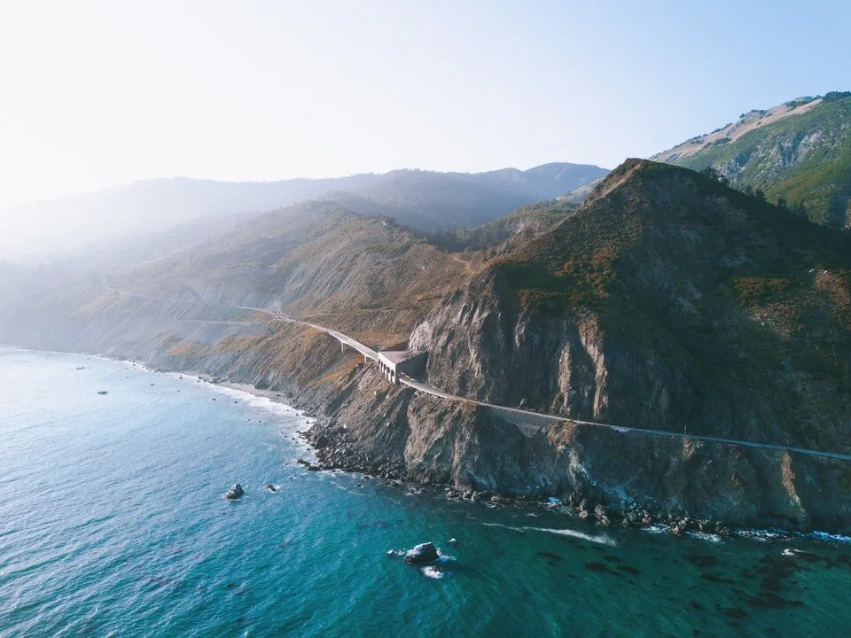
The next morning, you'll continue your drive down towards Monterey Bay. The town of Monterey has some great family activities (like the Monterey Bay Aquarium), but if you're longing to get to Big Sur you can continue straight on around the headland towards Pfeiffer Big Sur State Park.
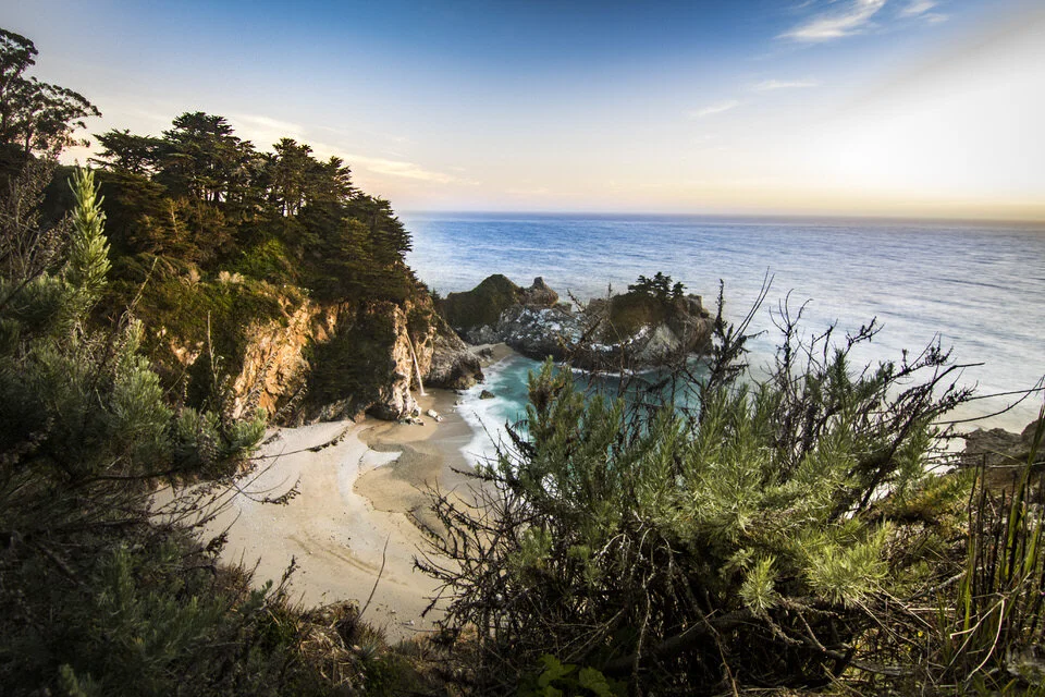
The drive into Big Sur is absolutely breathtaking! Once you arrive, you can enjoy the beach, take in the views of the McWay Falls, or add some adventure by hiking the Ewoldsen Trail.
While the drive from San Francisco to Big Sur is great all year round, it is especially beautiful in the spring. It is also lovely on autumn days when a chill is in the air in San Francisco, but it is warmer down on the coast.
- Road Trip Itinerary Contributed by Chrysoula from Travel Passionate
2. SAN FRANCISCO TO YOSEMITE & SEQUOIA NATIONAL PARKS
San Francisco to Yosemite & Sequoia National Parks Road Trip Quick Facts
Begin Location: San Francisco
End Location: Sequoia National Park
Total Distance: 365 miles
Number of Days Required: 7 days
Best Time to Go: Spring/Early Summer
Highlights: Yosemite Valley, Wawona Hotel, Giant Grizzly Sequoia Tree, Congress Trail, Grant Grove
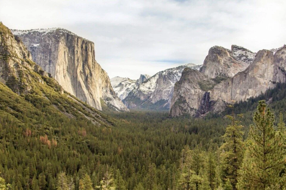
Another great California road trip is the journey from San Francisco to Sequoia National Park, via Yosemite National Park. It’s 365 miles along the shortest route.
The 195-mile leg from San Francisco to Yosemite National Park takes just under four hours without a break. There isn’t much to see along the way, so your best bet is to head straight to Yosemite. I recommend at least three days in Yosemite, especially if you like hiking.
Yosemite is famous for its dramatic rock formations and waterfalls. Some of the best Yosemite hiking trails highlights include:
(1) The Mist Trail to the beautiful Vernal Falls, Emerald Pool and Nevada Falls; Or, if you can grab Half Dome permits, you can hike the entire epic Half Dome trail, which is arguably one of the best hikes in the world. A good way to do this trail is by hiking up the Mist Trail and then hiking down the John Muir Trail, which is easier on your knees (plus its cool to hike on the iconic JMT Trail).
(2) The Lower Yosemite Falls hike, a relatively easy 1-mile loop, with nice views over Yosemite Valley.
(3) The Upper Yosemite Falls hike, a steep two-mile loop to Columbia Rock, where there are stunning views of Yosemite Valley, Half Dome, and Sentinel Rock plus an extra 0.5 miles to the falls.
(4) Glacier Point, with stunning views over the valley. The falls are fullest in spring/early summer, and this is the best time to do this road trip.
(5) And if you have some extra time, the Clouds Rest hike in Tuolumne is also worth checking out. It’s a longer day hike, but one of the best in the park (and doesn’t require a permit like Half Dome does.

Eventually, it will be time to leave Yosemite through the West Yosemite park entrance. The 170-mile drive to Sequoia National Park takes about 3.5 hours straight through. However, plan to stop off at the Wawona Hotel, a white Victorian-era hotel with huge porches and period furnishings, either overnight or just for lunch. Take a short detour to the Giant Grizzly, an enormous sequoia tree, and buy fruit at one of the many farm stands along the way.
It is worth spending at least two days in Sequoia National Park. Sequoia trees are the largest trees that exist in the world, and the biggest of them are in this national park. Visit General Sherman’s Tree, the largest of them all, and hike Congress Trail, which passes many more of the giant trees.
Be sure to take the Big Trees Trail in the late afternoon to have a chance of seeing wildlife grazing in the meadow there and visit the Grant Grove in the adjacent Kings Canyon National Park.

From there you can return to San Francisco or continue on to Death Valley National Park as part of a longer road trip, and if you’re still up for more hiking be sure to check out the Telescope Peak Hike in Death Valley (the tallest peak in the park).
- Road Trip Itinerary Contributed by James from Parks Collecting
3. SAN FRANCISCO TO MOUNT SHASTA
San Francisco to Mount Shasta Road Trip Quick Facts
Begin Location: San Francisco
End Location: Mount Shasta
Total Distance: 290 miles
Number of Days Required: 3-5 days
Best Time to Go: Summer
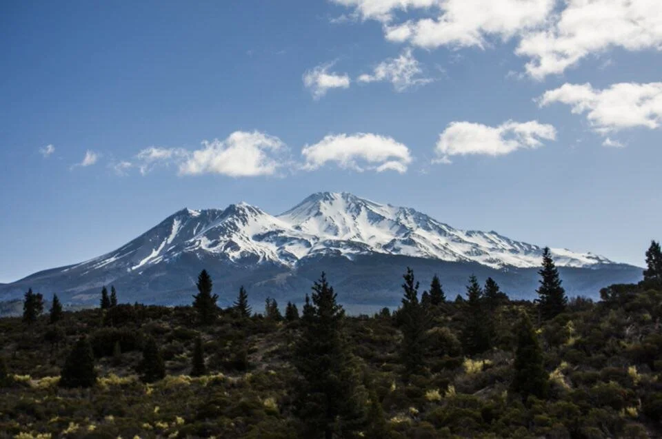
Highlights: Redding, Shasta-Trinity National Forest, Mt. Shasta, Klamath National Forest
There are lots of fun San Francisco day trips, but to enjoy the full experience of an area, sometimes it’s best to set a few days aside. That’s what you need to do when visiting Mount Shasta from San Francisco.
Mount Shasta is 290 miles from San Francisco and while that’s only a 5-hour drive, there is so much to do in the area that you really will want to take a few days to enjoy it all. Mount Shasta is a great location for outdoor lovers. It offers a range of fun activities such as camping, golf, fishing, hiking, climbing, horseback riding, and snow sports in the winter.
In fact, many people travel from all over the state to climb Mount Shasta. It’s a very popular peak to climb (since it’s a California 14er peak), and the most popular season to climb it is from May to July.
Getting to Mount Shasta is a simple drive from San Francisco. Jump on Highway 8 and head towards Sacramento, then use the 505 to join Highway 5 and head north towards Mount Shasta. The city of Redding is a great place to stop and pick up supplies before you head through Shasta-Trinity National Forest.

Forming part of the Cascades mountain range, Mt. Shasta is a potentially active volcano, and it makes for one of the more challenging climbs for mountaineers. Reaching the peak is far from the only option for enjoying the alpine scenery. There are plenty of hiking and cycling trails that offer wonderful views of the mountain.
I’d recommend setting aside at least 3 days to enjoy the area and as many as 5 days if you also want to head west and visit Klamath National Forest.
In the colder months head to Mount Shasta Ski Park for skiing and other fun activities. If you’re a hiker, the trails are closed during the winter so you will have to visit during the warmer months.
-Road Trip Itinerary Contributed by Robert from Roam Yonder
4. SACRAMENTO TO EUREKA
Sacramento to Eureka Road Trip Quick Facts
Begin Location: Sacramento
End Location: Eureka
Total Distance: 400 miles
Number of Days Required: 3-10 days
Best Time to Go: April-November
Highlights: Clear Lake State Park, Wineries, Redwoods National Park, Eureka
Road tripping through California can be one of the most scenic drives you’ll ever take - if you know where to go! Follow my suggested route from Sacramento to Eureka, and you will discover some of Northern California’s hidden gems that are well worth the drive.
This 400-mile road trip can be completed in 3-10 days, depending on how much hiking and exploring you’d like to do. If you want to avoid the Northern Californian cold, then I recommend taking this trip anytime from April to November.
Starting off in Sacramento, head northwest towards Clear Lake for your first stop at the ultimate water sports destination. This lake provides visitors with 100 miles of shoreline, plenty of activities, and access to Clear Lake State Park. If you want to explore the local Native American history, take a walk on the Indian Nature Trail which takes you through what was once a Pomo tribe village. If wine is more your thing, the surrounding hills produce impressive Cabernets and Sauvignon Blancs.

After your stay in Clear Lake, head northwest until you get to Eureka (feel free to stop along the way!) and grab a bite to eat before continuing on the coastal Route 101 to Redwood National Park. Don’t worry, you’ll have time for Eureka at the end of your trip.
When in the Redwoods, spend a few days here to truly see and experience this primeval wilderness that is home to the tallest trees on Earth. There are several great hikes that meander through these incredibly impressive trees including the short Lady Bird Johnson Grove Trail or the longer, more difficult McArthur Creek Loop Trail.
After your hikes, head back to Eureka for the end of your trip. Don’t forget to walk this historic town and admire the gorgeous Victorian mansions that date back to the logging heyday in the 1850-1880s.
Side trip opportunity: If you’re eager to get some backpacking in then you really should consider checking out the Lost Coast Trail, which is an epic stretch of coastline near this road trip route, largely untouched by humans due to its rugged cliffs and seas.
- Road Trip Itinerary Contributed by Ashley from Impact Winder
5. DEATH VALLEY TO BISHOP
Death Valley to Eastern Sierras Road Trip Quick Facts
Begin Location: Death Valley
End Location: Eastern Sierras
Total Distance: ~100 miles
Number of Days Required: 3 days
Best Time to Go: Spring or Fall
Highlights: Death Valley National Park, Mt. Whitney, Bishop, Alabama Hills

Are you itching to get on the road and see something new? Don’t want to go to yet another crowded place that sees millions of tourists?
Consider a road trip from Death Valley National Park to the Eastern Sierra Mountains. Begin your trip outside of Amargosa Valley, Nevada, and drive through Death Valley east to west along California Highway 190, the main road that runs through the park.
I recommend spending at least one day at Death Valley National Park. If you are short on time, stop at several scenic overlooks along Highway 190 such as Zabriskie Point, Mesquite Flat Sand Dunes, and Harmony Borax Works, an exhibit under an open sky where you can learn the park’s history. And don’t forget to bring your camera!
Continue along California State Route 190 until you arrive in Olancha, a census-designated place along U.S. Route 395. From there, continue north along U.S. Route 395. Several towns along this route comprise the area called Owens Valley: Lone Pine, Independence, Big Pine, and Bishop are small communities with an Old West vibe and plenty of recreational opportunities such as hiking, biking, kayaking, and camping.
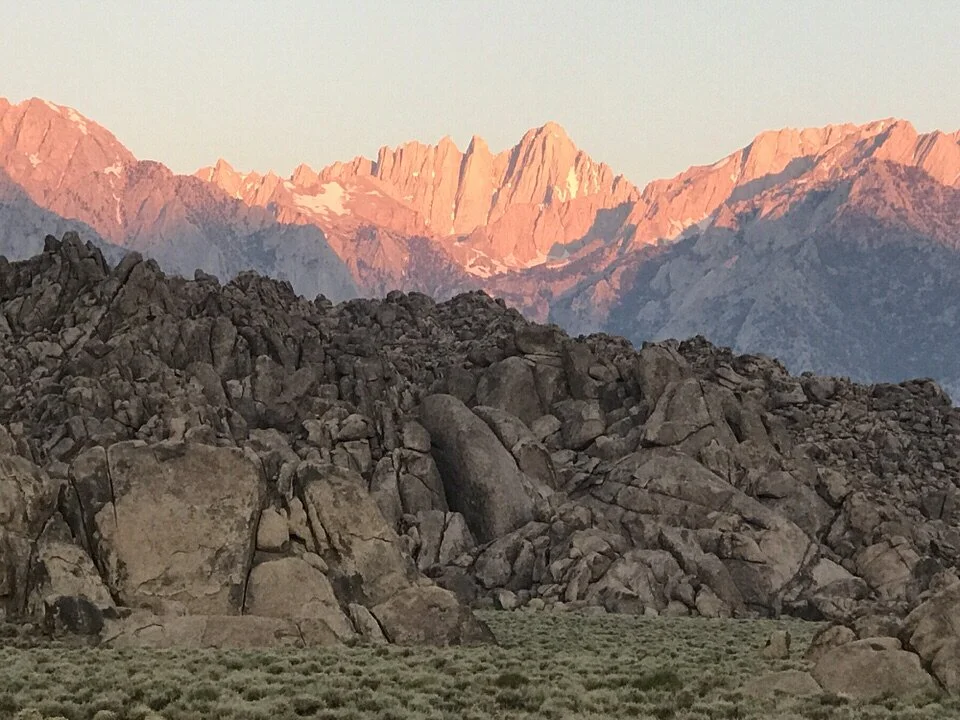
Lone Pine is home to Mount Whitney, the highest mountain in the contiguous United States. If you want to hike it, a Mount Whitney permit is required to summit.
Don’t feel like hiking? Head to Alabama Hills, a collection of sandstone formations in Lone Pine where you can wander and take scenic shots, and spend some time camping here as well (it’s free camping on BLM land).
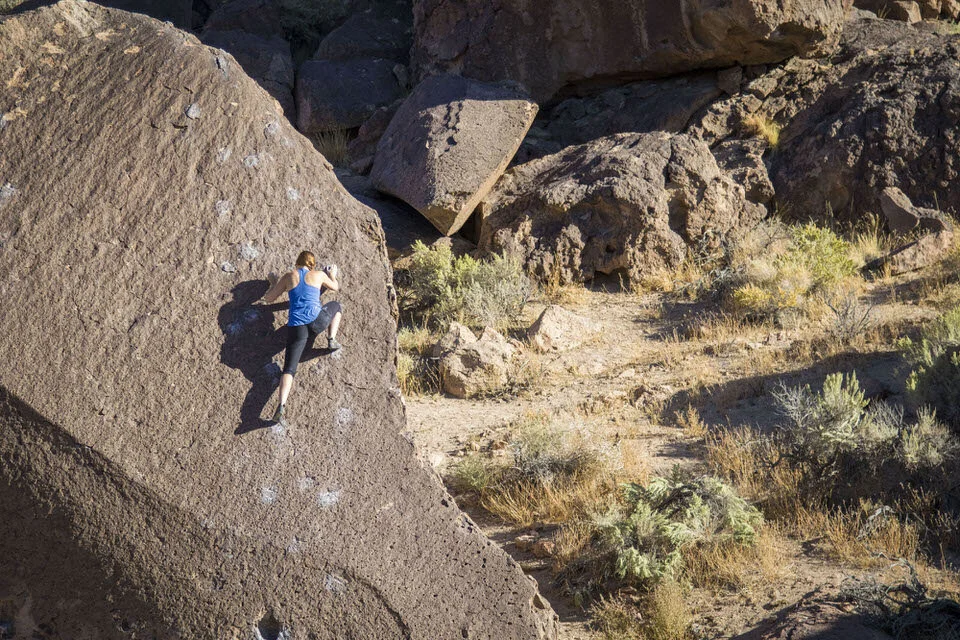
In the winter, many people flock to Bishop, California for some world-class Bishop bouldering (a style of rock climbing), but the season for bouldering here is really more from November to March.
Make sure to spend at least 3 days exploring Death Valley and the Eastern Sierras, and save this trip for a shoulder season. In summer, Death Valley has extremeley hot temperatures that reach into triple digits which make being outside tough. In winter, the Eastern Sierras often have snow which can make driving and hiking more complicated and dangerous.
- Road Trip Itinerary Contributed by Daria from The Discovery Nut
6. EASTERN SIERRAS ROAD TRIP
Eastern Sierras Road Trip Quick Facts
Begin Location: Bakersfield
End Location: Yosemite
Total Distance: ~300 miles
Number of Days Required: 7 days
Best Time to Go: Summer
Highlights: Mt. Whitney, Bishop, Mammoth Lakes, Tuolumne Meadows, Yosemite Valley
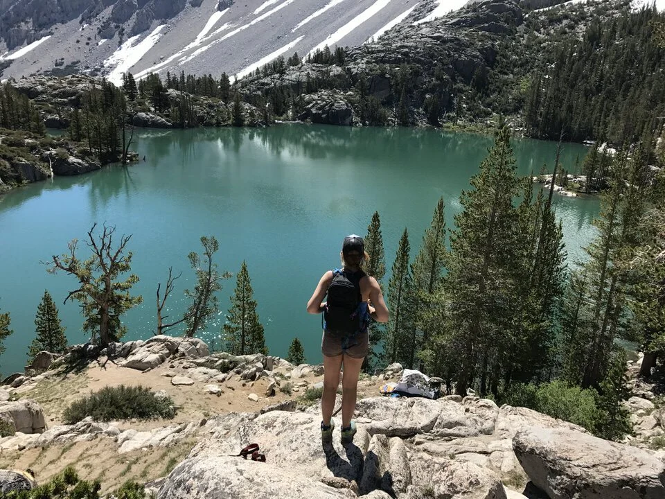
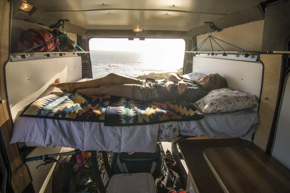
Driving through the Eastern Sierras showcases the natural wonders and outdoor spaces from Bakersfield to Yosemite National Park and is one of the best California road trips. There is so much to see and do outside on the way that you should plan to spend about a week on this road trip.
Some of this trip is similar to other California road trips in this post, but I wanted to make a few distinctions and highlight even more of the unique areas here and showcase some of my favorite hikes in the Eastern Sierra.
From Bakersfield, you’ll first head toward the town of Lone Pine, but I recommend taking the slightly longer route on highway 178 that goes through Kern Canyon.
This road through Kern Canyon is beautiful and filled with awesome outdoor opportunities like white water rafting on the Kern River (there are guided trips out of Isabella). You can also find some great hikes like the Powers Peak Trail, and the Kern River Brewing Company is worth visiting at least for lunch on your way through if you decide not to spend a day here.
Then take the 178 all the way to the 395 where you’ll continue on your way to Lone Pine.
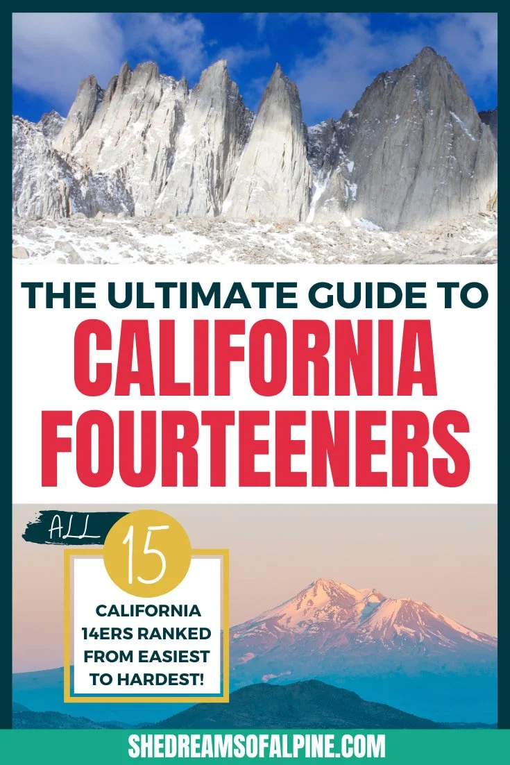
As mentioned earlier in this post, Lone Pine is home to the epic California 14er, Mt. Whitney, the tallest peak in the lower 48 states at 14, 505 feet. If you plan ahead and are lucky enough to get a Mt. Whitney permit, you can take the tough Mount Whitney trail to the summit. Otherwise, you can simply do a shorter hike and marvel at the view of this epic mountain.
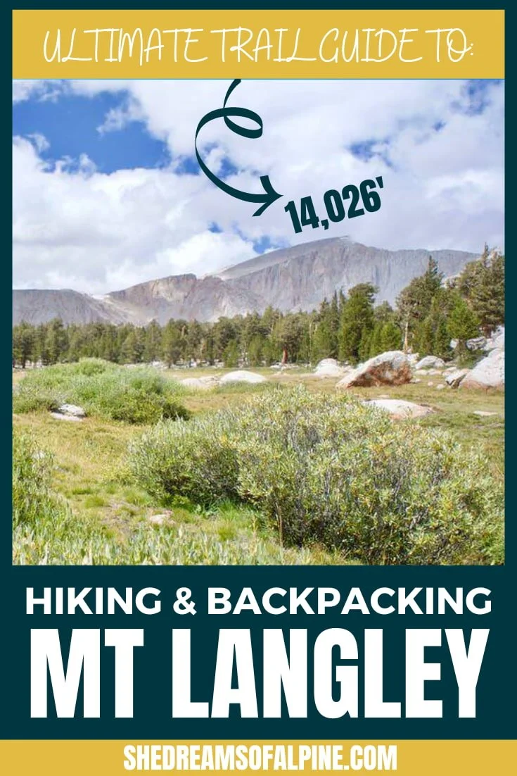
You can also opt to hike Mount Langley instead, which is another epic peak in the Sierra Nevadas that is less competitive for hiking permits. If you’ve never hiked a 14,000 foot peak, be sure to check out these tips for hiking 14ers before you attempt your first one.
If you have extra time and are looking for a challenge, you can backpack from Onion Valley to Whitney Portal for a full Sierra Nevada experience. This trail covers one of the best sections of the John Muir Trail (the iconic California thru-hike).
Then you’ll continue on the road to Bishop, where you can pursue your favorite outdoor passion, whether that’s hiking, mountain biking, or climbing. Bishop is famous for its bouldering, especially the giant and intimidating highballs of the Peabodys.
If it’s hot out, you likely won’t want to boulder, but there are some fun swimming holes near the town of Bishop where you can cool off.

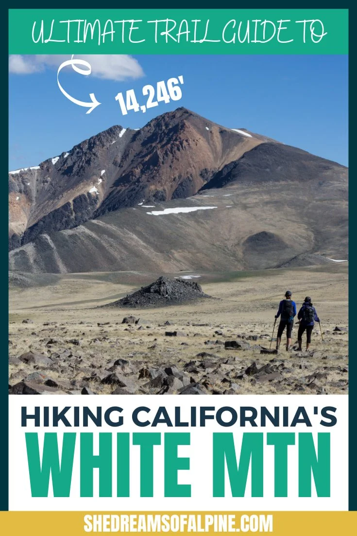
From Bishop you can also venture off to day hike another 14,000 foot peak, White Mountain Peak. This is one of the few California 14ers that can be easily hiked in a day. Also be sure to check out the Old Bristlecone Pine Forest on your drive up. These are some of the oldest trees in the world!
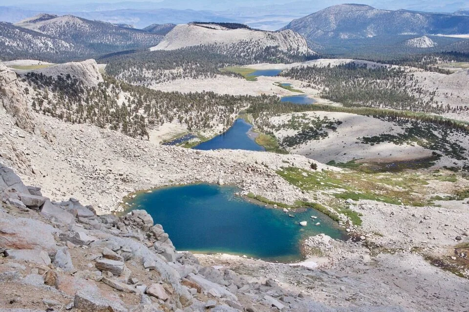
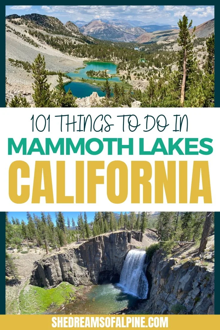
Next, make your way to the cute mountain town of Mammoth Lakes to spend some time at higher elevations for cooler summer weather. Here you can do some more hiking, as well as fishing, and you can also relax in the natural hot springs. Check out this list of 101 things to do in Mammoth Lakes in the summer for even more ideas.
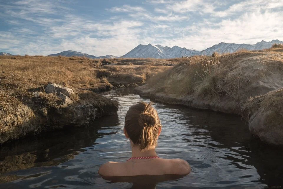
Mammoth Lakes is a hub for all things adventurous. It’s worth spending 2-3 days here to sample everything it has to offer. Mammoth has a little bit of something for everyone: mountain biking, road biking, day hiking, camping, four-wheeling, breweries, fly-fishing, lakes (so many lakes!)... its one of my favorite spots in the Eastern Sierras.
If you have time, also check out June Lake and Mono Lake as well during your visit to this area.
Your final destination is Yosemite National Park. When you enter the park from the east side, you’ll drive through Tuolumne Meadows. Make sure to take some time to appreciate the alpine lakes and wildflowers there before you head into the heart of Yosemite Valley.
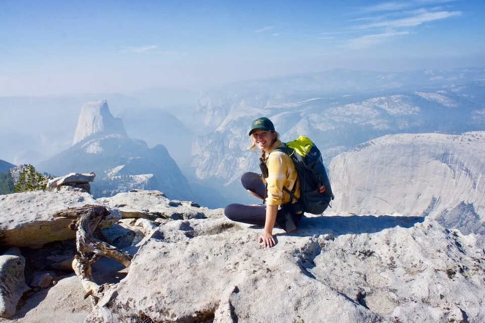
Yosemite National Park never gets old in my opinion. You can spend several days exploring the valley, marveling up at its giant granite walls, and hiking some of the best trails in Yosemite from the iconic Half Dome hike to the equally epic Clouds Rest hike.
Yosemite is also the end of the classic John Muir Trail hike (or beginning depending on which trailhead you start at). You need JMT permits to hike the full 211-mile JMT trail, but you can backpack certain sections of the JMT like the section from Tuolumne Meadows to Devils Postpile easily over 3 days.
If you live in California, it’s likely you’ll make many trips out here to explore everything it has to offer. The list is endless!
- Road Trip Itinerary Contributed by Allison from She Dreams of Alpine
7. LAKE TAHOE TO MOUNT SHASTA
Lake Tahoe to Mount Shasta Road Trip Quick Facts
Begin Location: Lake Tahoe
End Location: Mount Shasta
Total Distance: 250 miles
Number of Days Required: 5-7 days
Best Time to Go: Summer
Highlights: Lake Tahoe, Plumas National Forest, Lassen Volcanic National Park, McCloud Falls, Panther Meadow, Lake Siskiyou, Heart Lake
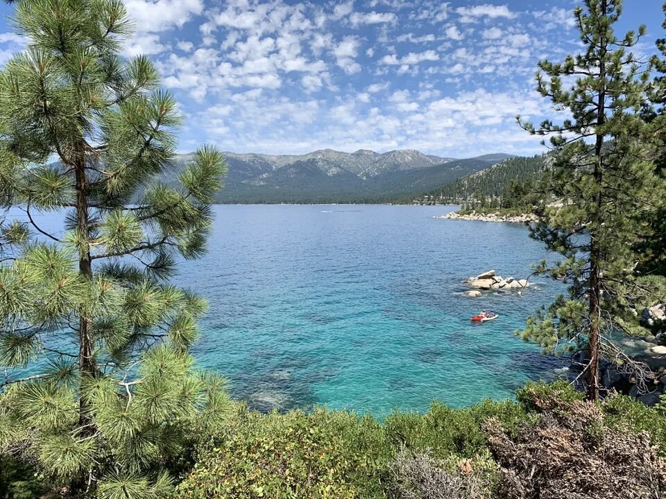
Along the Nevada and California border you’ll find the beautifully stunning Lake Tahoe. Start your journey by spending three days in Lake Tahoe. Explore amazing hiking trails, relax on the stunning rocky shores, go boating, and explore a few scenic viewpoints, such as Cave Rock.
The lake itself is huge and there are several small towns to explore. Stay on the north shore for a more tranquil visit or enjoy the high-rise casinos on Tahoe’s southern coast.
After you’ve had your fill, head north towards Mt. Shasta. As a potentially active volcano, this high-flying peak is a beautiful California landmark you can’t miss. Located near the Oregon and California border, the scenic drive towards Shasta takes you through a few must-see attractions. Take the longer route (4 hours and 50 minutes or 252 miles) through Truckee and the Plumas National Forest.

Stop along the way at many of the scenic areas such as Indian Falls, Lake Amore, or Lassen Volcanic National Park. If you find yourself with extra time, Lassen Volcanic National Park is worth spending the day hiking in while soaking in the unique geography.
Once you reach Mt. Shasta, there’s plenty to explore including taking a dip at McCloud Falls, camping at Panther Meadow, visiting Lake Siskiyou, and hiking to Heart Lake. You’ll want to spend at least three days exploring the area.
This excellent northern California road trip brings the best of nature straight to you. You’ll ideally want a week for the entire trip, but if you’re short on time, you can easily see the highlights in just 5 days. So make a splash this summer with this watery alpine adventure!
- Road Trip Itinerary Contributed by Meg from Fox in the Forest
8. RUSSIAN RIVER VALLEY ROAD TRIP
Russian River Valley Road Trip Quick Facts
Begin Location: Healdsburg
End Location: Jenner
Total Distance: 35 miles
Number of Days Required: 2-3 days
Best Time to Go: Spring through Fall
Highlights: Armstrong Redwood State Natural Preserve, Kayaking the Russian River, Goat Rock State Beach, Sea to Sky Trail, Korbel Champagne Cellar

The Russian River Valley is a great location for a quick and quiet California road trip. It’s less than two hours from San Francisco but it’s a whole other level of relaxing vibe with redwoods, rivers, and wine.
This road trip route starts in Healdsburg heading southwest along Westlake Road. It goes further west on River Road, eventually merging with Highway 116. The road ends at the Russian River Estuary near Jenner, where you can then explore north or south along coastal Highway 1.
The whole route is only 35 miles, and you could zoom through it in under an hour. But that’s not the point! The point is to make this a slow road trip, spending more time out of the car than in it. This region is pretty rainy from December through March, but any other time of year would be lovely.

Here are a few top things to do in Guerneville and along the Russian River:
Hiking in Armstrong Redwood State Natural Preserve: Armstrong has a well-preserved grove of ancient Coast Redwoods, some up to 1,000 years old. The park has a visitor’s center, camping and picnic grounds, and 20 miles of hikes ranging from easy one-mile interpretive trails to nine-mile ridge trails.
Kayaking the Russian River: From Guerneville, you can take a 10-mile self-guided boat trip down the river toward Jenner. It takes a leisurely 4-5 hours and Burkes Canoes will shuttle you back.
Stroll on the beach: There are a whole series of blufftop and beach trails that run just north and south of the estuary at Jenner. Check out Goat Rock State Beach, Kortum Trail, the Sea to Sky Trail… or just pick a lovely beach and take a stroll.
Drink some wine & beer: There are wineries and breweries dotted all throughout the Russian River Valley (here’s a map), and you can stop into any of them for a tasting. Be sure to visit the MacRostie Winery for their incredible views and the Korbel Champagne Cellar for bubbly and cave tours. If you’re a fan of beer, you’ll also want to check out the Russian River Brewing Company.
- Road Trip Itinerary Contributed by Carol from Wayfaring Views
BEST SOUTHERN CALIFORNIA ROAD TRIPS
9. LOS ANGELES TO PALM SPRINGS
Los Angeles to Palm Springs Road Trip Quick Facts
Begin Location: Los Angeles
End Location: Palm Springs
Total Distance: ~100 miles
Number of Days Required: 4-5 days
Best Time to Go: Spring or Fall
Highlights: Santa Monica Beach, Runyon Canyon, Cabazon Dinosaurs, Idyllwild, Palm Springs Aerial Tramway

One of the most popular Southern California road trips for outdoor lovers is a Los Angeles to Palm Springs road trip. Both Los Angeles and Palm Springs are conveniently surrounded by mountains and national parks, making them ideal for outdoor adventure opportunities, and home to some of the best hikes in Southern California.
Before departing Los Angeles, be sure to spend some time in the ocean near Santa Monica or Malibu. Both areas are ideal for swimming and surfing and even sailing. There’s also a boardwalk along the coast in Santa Monica, called the Marvin Braude Bike Trail, that is perfect for a bike ride along the beach.
You also don’t want to miss the Runyon Canyon trail in Hollywood to hike to the Hollywood Sign. This is a short but steep hike popular with locals. If you’re up for a challenge, consider hiking Mount Baldy as well, which is one of the most popular challenging hikes in the Los Angeles area.
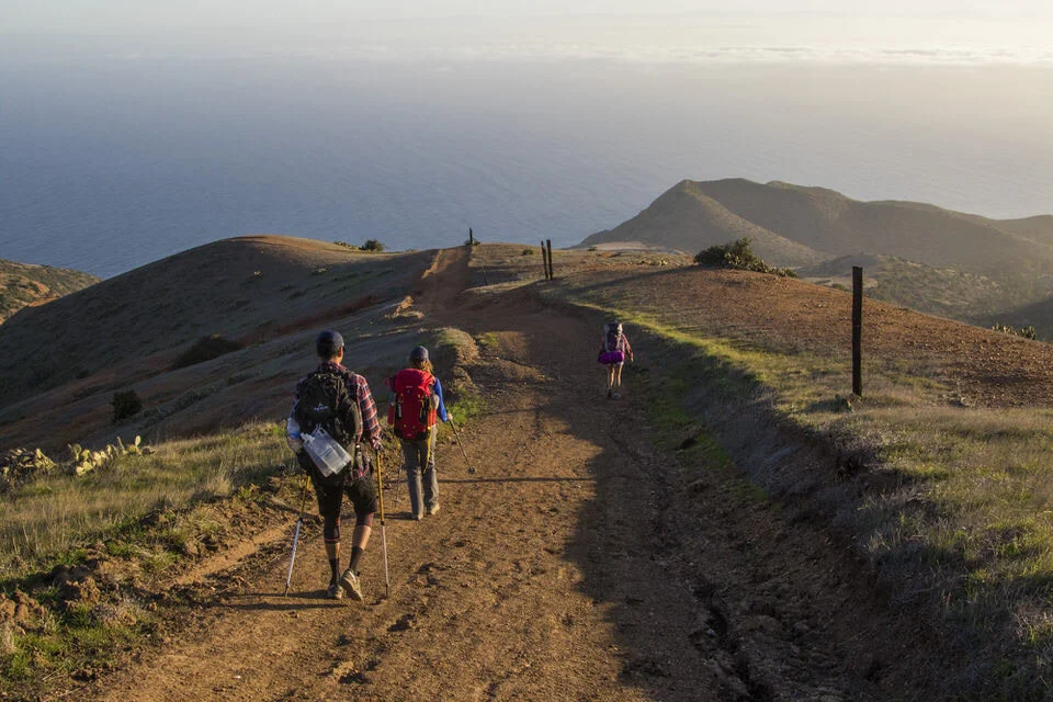
If you have more time to set aside for this trip, it’s also worth visiting Catalina Island. A quick ferry ride from Los Angeles will take you to this beautiful California island and you can spend time exploring & relaxing in the town of Avalon.
If you’re up for it, you could even spend 3-4 days backpacking the entire island via the Trans-Catalina Trail. You could also just hike a section of the Trans-Catalina Trail if you don’t want to hike the whole thing. Check out our Trans-Catalina Trail Map to see the different hiking sections along this 40-mile trail.
After departing Los Angeles, head east towards Palm Springs with a stop in Idyllwild, a small community in the San Jacinto Mountains. Idyllwild is a popular destination for its hiking, fishing, climbing, and camping. Try out one of the local hikes and grab lunch in town before heading out.
After your time in Idyllwild, continue east on the 10 freeway to the town of Cabazon. Here, you’ll find a unique roadside attraction called the Cabazon Dinosaurs. You can’t miss the 65-foot tall T-Rex or 150-foot long Brontosaurus. This is just a quick stop, but it's unique and worth it for the pictures.

Finally, you’ll head east into the town of Palm Springs. The city is known for its art deco architecture, sunny weather, and poolside parties. For those interested in outdoor adventures, you’ll find lots of awesome hikes in Palm Springs, including the trails in Indian Canyon. And be sure to check out the Palm Springs Aerial Tramway for incredible views and a chance to visit Mt. San Jacinto State Park.
- Road Trip Itinerary Contributed by Eden from Rock a Little Travel
10. SAN DIEGO TO COACHELLA VALLEY
San Diego to Coachella Valley Road Trip Quick Facts
Begin Location: San Diego
End Location: Coachella Valley
Total Distance: 500-600 miles
Number of Days Required: 4-7 days
Best Time to Go: Spring
Highlights: Anza-Borrego State Park, Imperial Sand Dunes, Salvation Mountain & Slab City, Joshua Tree National Park, Palm Springs

The Coachella Valley loop is a California road trip staple. At approximately 500-600 miles, the Coachella Valley loop will take you around the best of Southern California's deserts. This loop also includes the darkest night skies, clear from light pollution, anywhere in SoCal.
The best time of year for this trip is definitely spring, around April, when the wildflowers are blooming and the valley hasn't hit peak summer temperatures yet. During spring, you might also catch one of Coachella Valley's coolest outdoor art exhibits, Desert X.
For a leisurely pace that allows for some hiking and climbing, budget for a week for this road trip. However, on a time crunch, you can speed through in a long 4-day weekend.
Starting from San Diego (although the road trip could also be done from Los Angeles), head east to Anza-Borrego State Park. At Anza-Borrego, you can hike through slot canyons and find hidden oases surrounded by wildflowers, as well as incredible iron sculptures in the nearby town. Stay the night if you have time, otherwise continue onward to the Imperial Sand Dunes for ATVing and enjoying the sunset.
Wake up bright and early the next day to check out Salvation Mountain and Slab City, coined the ''Last Free Place in America,'' for contemporary art pieces that provoke social criticism. From Slab City, head north along the Salton Sea to Joshua Tree National Park.
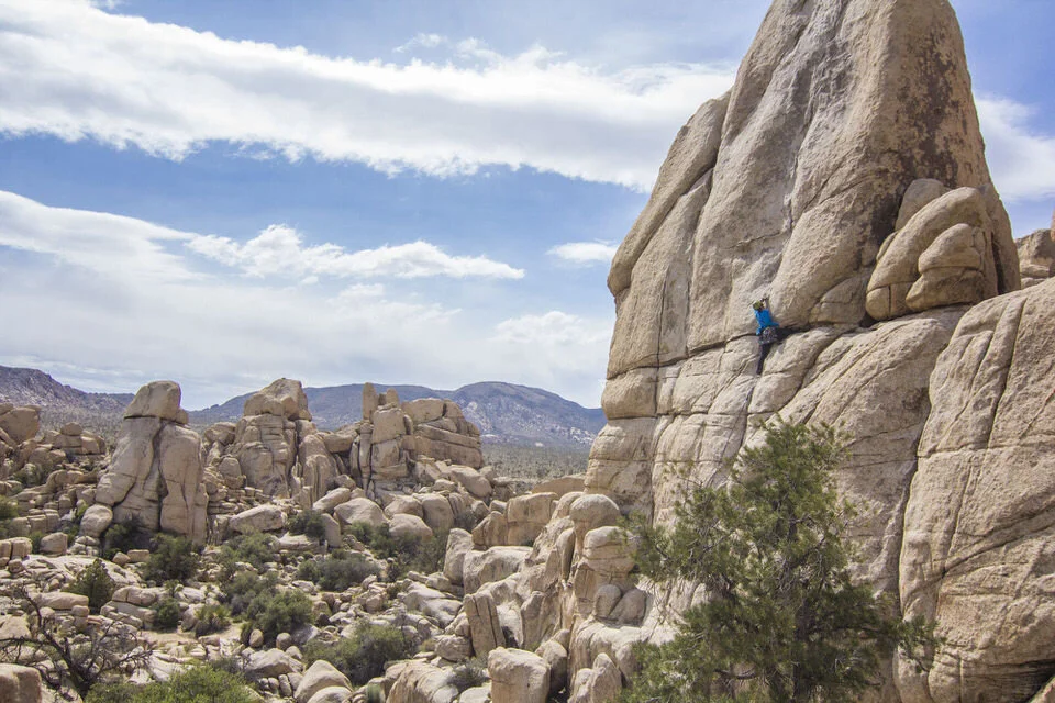
Although this national park is most known for its iconic Joshua trees, which are part of the yucca family, Joshua Tree is also a popular destination for bouldering and climbing! In fact, Joshua Tree is one of the best climbing areas in California. Most of the climbing in Joshua Tree is easily accessible, and there’s a mix of all styles here, though it’s definitely more of a trad climbing and bouldering destination than sport climbing.
If you’re not a climber, don’t worry, Joshua Tree has plenty of amazing trails for hiking as well. Some of the best hikes in Joshua Tree include Hidden Valley, Split Rock, and Fortynine Palms Oasis.
To finish your southern California road trip, you can head back to San Diego after a night in Joshua Tree. Or, if you have more time, go down to nearby Palm Springs to explore the surrounding canyons and maybe catch a glimpse of California's incredible wildflower super blooms!
- Road Trip Itinerary Contributed by Kay from The Awkward Traveller
BEST EXTENDED CALIFORNIA ROAD TRIPS
11. SAN DIEGO TO MONTEREY
San Diego to Monterey Road Trip Quick Facts
Begin Location: San Diego
End Location: Monterey
Total Distance: 440 miles
Number of Days Required: 2-3 days
Best Time to Go: Spring or Fall
Highlights: Orange County, Los Angeles, Big Sur, Carmel, Monterey Aquarium, Cannery Row
One of the most famous sections of the Pacific Coast Highway in California is the Big Sur coastline, and this California coast road trip from San Diego to Monterey will take you right through it. Along the way you can enjoy stops in the laid back coastal cities of Southern California as you travel through North County, San Diego, Orange County, and Los Angeles.
After you enjoy the surfer town vibes and mentality of Southern California, you'll travel along the rugged coast of Central California and soon come face to face with the dramatic cliffs and roaring waves of Big Sur. A must-do hike in Big Sur is the McWay Falls trail that leads you to the view of a tall waterfall right next to the open water of the Pacific.
As you continue your road trip up the PCH, after miles upon miles of coastline marked by cliffs and waterfalls and pine trees -- and even colonies of elephant seals -- you'll come to the beautiful seaside communities of Carmel and Monterey.
Check out ritzy Carmel and its charming neighborhoods full of beach cottages plus a lovely downtown area, then head onto Monterey, where you'll find some of the best tourist attractions of the PCH drive: the Monterey Bay Aquarium and Historic Cannery Row plus gorgeous beaches with rocky islands not too far out in the sea, where seals and sea lions are often frolicking.
The total distance from San Diego to Monterey along the PCH is 440 miles. It can be done in a day, but it's best to give yourself two to three days to make the drive to truly enjoy the stops and sights along the way.

To have more daylight hours to enjoy the views, avoid winter, when the sun sets quite early in California. To avoid crowds, don't do the drive over holiday weekends, and try to go in fall or spring instead of summer.
This is just a sampling of things you can do along this drive. Other notable stops include: Ventura (great for surfing), Pismo Beach (know for its epic beach sand dunes), San Luis Obispo, Morro Bay (a cute beach town with great clam chowder!), and so much more! You can even extend your trip and. make a side trip East to Paso Robles (known for its wineries) while passing through San Luis Obispo.
- Road Trip Itinerary Contributed by Gina from Evergreen & Salt
12. PACIFIC COAST HIGHWAY
Pacific Coast Highway Road Trip Quick Facts
Begin Location: Dana Point
End Location: San Francisco
Total Distance: 650 miles
Number of Days Required: 7-10 days
Best Time to Go: Early Spring or Late Fall
Highlights: Malibu, Santa Barbara, Solvang, Pismo Beach Butterfly Grove, Morro Bay, Hearst Castle, Big Sur
We’ve covered sections of the Pacific Coast Highway (PCH) in this post, but if you’re up for the full PCH experience, check this out!
The Pacific Coast Highway is another one of the best California road trips (next to the Eastern Sierras road trip), taking you all the way along the coast from Dana Point in Southern California up to San Francisco and beyond following Highway 1 the whole way.
You have so many options for stops along the way that you should plan to take a week or two to make this 650 mile drive and see everything along the way.
After leaving Dana Point, you’ll head up through Santa Monica and Malibu, where you can stroll the promenade and play on the beach. Then make your way to the adorable Danish-style town of Solvang to appreciate the architecture – including a windmill – and do some wine-tasting.

If you’re taking this PCH road trip between November & February, plan for a stop at the Pismo Beach Butterfly Grove. Over 10,000 monarch butterflies flock to the beach every year during their migration, and it is truly a stunning sight to behold.
Continue your drive up to Morro Bay, which is right in the middle between Los Angeles and San Francisco. The harbor is home to a variety of marine life, including seals, sea lions, and otters. It also features the distinctive volcanic formation of Morro Rock. There’s also some great hiking and even rock climbing in this area.
For something truly unique on your Pacific Coast Highway road trip, stop in San Simeon for a tour of the grand estate of Hearst Castle. This extravagant mansion encompasses 165 lavishly-decorated rooms, as well as acres of gardens, fountains, pools, and palm trees, and it is a designated National Historic Landmark.
After all that opulence, escape up the coast to Big Sur and its secluded seaside cliffs. Then finish your trip along the Pacific Coast Highway in San Francisco or continue all the way up to Mendocino.
- Road Trip Itinerary Contributed by Allison from She Dreams of Alpine
Which awesome California road trip are you excited to take on? Let us know in the comments!
Looking for More CALIFORNIA adventures?
If you’re looking for more ways to explore California, check out these blog posts:
And here are some specific trail guides for some of the most amazing hikes in California:
Cheers,
Allison - She Dreams of Alpine


How to Get a Mt. Whitney Permit: Understanding the Permit & Lottery Process for Day Hiking and Backpacking the Whitney Area | Mount Whitney is the tallest peak in the lower 48 states, which makes it a very popular peak to hike and climb. Due to its popularity, there is a very structured permit process, and this post covers everything you need to know about grabbing Mount Whitney permits so you can plan your hike up this epic California peak. | shedreamsofalpine.com