15 Best Sedona Hikes That You Need to Do

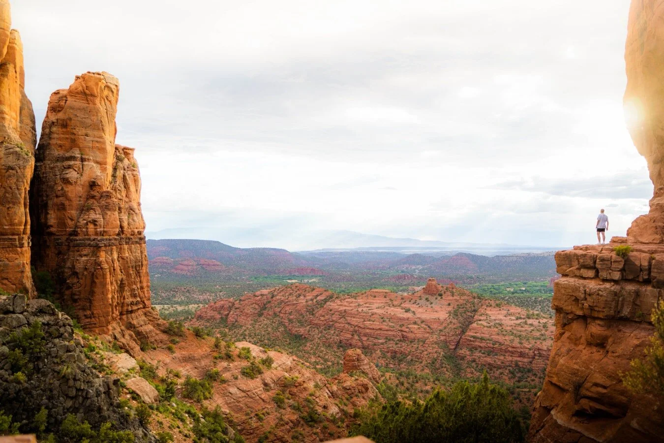
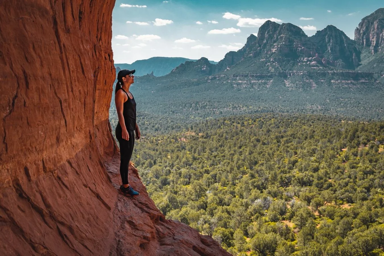
If you've ever had the opportunity to visit Sedona, Arizona then you know what magical, beautiful place it is. The stunning red rocks of Sedona sit on the native land of the Hopi, Pueblos, Western Apache, and Hohokam, and there are so many amazing outdoor adventure opportunities, including some of the best trails for Arizona hiking, and arguably some of the best hikes in the world.
Because there are limitless opportunities for great hiking in Sedona, I've pulled together a list with 15 of the best Sedona hikes to help you know where to start! You really can't go wrong with any of these best hiking trails in Sedona below, and you are certain to fall in love with this place and its mesmerizing red rock features once you visit!
This post will go into details of the 15 best hikes in Sedona, and if you are interested in more guides for hiking in Arizona, be sure to check out our other resources at the bottom of the post. You’ll find links to some classic hikes in Arizona include a complete guide to hiking Havasu Falls (+ an essential Havasu Falls backpacking gear list) and a trail guide to hiking Arizona's tallest peak, Humphreys Peak!
ABOUT THIS GUIDE TO THE BEST HIKES IN SEDONA
We’ve organized the list of hikes in Sedona by difficulty, so you can easily find a perfect hike for you! Since everyone has a slightly different gauge of what is “easy” or “difficult” hiking, here is how we’ve defined the list:
1. Best Easy Hikes in Sedona - If a trail is less than 3.5 miles OR under 350 feet of total elevation gain, the hike is rated as “easy”
2. Best Moderate Hikes in Sedona - If the trail is within the 4-6 mile range OR between 350-500 feet of total elevation gain, the hike is rated as “moderate”
3. Best Difficult Hikes in Sedona - If a trail is 6-10 miles long OR between 500 to 1.500 feet of total elevation gain, the hike is rated as “difficult”
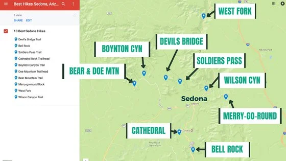
Sedona Hiking Map
Many of the best Sedona hiking trails are located only a short distance from the center of Sedona. Some of the trails are very popular and often crowded (the price you pay for easy, accessible beautiful hiking trails), but some of the trails afford you a bit more solitude in the wilderness area surrounding Sedona.
Our list of top hikes in Sedona has a bit of everything, including a trail that is a bit more like rock scrambling than true hiking!
Below is a map showing the location of these Sedona trails.
So without further ado, here are 15 of the best Sedona hikes to ignite your next Sedona Arizona hiking adventure!
BEST EASY HIKES IN SEDONA
1. Fay Canyon Hike
Fay Canyon Hike Quick Facts:
Trail to Summit: Fay Canyon Trail
Type of Trail: Out & Back
Total Mileage: 2.5 miles round trip
Total Elevation Gain: 273 feet
Difficulty: Easy
Permit Required: You must display a daily Red Rock Pass ($5) or show your Annual National Parks pass for parking.
The Fay Canyon Trail is truly a perfect introduction to Sedona hiking trails. It is a short out-and-back hike without a lot of elevation gain, so hikers of all levels will be able to enjoy the stunning scenery along the way.
As you make your way along the Fay Canyon Trail, you’ll be surrounded by red sandstone walls on either side. You’ll also encounter lots of native plants, including yucca, cacti, and even desert wildflowers when they’re in season.
One of the highlights of this trail is Fay Canyon Arch, a cool formation made of sandstone. It’s surprisingly easy to miss, so keep an eye out on the north side of the trail as you hike. You can also take a short detour off the main trail to hike directly to the base of the arch.
Pro Tip: When the actual trail ends, you can scramble up some rock for a beautiful vista of Fay Canyon. You’ll be able to see Bell Rock and even Courthouse Butte off in the distance.
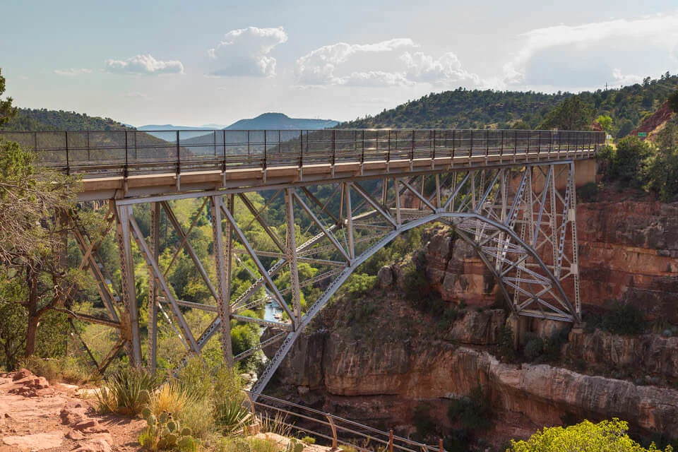
2. Wilson Canyon Hike
Wilson Canyon Hike Quick Facts:
Trail to Summit: Wilson Canyon Trail
Type of Trail: Out & Back
Total Mileage: 2.6 miles round trip
Total Elevation Gain: 426 feet
Difficulty: Easy
Permit Required: You must display a daily Red Rock Pass ($5) or show your Annual National Parks pass for parking.
The Wilson Canyon Trail is another one of the easier, short hikes in Sedona and starts at the iconic Midgley Bridge. There are actually a lot of trails in this area, so if you finish this trail and still are up for hiking more, you can connect to another one of the trails nearby after your Wilson Canyon Trail hike. The Wilson Canyon Trail is also a great trail to do in the summer due to its shorter distance and abundant shade.
Like most of the hiking trails in Sedona, the Wilson Canyon trail features more beautiful red rock scenery and is only a short distance from a creek where you can cool down during the summer months. The hike itself is leisurely and has minimal elevation gain. The trail is well marked and well-shaded, perfect for the family and hikers of all age groups.
Pro Tip: As with many easily accessible trails in Sedona, this area fills up fast and parking can be hard to get. Make sure to get here early and start your hike before the crowd!
3. Birthing Cave Hike
Birthing Cave Hike Quick Facts:
Trail to Summit: Long Canyon Trail
Type of Trail: Out & Back
Total Mileage: 2 miles round trip
Total Elevation Gain: 291 feet
Difficulty: Easy
Permit Required: None
This is a quick hike to a unique sandstone cave that provides excellent views of the Sedona red rock formations in the distance. To get to the Birthing Cave, you’ll take the Long Canyon Trail for just over half a mile, until you reach a fork. The main trail continues right, but you will head left on the less-traveled path – pay attention to make sure you stay on the faint trail.
As you make your way towards the red cliffs, the Birthing Cave will come into view when you get closer. To actually get into the cave, you’ll have to do a little rock scrambling, but it is absolutely worth it. Once you’re in the cave, turn around for a fantastic view of the sandstone scenery of Sedona.
Pro Tip: While this hike is mostly flat and can be done by just about anyone, getting into the cave is a little more challenging. Wear shoes with good traction and it shouldn’t be too difficult, but be careful and watch your step in the Birthing Cave.
4. Bell Rock Pathway Hike
Bell Rock Hike Quick Facts:
Trail to Summit: Bell Rock Pathway Trail
Type of Trail: Out & Back
Total Mileage: 3.6 miles round trip (depending on exact trail taken)
Total Elevation Gain: 377 feet
Difficulty: Easy
Permit Required: You must display a daily Red Rock Pass ($5) or show your Annual National Parks pass for parking.
The iconic Bell Rock formation is named after its unique bell-like shape, and is a great family-friendly easy hike in Sedona. While there are many ways to enjoy this area (including hiking up the Bell Rock formation) most tend to hike along the Bell Rock Pathway Trail.
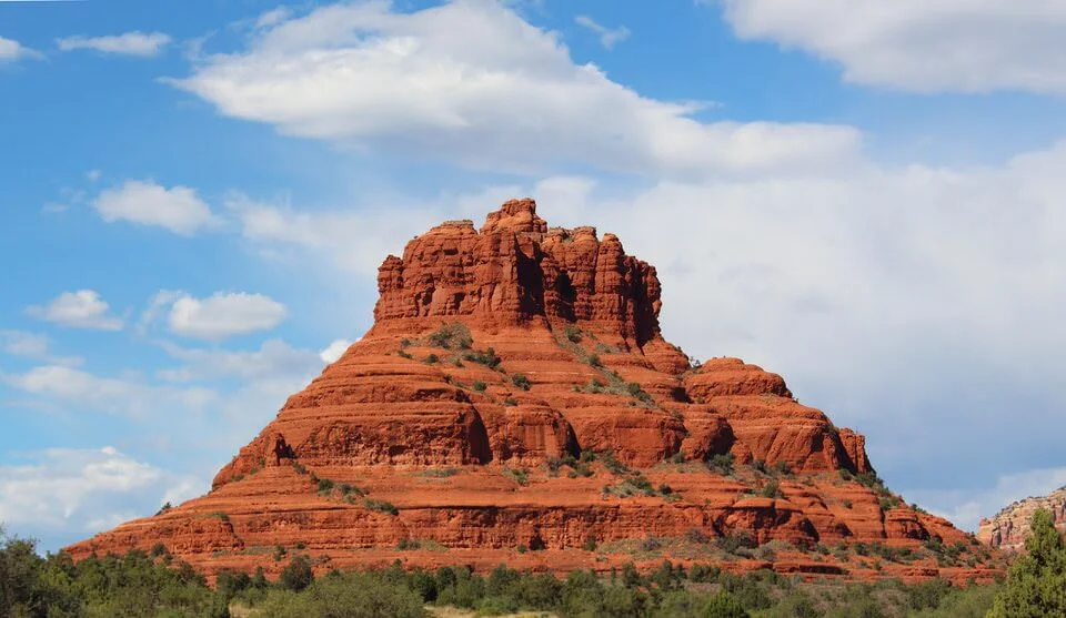
The Bell Rock Pathway trail links up the Bell Rock Vista Trailhead to the Little Horse Trailhead for a total of about 3.6 miles (out and back). Hiking this trail affords you amazing views of not only Bell Rock, but also Courthouse Butte and other notable landmarks in the area.
The Pathway Trail is generally easy-going and a flat trail, but there are some rocky and hilly areas. Hiking to the west side of Bell Rock will give you great views of the rock that you cannot get from the highway.
Pro Tip: Relative to other hikes in the area, this is one of the easiest hikes in Sedona. It is great for kids and families, and dogs are even welcome on the trail as long as they are on leash. If you want to attempt hiking up Bell Rock formation, follow the signs that say "Bell Rock Climb.” Only do this at your own risk, of course, as many parts of the Bell Rock climb could be considered Class 3 terrain, which is much more strenuous than the Bell Rock Pathway.
GRAB MY [FREE] OUTDOOR BACKPACKER STARTER KIT:
I created the Ultimate Outdoor Backpacker Starter Kit for you (and it's FREE)! This starter kit is filled with 14 pages of my best hiking and backpacking tips to help you learn what it takes to become a safe, confident, and self-sufficient outdoor backpacker!
BEST MODERATE HIKES IN SEDONA
5. Courthouse Butte Hike
Courthouse Butte Hike Quick Facts:
Trail to Summit: Courthouse Butte Loop Trail (reach the trail by starting at Bell Rock Pathway)
Type of Trail: Loop
Total Mileage: 3.9 miles
Total Elevation Gain: 357 feet
Difficulty: Moderate
Permit Required: You must display a daily Red Rock Pass ($5) or show your Annual National Parks pass for parking.
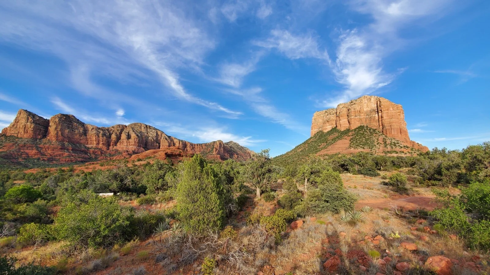
A slightly longer and less crowded alternative to the Bell Rock Pathway hike mentioned above is the Courthouse Butte hike. This moderate loop is a great trail to see some of the most distinctive sandstone formations in Sedona, including Bell Rock, Courthouse Butte, and Cathedral Rock.
You will start on the Bell Rock Pathway trail for about half a mile, until you reach the junction for the Courthouse Butte Loop. Head to the right and you will start a gentle uphill climb. Along the way you will get views of Horse Mesa, and you will eventually encounter Spaceship Rock. You can easily scramble to the top of this short formation to take a little break before continuing the rest of the loop.
Pro Tip: There is very little shade on this trail, so make sure you’re prepared with sunscreen and plenty of water. Avoid the blazing desert sun by doing this hike early or late in the day.
6. Airport Mesa Hike
Airport Mesa Hike Quick Facts:
Trail to Summit: Airport Mesa Loop Trail
Type of Trail: Loop
Total Mileage: 3.5 miles
Total Elevation Gain: 416 feet
Difficulty: Moderate
Permit Required: None
Beyond its iconic red rocks, Sedona is also known for its energy vortexes, spots where the earth’s natural energy is thought to be especially strong, and the Airport Mesa Loop hike will take you through one of these vortexes. Plus, you’ll get great views of Sedona from the top of the mesa.
Near the start of the trail, you can venture off on a detour directly to the Airport Vortex, which includes a steep climb with chains to help. Then head out on the loop, where a gentle incline will bring you to the top of the mesa. From there, you can add on the half-mile Table Top Trail spur, which takes you out to a finger of land to the southeast and offers panoramic views. Head back the way you came to the main trail, and then continue the loop back down and around to the trailhead.
Pro Tip: This trail is rocky and features some steep drop-offs, so this might not be your favorite hike if that makes you nervous, You’ll definitely want good hiking boots or shoes for this hike to navigate the rocky terrain.
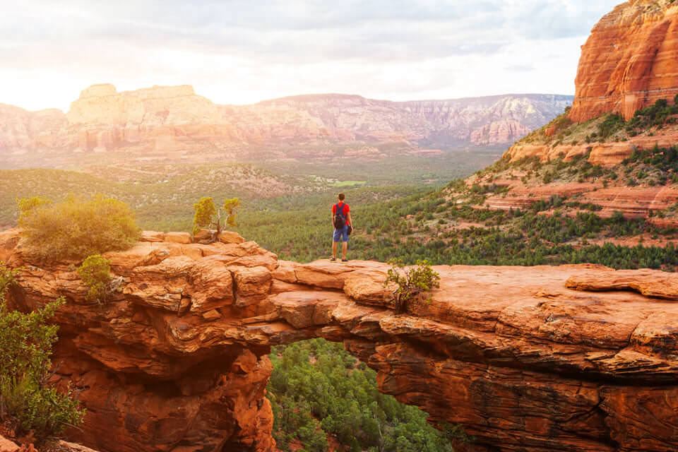
7. Devil's Bridge hike
Devil's Bridge Hike Quick Facts:
Trail to Summit: Devil’s Bridge Trail
Type of Trail: Out & Back
Total Mileage: 2-4 miles round trip (depending on where you start)
Total Elevation Gain: ~400 feet
Difficulty: Moderate
Permit Required: None
If you are looking for a trail with epic views of Sedona, then you should put the Devil's Bridge hike high on your must-hike list! According to USDA Forest Service, Devil’s Bridge is the largest natural sandstone arch in the Sedona area.
Your hike can start from one or two parking areas. If you have a higher clearance vehicle, you will be able to drive down Dry Creek Road (FR 152) to the trailhead which will make your total hike mileage around 2 miles roundtrip. However, if you are uncertain your car can make the clearance, opt to park at the Mescal Trailhead on Long Canyon Road and hike from Mescal to Chuckwagon to Devils Bridge for about 4 miles roundtrip.
The trail is relatively simple to follow, and you'll find the path starts out rather easy, but eventually you will gain a bit of uphill on your hike towards Devil's Bridge. Follow the trail markers that point the way from the parking area.
At about 3/4 of a mile from the parking area you will hit your first fork in the trail. Taking the left fork will lead you toward the base of the bridge, where you can look up and see the bridge standing tall above you. The right fork, however, will lead you up a natural rock staircase to the bridge itself, and if you're brave enough you can even hike onto the top of the bridge. It's a fairly wide bridge, but make sure to be careful and exercise caution because a fall here would be dangerous.
Pro Tip: Since this trail is one of the best places to hike in Sedona and offers great views of Sedona, it is a very popular trail. If you are looking for quiet and solitude on your hike you may want to reconsider hiking this trail. However, for an attempt at solitude consider doing this one early in the morning, on a weekday, or later in the evening.
Also note that this area is flagged as a "No Drone Zone", so leave the drones at home for this one.
8. Doe Mountain Hike
Doe Mountain Hike Quick Facts:
Trail to Summit: Doe Mountain Trail
Type of Trail: Out & Back
Total Mileage: 1.4-2.6 miles round trip (Depending on how much you hike around the mesa once you get to the top. It’s only about 0.7 miles to the top of the mesa.)
Total Elevation Gain: ~400 feet
Difficulty: Moderate
Permit Required: None
Doe Mountain has that iconic mesa shape that you see throughout the state of Arizona, and is another easily accessible trail from Sedona. It’s a quick hike with a bit of elevation gain, but your efforts toward the top of the mesa will award you with top-notch Sedona views.
With great views and less crowds than some of the other popular Sedona hikes, Doe Mountain Trail should be at the top of your list!
You’ll start your hike switchbacking up the main trail toward the top of the flat-top mesa of Doe Mountain. It’s a short and moderate hike to the top where you have ample room to enjoy the view. For the best views continue following the cairns to the other side of the mesa. From the top you can look out and see a lot of different iconic Sedona features, including Bear and Wilson Mountain, Chimney Rock, and even Sedona itself.
Pro Tip: Since this trail is fairly straightforward and shorter, consider doing this hike around sunset so that you can experience an epic Arizona desert sunset combined with top-notch views of Sedona. Just be mindful of your hike back. Watch your step (you don’t want to hike off the side of the mesa) and bring a headlamp!
9. Soldier Pass Hike
Soldier Pass Hike Quick Facts:
Trail to Summit: Soldier Pass Trail
Type of Trail: Out & Back
Total Mileage: 4.5 miles round trip
Total Elevation Gain: ~650 feet
Difficulty: Moderate
Permit Required: No, but the trailhead is only open from 8am-6pm. A permit is needed for off road vehicles.
The Soldier Pass Trail provides a diverse hiking experience through the Red Rock Secret Mountain Wilderness area, featuring beautiful red rock features along the whole hike and ultimately leading to scenic views of Sedona and red cliffs in the wilderness.
The trail is approximately 4.5 miles roundtrip and is a moderate hike. Parts of the trail are gradual, but as you get closer to the pass, the trail will become steeper and more rocky until it eventually levels out with panoramic views.
The beginning of the trail can be a pretty popular area, so be prepared to share the trail with many hikers as well as Jeep tours and off-road vehicles in the area.
Starting your hike at the trailhead, you will follow the trail toward the Devil’s Kitchen sinkhole, which is just off trail about 1/4 mile. As you continue on past Devil’s Kitchen Sinkhole, you will hike for about another 1/4 mile past the “Seven Sacred Pools”, which will be on your left. You will continue on the Soldier Pass Trail, which intersects an off-road trail, and continue on until you reach a distinct fork in the trail marked by a wilderness area boundary sign.
The main trail takes the left fork, and the right fork leads to an arch. Continuing on the main trail, the trail will start to become a bit steeper and rockier until your hike flattens out on the Brins Mesa. Return back to the trailhead the same way you came up!
Pro Tip: If you are looking for a longer hike, link up the Soldier Pass Trail with the Brins Mesa Trail! In fact, there are a lot of cool interlinking trails in the area! Also, parking can be a challenge in this area, so plan to come early or consider other areas for parking.
10. Cathedral Rock hike

Cathedral Rock Hike Quick Facts:
Trail to Summit: Cathedral Rock Trail
Type of Trail: Out & Back
Total Mileage: 1.5 miles round trip
Total Elevation Gain: ~550 feet
Difficulty: Moderate
Permit Required: You must display a daily Red Rock Pass ($5) or show your Annual National Parks pass for parking.
The Cathedral Rock trail is a steeper but short hike that is very popular in the Sedona area. The steep climb is worth it, as you will be rewarded with excellent views all along the trail.
Be prepared to not always be following a trail though, since many portions of this trail require using your best judgement to follow the path of least resistance toward the top. However, there are ample places to climb, and you can watch others if you are uncertain of the best path to take.
This hike is more of a scramble than a hike really, but that is what makes it fun! Be prepared to use your hands and your feet to hike this one.
You’ll stay on the right path by following cairns from the trailhead and taking the fairly obvious trail and staircases of steep rocks toward the top of the trail. Once the trail gets a bit rockier, there may be a point where you hesitate before deciding to continue on the steeper end of the trail.
However, it is totally doable, just be smart and make use of the many hand and foot holds that lead toward the top of a “crevasse” feature. Please exercise caution at attempting this portion of the trail if it has recently rained. Continue onwards, scrambling up rock and climbing natural rock staircases as you make your way to the top, resting when you need to.
When you get to the top you’ll see a sign that shows “End of the Trail” and that’s your cue to take in the beautiful views from the top! Return to the trailhead via the same route you hiked to the top.
Pro Tip: Parking can be challenging here since this is one of the best day hikes in Sedona, so try to get to the trail early if you can. This trail is also pretty exposed the whole way. There isn’t really any shade along the route. Bring plenty of sunscreen! This might not be the best hike to do if you are very afraid of heights, since some rock scrambling is involved.
11. Mescal Mountain Hike
Mescal Mountain Hike Quick Facts:
Trail to Summit: Mescal Trail
Type of Trail: Loop
Total Mileage: 5 miles
Total Elevation Gain: 501 feet
Difficulty: Moderate
Permit Required: None
The Mescal Mountain Loop is a great trail that is very popular among mountain bikers but is also lots of fun to hike. This trail circles up Mescal Mesa, offering amazing views of the sandstone cliffs of the mesa as well as the Secret Mountain Wilderness. About a mile in, you’ll make your way around a ridge, and get an awesome vantage point of a massive red rock bowl below you.
To make the loop up Mescal Mountain and back down, you will connect three different trails.
Start at Mescal Mountain Trailhead on Mescal Trail and hike for about 2.4 miles until you reach a junction with Deadman’s Pass Trail on the opposite side of the mesa from where you started. Turn right onto Deadman’s Pass and hike for a mile or so until you reach Long Canyon Trail, where you will turn right again. From here, hike another 1.1 miles to Long Canyon Road, then take a short (0.3 mile) connector back to the Mescal Mountain Trailhead.
Pro Tip: As you make your way up to the mesa, you will be hiking up what is known as “slickrock.” While this sandstone actually provides good traction most of the time, it can be very slippery when wet, so you should probably avoid this trail if it recently rained.
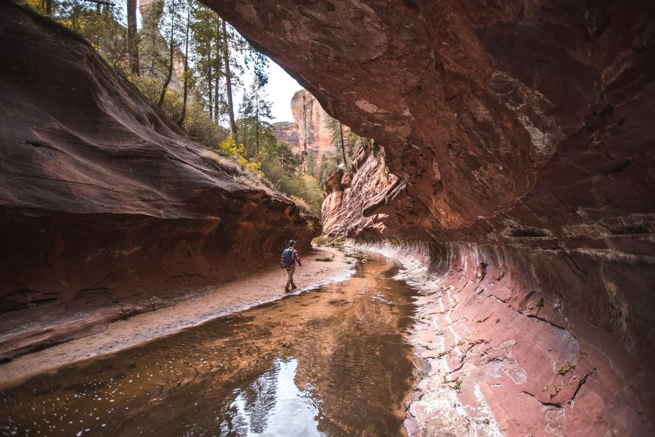
12. West Fork Hike
West Fork Trail Quick Facts:
Trail to Summit: West Fork Trail
Type of Trail: Out & Back
Total Mileage: 6 miles round trip
Total Elevation Gain: ~839 feet
Difficulty: Moderate
Permit Required: $10 fee per car
The West Fork Trail is probably one of the most popular Sedona trails, and one of the biggest reasons why is because the trail has something to offer hikers year-round during every season. Even hiking here in the summer months can be pleasant as you will find shade next to the tall canyon walls and hiking along the nearby stream. In fact, there are around 12 fun creek crossing in this hike.
The West Fork Trail offers fun for every level of hiker and is great for families. Even though you will be creek crossing from time to time, the water is only a couple of inches deep. Just take your time, and if you own some water-resistant shoes, wear them (or opt to get your feet a little wet on this one).
Generally, the water can be avoided by stepping over stones along the creek. The trail is easy to follow and well maintained for to the first 3 miles. You can also choose to explore farther along the trail, just be aware that it will not be as well maintained or marked. Mornings and weekdays will be the least crowded times to explore this popular Sedona hike.
Pro Tip: If you are feeling EXTRA ambitious, turn this easy hike into more of a challenge by hiking the full length of the canyon for 14 miles. Just be prepared to get wet, and possibly even do some swimming to get to the end of the canyon. This hike should only be attempted by experienced hikers who are in good physical condition (and who are good swimmers!)
BEST DIFFICULT HIKES IN SEDONA
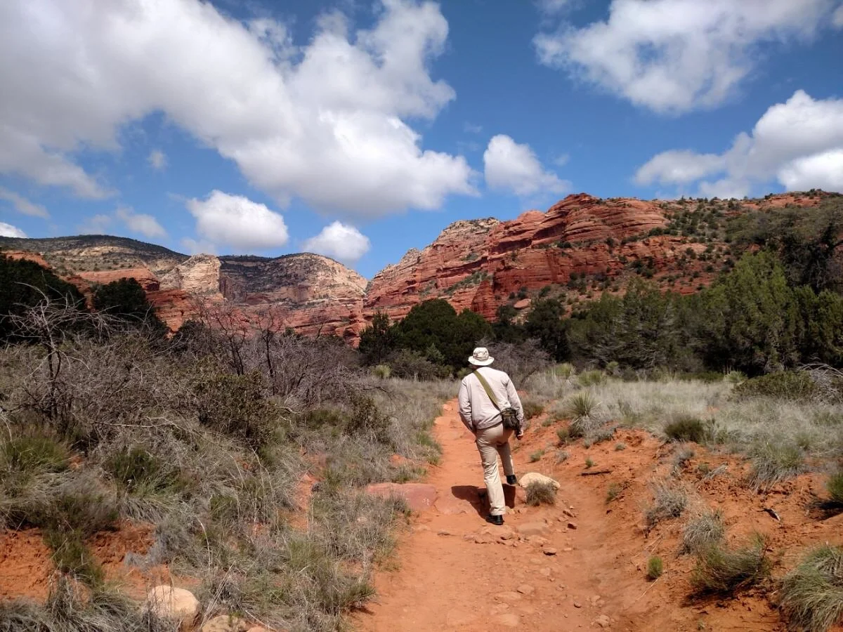
13. Boynton Canyon Hike
Boynton Canyon Trail Quick Facts:
Trail to Summit: Boynton Canyon Trail
Type of Trail: Out & Back
Total Mileage: 6 miles round trip
Total Elevation Gain: ~650 feet
Difficulty: Difficult
Permit Required: None
I don’t know about you, but I love a good canyon hiking trail, especially ones immersed in beautiful desert landscapes like Arizona and Utah (Utah’s gorgeous Kanarra Falls Trail is also has a beautiful canyon hike).
Boynton Canyon is one of those stunning canyon hikes, and it is also fairly convenient and accessible to get to from Sedona. Filled with not only beautiful desert scenery like tall, towering buttes and red sandstone rock, but also forests with a variety of trees and plant-life, it is one of the most beautiful box canyons in Sedona!
The trail is roughly 6 miles round trip, but it is worth the effort and most of the hiking is fairly easy going. Your hike will start out by a nearby resort, but will soon continue into the canyon where you will hike among the varied and beautiful desert environment.
You will transition from forest to desert landscape throughout the hike, so be sure to take note of all the different plants and trees around you! Be prepared to spend about 3-4 hours hiking the trail if you choose to go all the way to the end of the trail (which we recommend!).
Pro Tip: Since the trail is a bit more accessible than others (think: no long bumpy off roads), there may be more of a crowd at this hike. You’ll do best to get here early, and/or hike on the weekdays.
14. Merry Go Round Rock (Carousel Rock
Merry-Go-Round Rock Hike Quick Facts:
Trail to Summit: Munds Wagon Trail
Type of Trail: Out & Back
Total Mileage: 8 miles round trip
Total Elevation Gain: ~1200 feet
Difficulty: Difficult
Permit Required: None
Merry-Go-Round Rock is a spectacular setting for some epic Sedona views and is often a coveted spot for couple's engagement and wedding photos.
There are two primary ways to access Merry-Go-Round Rock. One option is a 2-mile round trip trail via Schnebly Hill Road, but accessing this road can prove difficult, and it is recommended that you have a 4WD high clearance off-road vehicle to get to the trailhead. The other option for hiking to Merry-Go-Round Rock is via Munds Wagon Trail which requires a bit longer of a hike, but the trailhead is much more accessible to get to.
If you opt to hike to Merry-Go-Round Rock via Munds Wagon Trail, you will hike about 8 miles round trip and climb roughly 1,200 feet of total elevation gain.
This main trail intersects a dirt road from time to time, and some people find it easier to hike up the dirt road and back down via the trail. Even though there is roughly 1,200 feet of climbing involved, it ascends gradually on a well maintained and well marked trail and takes you by two popular rock formations. One of those formations is called Cow Pies and is a short distance off trail, and the other is the Merry-Go-Round Rock (aka Carousel Rock).
When you get to Merry-Go-Round Rock, you will find with amazing panoramic views of Bear Wallow Canyon and Munds Mountain.
Pro Tip: Due to the trail’s gradual uphill climb, this area is also a popular mountain biking trail. Also be aware that this trail is mostly unshaded and can get very warm in the summer, so plan accordingly.
GRAB MY ESSENTIAL HIKING GEAR PACKING LIST
15. Bear Mountain Trail
Bear Mountain Trail Quick Facts:
Trail to Summit: Bear Mountain Trail
Type of Trail: Out & Back
Total Mileage: 4.6 miles round trip
Total Elevation Gain: ~2100 feet
Difficulty: Difficult
Permit Required: None
Unlike some of the other hikes in this list, the Bear Mountain Trail is a more strenuous hike and you should make sure to assess your physical fitness before attempting the trail. The trail is mostly unshaded (so do this one when the temps are cooler and wear plenty of sunscreen) and gains over 1800 feet toward the top of Bear Mountain summit.
Starting at the parking lot, you will make your way for roughly 2.3 miles toward Bear Mountain. When you are at the base of Bear Mountain the trail will become more narrow and you will begin your steep march to the summit, hiking up a series of rocky switchbacks.
Eventually those switchbacks will level out (but only for a bit) until ultimately you begin your climb again up another steep and rocky side canyon. When the trail becomes faint, keep an eye out for white painted diamond shapes on the rock to direct you to the correct path.
This trail is full of its share of “false summits” (when you think you are almost there, but you aren’t), but keep fighting the good fight, because once you do finally reach the true Bear Mountain summit you will be rewarded with panoramic views of the Sedona Wilderness. Expect this hike to take you anywhere from 4-6 hours roundtrip.
Pro Tip: If you don’t feel up to the entire hike to the summit of Bear Mountain, you can still hike portions of this trail and turn around at the mileage you’re comfortable with. This trail is gorgeous and has great views the whole way, so it is still an excellent choice for hiking in Sedona.
Looking for more Arizona adventures?
If you are looking for additional Arizona hiking adventures, check out our resources below:
How to Get Havasu Falls Hiking Permits
Other Essential Hiking Resources:
Also, be sure to check out these essential hiking resources!
And if you’re looking for some more “Best Hikes In” Blog Posts, be sure to check out these:
How many of the hikes above have you done? Are any of these still on your hiking bucket list?! Or did we miss any of your favorite Sedona hikes? Let us know in the comments below!
Cheers,
Allison - She Dreams of Alpine


Travel Alone – 57 Quotes to Inspire Your Solo Travels | There’s something magical about traveling alone or going on solo adventures. Traveling alone forces us to grow and test what we are really made of and maybe even go through a transformation of self-discovery. These 57 travel alone quotes celebrate the beauty in going solo. | shedreamsofalpine.com