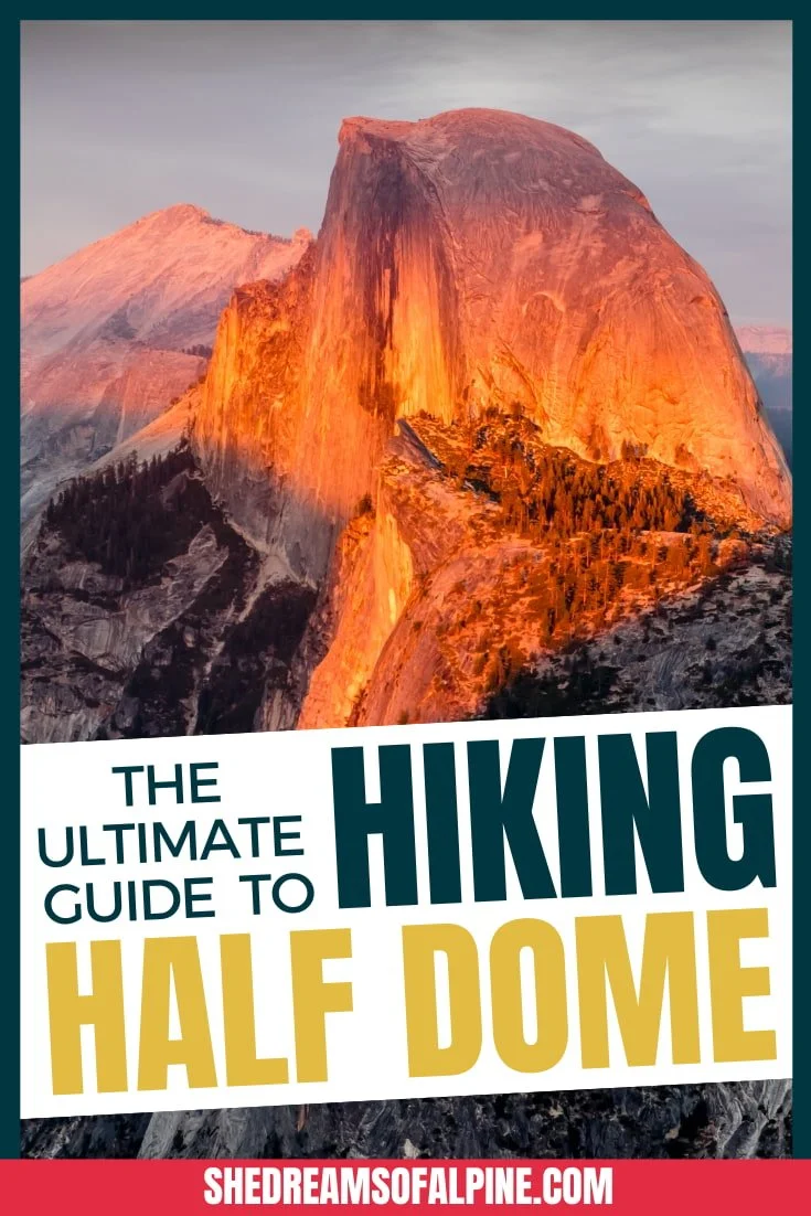
The 19 Best Hikes in Southern California to Add to Your Must-Do List

Southern California is known as a mecca for aspiring actors and beach lovers, but it’s also an amazing place for hiking! The best hikes in Southern California will take you through terrain that ranges from the desert to mountain peaks.
You can find hikes in Southern California for all ability levels, from beginners who want to take a short hike in the Hollywood Hills to get a glimpse of the famous sign to athletes looking for a steep challenge to train for fourteeners. I also reached out to 3 other local female hikers who weigh in on their favorite Southern California hikes.
The best hikes in Southern California can be found throughout the region, from Los Angeles to Palm Springs to Death Valley to Bakersfield. There’s even an epic hike on Catalina Island!
Find your perfect Southern California hike in this guide, then get out and hit the trail!
ABOUT THIS GUIDE TO THE BEST HIKES IN SOUTHERN CALIFORNIA
We’ve split up the list of Southern California hikes by difficulty, so you can easily find the right hike for you! Since everyone has a different gauge of “difficult” and “easy” hiking, here is how the list is defined:
1. Best Easy Southern California Hikes - If a trail is under 5 miles long OR under 1,250 feet of total elevation gain, the hike is rated as “easy”
2. Best Moderate Southern California Hikes - If the trail is within the 5-10 mile range OR between 1,250 to 3,500 feet of total elevation gain, the hike is rated as “moderate”
3. Best Difficult Southern California Hikes - If a trail is 10-15 miles long OR between 3,500 to 4,500 feet of total elevation gain, the hike is rated as “difficult”
4. Best Extremely Challenging Southern California Hikes - If a trail is over 15 miles long OR over 4,500 feet of total elevation gain, the hike is rated as “extremely challenging”

GRAB MY [FREE] OUTDOOR BACKPACKER STARTER KIT:
I created the Ultimate Outdoor Backpacker Starter Kit for you (and it's FREE)! This starter kit is filled with 14 pages of my best hiking and backpacking tips to help you learn what it takes to become a safe, confident, and self-sufficient outdoor backpacker!
BEST SOUTHERN CALIFORNIA HIKES MAP
Much of the best hiking Southern California has to offer is located near Los Angeles and San Bernardino, but our list also features a hidden gem training hike located in the Kern River Canyon area near Lake Isabella and a hike that is located in Death Valley National Park, as well as hikes near Palm Springs and in Joshua Tree.
Below is a map of Southern California showing the location of some of the hikes that we will go over in more specific detail later in the post. Click the map to be taken to an interactive Google Map to explore the locations further.

And here’s a quick list of all the Southern California hikes we cover in this post in order. If there’s a specific Southern California hike you’re looking for, just jump to that one!
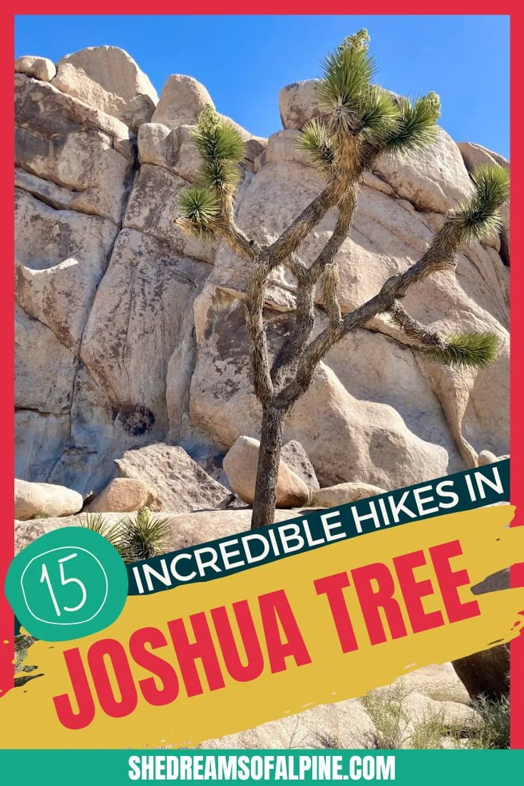
Hidden Valley, Joshua Tree (1 mile)
Split Rock, Joshua Tree (2.5 miles)
Solstice Canyon, Santa Monica Mountains (3.2 miles)
Mount Pinos, Kern County (3.6 miles)
Hollywood Sign, Hollywood Hills (6.4 miles)
Strawberry Peak, San Gabriel Mountains (7.2 miles)
Bear Creek Oasis, Coachella Valley (8.4 miles)
Bridge to Nowhere, San Gabriel Mountains (10.5 miles)
Powers Peak, Kern River Valley (10.1 miles)
Mount Baldy, San Gabriel Mountains (11 miles)
Cucamonga Peak, San Gabriel Mountains (12 miles)
Bastards Ridge, San Gabriel Mountains (13 miles)
Telescope Peak, Death Valley (13 miles)
Mill Creek, Kern Canyon (15 miles)
Boy Scout Trail, Joshua Tree (16 miles)
San Bernardino Peak, San Bernardino Mountains (16 miles)
San Gorgonio Peak, San Bernardino Mountains (18 miles)
Mount San Jacinto, Palm Springs (21 miles)
Trans Catalina Trail, Catalina Island (38.5 miles)
Without further ado, here are 19 of the absolute best hikes in Southern California!
BEST EASY SOUTHERN CALIFORNIA HIKES
HIDDEN VALLEY HIKE
Hidden Valley Hike Quick Facts:
Trail Name: Hidden Valley Trail
Trailhead: Hidden Valley
Type of Trail: Loop
Total Mileage: 1 mile
Total Elevation Gain: Minimal
High Point Elevation: 4,270 feet
Difficulty: Easy
Permit Required: No, but a National Parks Pass or entrance fee is required to enter Joshua Tree.

Hiking through Hidden Valley is the perfect introduction to the landscape of Joshua Tree National Park. This short hike showcases both the Joshua Trees and rock formations that exemplify the park. In fact, you’ll probably see some rock climbers here, since this area has some of the park’s most popular routes.
Speaking of popular, this trail is usually full of people, so don’t expect seclusion – Hidden Valley is not in fact hidden. :) The trail is well-marked and easy to follow, and is a great way for hikers of all skill levels to experience the magic of Joshua Tree, and it is definitely one of the best easy hikes in Southern California.
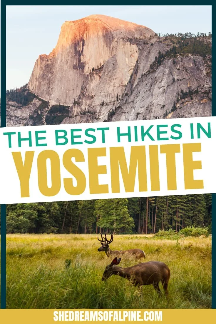
For more of the best Joshua Tree hikes, check out our blog post on 15 of the incredible trails in the park!
SPLIT ROCK HIKE
Split Rock Hike Quick Facts:
Trail Name: Split Rock Loop
Trailhead: Split Rock
Type of Trail: Loop
Total Mileage: 2 miles
Total Elevation Gain: 275 feet
High Point Elevation: 4,365 feet
Difficulty: Easy
Permit Required: No, but a National Parks Pass or entrance fee is required to enter Joshua Tree.
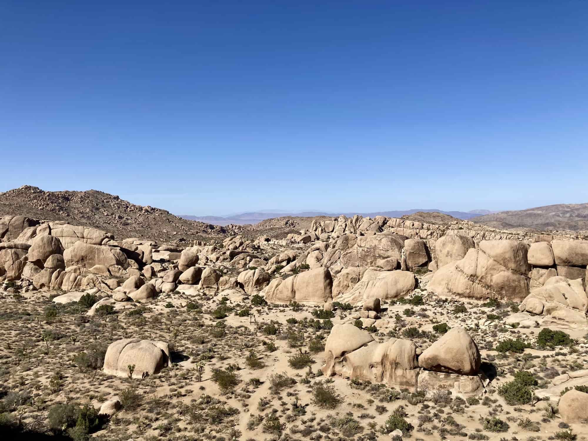
Another great easy trail in Joshua Tree is the Split Rock Loop. Even though it’s just 2 miles long, it packs a lot of awesome scenery into a short hike. Plus, it tends to be somewhat less crowded than Hidden Valley.
The trail winds its way among boulders and past bigger rock formations, and can be a little hard to follow at times, so stay on the lookout for the trail markers. Enjoy scrambling up the boulders (and watching climbers scale the larger walls) as you make your way along this loop.
You’ll see plenty of Joshua trees and cool cactus sprinkled throughout this desert landscape.
SOLSTICE CANYON HIKE
Solstice Canyon Hike Quick Facts:
Trail Name: Solstice Canyon Trail to Rising Sun Trail
Trailhead: Solstice Canyon Trailhead
Type of Trail: Loop
Total Mileage: 3.2 miles
Total Elevation Gain: 676 feet
High Point Elevation: 767 feet
Difficulty: Easy
Permit Required: No
A 3-mile loop that winds its way through Malibu, the Solstice Canyon Trail is a picturesque hike in Southern California. The sights along this trail are unique, from the ruins of old homesteads to an ancient oak to a waterfall.
From the trailhead, you’ll take the easy-to-follow trail past a nice picnic area. Soon you’ll pass what’s left of the historic Matthew Keller House, and as you continue on the trail, you’ll come to the ruins of the Roberts Ranch House, surrounded by palm trees. Just ahead is a small but lovely waterfall to explore. Then you can head back the way you came or take the Rising Sun Trail for excellent views of both the canyon and the coast.
The Solstice Canyon Trail can be accessed year-around, and this hike is mellow enough for just about anyone, including families. Of course, that makes this trail extremely popular, so be prepared for crowds. Still, this is a truly great Southern California hike for a short excursion.
MOUNT PINOS HIKE
Mount Pinos Hike Quick Facts:
Trail Name: Mount Pinos Trail to Sawmill Trail
Trailhead: Mount Pinos Nordic Base
Type of Trail: Out & Back
Total Mileage: 3.6 miles
Total Elevation Gain: 515 feet
High Point Elevation: 8,809 feet
Difficulty: Easy
Permit Required: No
With amazing summit views from a relatively easy trail, Mount Pinos is a wonderful hike in Southern California. The trail itself is a former service road, so it’s a wide and easy to follow path that’s great for adventurers of all ages as well as four-legged friends.
While the trail itself starts at a higher elevation of around 8,000 feet, the elevation gain as you hike is fairly minimal at about 500 feet. You’ll pass through a shady sub-alpine pine forest as you make your way toward the summit of Mount Pinos. At the top, you’ll get amazing views of the San Joaquin Valley and the Tehachapi Mountains, as well as the Temblor Mountains and Carrizo Plain.
You can also continue the hike up to Sawmill to enjoy a beautiful valley between the peaks and even more expansive summit views. The Mount Pinos trail is a fantastic hike to do at sunset, and you can even do some star-gazing before heading back down (just be sure to bring a headlamp).
BEST MODERATE SOUTHERN CALIFORNIA HIKES
HOLLYWOOD SIGN HIKE
Hollywood Sign Hike Quick Facts:
Trail Name: Brush Canyon Trail to Mount Lee
Trailhead: Canyon Drive in Griffith Park
Type of Trail: Out & Back
Total Mileage: 6.4 miles
Total Elevation Gain: 1,050 feet
High Point Elevation: 1,709 feet
Difficulty: Easy
Permit Required: No

This quintessential Southern California hike takes you directly behind the iconic Hollywood Sign. While there are a few different trails to get to the Hollywood Sign, access via private property is under dispute, so Brush Canyon Trail up to Mount Lee is the best and easiest available route.
Brush Canyon Trail starts in Griffith Park at the north end of Canyon Drive. There are many free parking lots, but be aware that the gates close at sunset, so if you’re planning to do a sunset hike, you’ll want to park outside the gates to avoid getting trapped inside.
You’ll start hiking on a dirt road, and after just over a mile, you’ll come to an overlook with excellent views of the city Los Angeles. Keep going as the trail merges with Mulholland Fire Road, then continue on to Mount Lee. The trail is very well-signed, so it should be easy to follow. Eventually, you’ll round a corner and get your first view of the “H” in Hollywood.
The sign itself is fenced off, so follow the path left of the radio towers to the summit of Mount Lee. This is where you’ll find the famous view from behind the Hollywood Sign. This unique perspective of the famous landmark definitely makes the hike to the Hollywood Sign a must-do hike in Southern California.
STRAWBERRY PEAK HIKE
Strawberry Peak Hike Quick Facts:
Trail Name: Strawberry Peak Trail
Trailhead: Red Box Picnic Area
Type of Trail: Out & Back
Total Mileage: 7.2 miles
Total Elevation Gain: 1,720 feet
High Point Elevation: 6,164 feet
Difficulty: Moderate
Permit Required: National Forest Adventure Pass for parking at the trailhead

Gorgeous views and a great leg-workout make the climb up Strawberry Peak an awesome Southern California hike. The trail begins at Red Box Picnic Area, where you can enjoy a pre-hike breakfast or a post-hike lunch.
From the trailhead, the hike takes you around Mt. Lawlor, offering up simply stunning views of Mt. Wilson. As you go around a bend, you’ll see Strawberry Peak itself in the distance.
Once you reach the saddle below Strawberry Peak, you’ll begin the truly challenging part of the hike. The trail steepens and you’ll find several false summits on your way to the real summit of Strawberry Peak. But once you finally make it, you can catch your breath as you savor the views of Mount Baldy, Mount Wilson, and Los Angeles below you.
Strawberry Peak is an excellent training hike if you have dreams of summitting other tough peaks in California.
BEAR CREEK OASIS HIKE
Bear Creek Oasis Hike Quick Facts:
Trail Name: Bear Creek Oasis
Trailhead: Cove Oasis
Type of Trail: Out & Back
Total Mileage: 8.4 miles
Total Elevation Gain: 2,301 feet
High Point Elevation: 2,350 feet
Difficulty: Moderate
Permit Required: No
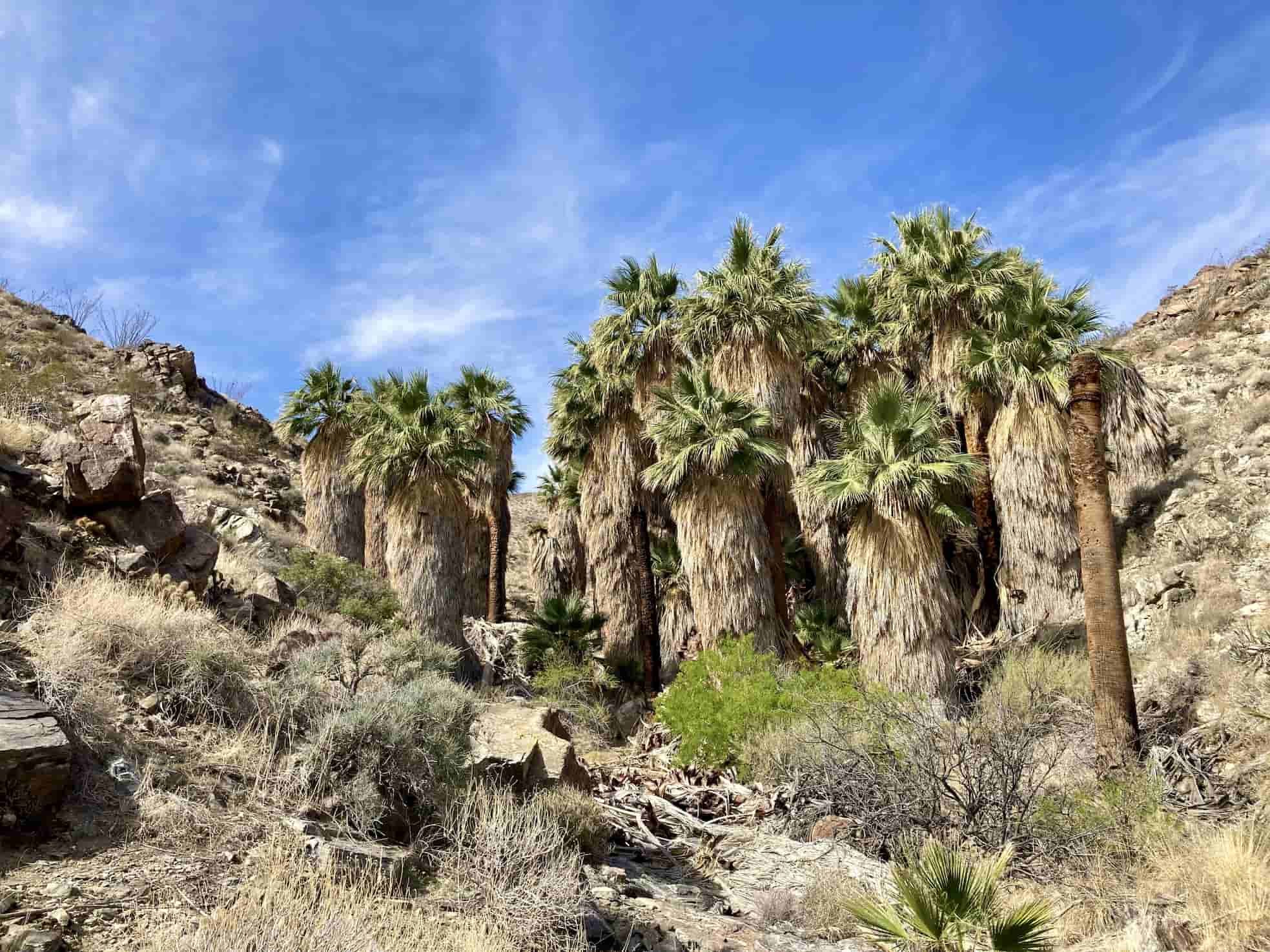
The Bear Creek Oasis hike is a desert gem located in the town of La Quinta, slightly southeast of Palm Springs. The trail offers incredible views of the Coachella Valley as well as surrounding mountain peaks and features a fun surprise at the end.
This hike starts at Cove Oasis, where many trails branch out, so you’ll definitely want to have a map or a GPS and pay attention to signs. Once you start the steep uphill section about a mile in, the trail becomes easy to follow - just keep going up!
As you ascend, you’ll start to see the peaks of Mount San Jacinto and San Gorgonio, as well as the vast Coachella Valley and the Salton Sea. Once you reach the top, take a break and enjoy the views before you make your way slightly down into a small canyon where you’ll be rewarded with a unique oasis of palm trees in the middle of the desert.
>>>For more awesome trails in the area, check out our guide to best Palms Springs hikes!
BRIDGE TO NOWHERE HIKE
Bridge to Nowhere Hike Quick Facts:
Trail Name: Bridge to Nowhere via East Fork Trail
Trailhead: Bridge to Nowhere Trailhead
Type of Trail: Out & Back
Total Mileage: 10.5 miles
Total Elevation Gain: 1,276 feet
High Point Elevation: 2,755 feet
Difficulty: Moderate
Permit Required: National Forest Adventure Pass for parking at the trailhead & a free wilderness permit for Sheep Mountain Wilderness
The namesake of the Bridge to Nowhere hike is a 120-foot arched bridge that was constructed in 1936 to connect the East Fork Road from the San Gabriel Valley to Wrightwood. Just two years later in 1938, a massive flood washed out the road, and it was never rebuilt. But the bridge still stands tall and attracts hikers who check out the views, as well as bungee jumpers who leap off it.
To get to the Bridge to Nowhere, you’ll start at Coyote Flat off of East Fork Road, then make your way along the river and navigate a few river crossings. You’ll eventually enter Sheep Mountain Wilderness, and then gain some elevation until you find yourself at the bridge itself.
Once you reach the bridge, you can appreciate the views, watch bungee jumpers (on the weekends), and follow a short trail down to the river and some swimming holes. After taking a dip to cool off, you’ll turn around and head back because there’s nowhere else to go!
POWERS PEAK HIKE
Powers Peak Hike Quick Facts:
Trail Name: Powers Peak Trail
Trailhead: Cannell Meadow Trailhead
Type of Trail: Out & Back
Total Mileage: 10.1 miles
Total Elevation Gain: 3,200 feet
High Point Elevation: 5,778 feet
Difficulty: Moderate
Permit Required: No

The Powers Peak hike is a Kern River Valley hidden gem. While it isn't one of the most well known hikes in SoCal, in my opinion, it ranks up there as some of the best hiking in Southern California. The trail is beautiful and the summit takes you to the best views in Kernville, looking out over the breathtaking Lake Isabella area.
Sitting at 5,778 feet, the summit elevation may seem pretty low key at first glance, but the 10 miles round trip along with 3,200 feet of elevation gain will definitely test you. And, unlike the popular hiking trails of Los Angeles and San Bernardino, Powers Peak is not very crowded, and you can often find yourself hiking alone for miles on end.
Since this trail is at lower elevation it is best to hike Powers Peak in the winter or spring time to avoid the hot summer heat. Plan to make a day out of your hike up Powers Peak to explore the town of Kernville and grab a celebratory beer at the world-renowned Kern River Brewing Company, which is only minutes away from the Cannell Meadow Trailhead.
Treat yourself to some solitude on Powers Peak and get an excellent hike in while you're at it! For further details on the trail, check out our complete guide to hiking Powers Peak!
BEST DIFFICULT SOUTHERN CALIFORNIA HIKES
MOUNT BALDY HIKE
Mount Baldy Hike Quick Facts:
Trail Name: Baldy Bowl Trail to Devil’s Backbone
Trailhead: Manker Flats Trailhead
Type of Trail: Loop
Total Mileage: 11 miles
Total Elevation Gain: 3,990 feet
High Point Elevation: 10,064 feet
Difficulty: Difficult
Permit Required: National Forest Adventure Pass for parking at the trailhead

Mount Baldy, also known as Mount San Antonio, is one of the most popular hikes in the Los Angeles area. It makes a great summer and fall training hike for bigger peaks due to its intense elevation gain and leg burning switchbacks on the Baldy Bowl Trail. It is also a really beautiful and interesting trail, especially because you are able to make a loop up the Baldy Bowl Trail and go down its iconic "Devil's Backbone" trail to the Manker Flats Trailhead.
In fact, it’s possible to hike up to the Mount Baldy summit, then hike down to the Mount Baldy Ski Area via the Devil's Backbone Trail and take the ski lift (which runs in the summer months) the remaining way back down to Manker Flats Trailhead, saving a little wear and tear on your knees from all the downhill hiking.
Mount Baldy is a fantastic hike, but that means it is super popular. If possible, try to visit the trail during the weekday when it is less busy. Otherwise, be prepared to share the trail with the locals and oftentimes their pets (yes, it's pet friendly!).
Also, make sure to check the trail conditions before visiting Mount Baldy because snow can stick around on this peak well into the month of June. The Devil's Backbone Trail can be particularly dangerous if it has snow or ice on it because of the steep drop offs. If Devil's Backbone looks unsafe to hike, stick to the Baldy Bowl Trail. While you can find people hiking the Mount Baldy trail year round, in the winter, it typically requires special snow gear and mountaineering skills to reach the summit.
Be sure to keep an eye out for San Antonio waterfall when hiking up the Baldy Bowl Trail! Whether you are training or not, this is an excellent hike and should be at the top of your Southern California hiking list. For more trail information, check out our complete guide to hiking Mt Baldy.
CUCAMONGA PEAK HIKE
Cucamonga Peak Hike Quick Facts:
Trail Name: Cucamonga Peak Trail
Trailhead: Icehouse Canyon
Type of Trail: Out & Back
Total Mileage: 12 miles
Total Elevation Gain: 4,314 feet
High Point Elevation: 8,859 feet
Difficulty: Difficult
Permit Required: Wilderness Permit recommended
>>> Meet Rachelle! Rachelle is an accomplished and avid hiker from Southern California. She is an ambassador for Mountain Chicks SoCal (an all-inclusive women's adventure group), and we met for the first time while hiking the Trans-Catalina Trail! She has an amazing spirit for all things hiking and the outdoors, so check out her instagram @rachellemhoward. Rachelle weighs in below on another one of the best hikes in Southern California.
The 11.6 mile round trip hike to Cucamonga Peak starts at the Icehouse Canyon trailhead. It’s a popular, challenging hike with a 4,300’ vertical gain to the top elevation of 8,859’. This hike starts with a gentle incline alongside the beautiful Icehouse Creek, passing by several cabins on the way. After about 1.5 miles you’ll cross the creek and begin a steady climb along switchbacks to Icehouse Saddle, a great place to rest and refuel.
Then press on towards the peak! The next section is increasingly steep but offers absolutely stunning views of the desert and beyond, making every step worth the effort. Once you reach the peak, celebrate with a well-deserved rest and amazing views all around. The peak offers many places to rest in the shade and even space to set up your tent if you are backpacking.
After taking it all in, retrace your steps back to your car and, if it’s warm enough, be sure to soak your tired feet in the icy creek before heading home. With the right equipment, you can even visit this trail in winter or come in fall to enjoy the vibrant changing of colors along the creekside section of the trail.
Arrive early for parking on the weekends and be sure to display your Adventure Pass and fill out a free self-serve permit at the trailhead. Whenever you decide to visit, the Cucamonga Peak hike will certainly not disappoint!
BASTARD RIDGE HIKE
Bastard Ridge Hike Quick Facts:
Trail Name: Old Mount Wilson Trail to Bastard Ridge Trail
Trailhead: Mount Wilson Trailhead
Type of Trail: Loop
Total Mileage: 13 miles
Total Elevation Gain: 5,000 feet
High Point Elevation: Jones Peak (3,390 ft.), Hastings Peak (4,000 ft.), Mount Yale (4,760 ft.), Mount Wilson (5,713 ft.)
Difficulty: Difficult
Permit Required: No

The name says it all! Bastard Ridge is not going to be a walk in the park, but the effort is worth it to summit 4 different peaks on your hike. Located in the San Gabriel Mountains, Bastard Ridge will take to the top of Jones Peak, Hastings Peak, Mount Yale, and Mount Wilson.
You’ll start your hike on the Old Mount Wilson trail, but will soon veer off the main trail and head up left on a side trail (unmarked) which is the Bastard Ridge Trail. The side trail is very, very steep and a bit of a struggle to the top, but if you persevere, you will soon gain the ridge-line. The first peak you will summit is Jones Peak (3,390 ft.), the second is Hastings Peak (4,000 ft.), the third Mount Yale (4,760 ft.), and then you will finally reach the summit of the most popular peak on the trail, Mount Wilson (5,713ft.). Once you gain the Mount Wilson summit, you will take the main Mount Wilson Trail back to the trailhead.
This is a brutal hike, but it’s a lot of fun too! Getting off the main Mount Wilson Trail will take you away from a lot of the crowds for a while, too. Ideally, try to hike this trail when it isn't too hot, and be sure to keep an eye out for rattlesnakes when you are hiking, particularly on the portions of the trail that are less traveled and possibly a bit more overgrown. All in all, Bastard Ridge is an excellent hike and nice change of pace from the standard Mount Wilson Trail.
This trail can be a little tricky to follow, so be sure to check out our guide on hiking Bastard Ridge and download the GPX file to make sure you are staying on the right path.
TELESCOPE PEAK HIKE
Telescope Peak Hike Quick Facts:
Trail Name: Telescope Peak Trail
Trailhead: Mahogany Flat Trailhead
Type of Trail: Out & Back
Total Mileage: 13 miles
Total Elevation Gain: 3,323 feet
High Point Elevation: 11,049 feet
Difficulty: Difficult
Permit Required: No
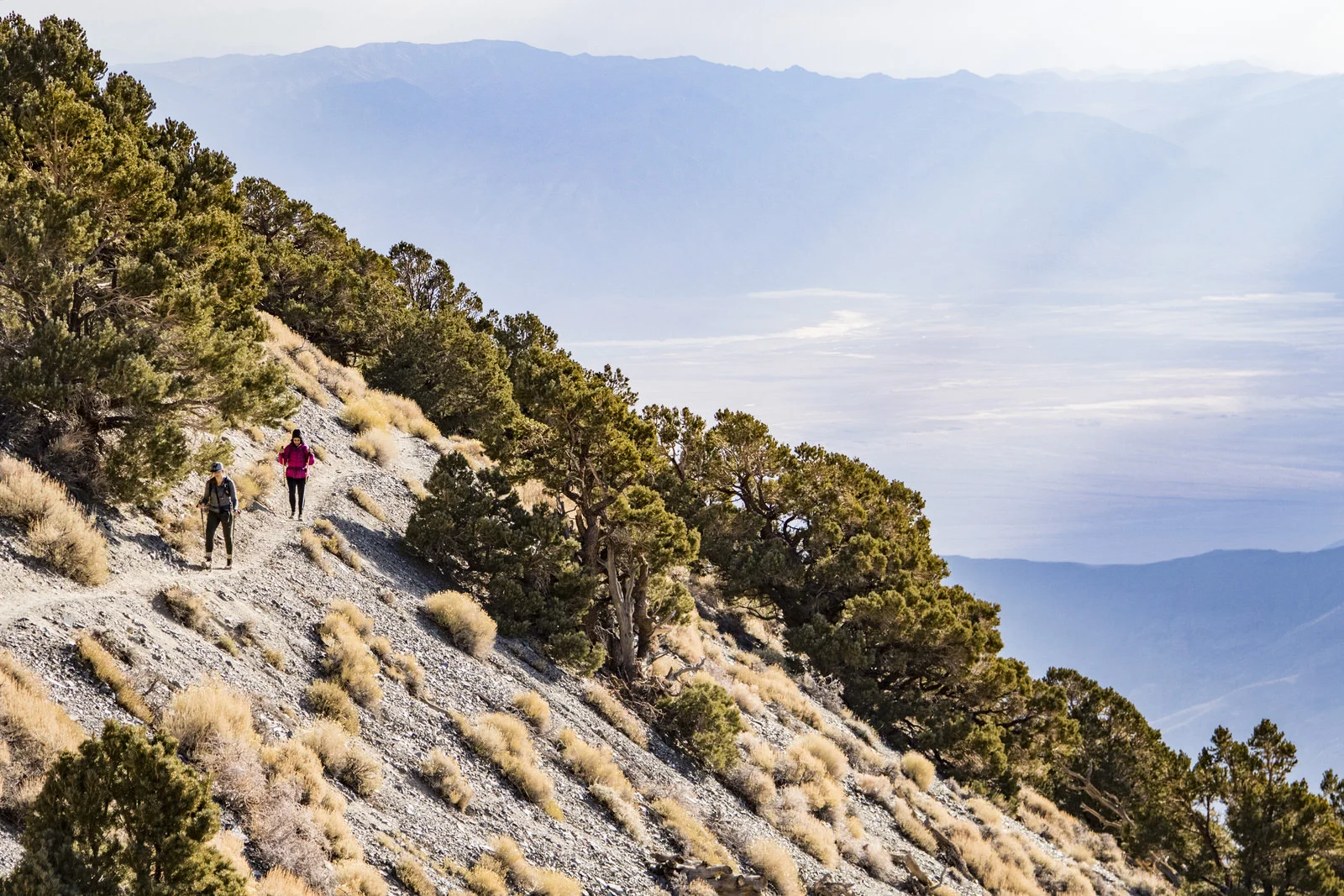
People don’t often think about hiking mountains when they think of visiting Death Valley National Park, but Telescope Peak is actually one of the best hikes in Southern California. The 13 miles of hiking with 3,000 feet of elevation gain truly showcases the diverse landscape of Death Valley.
The trail starts at Mahogany Flat Campground and is very straightforward, which makes it an easily accomplished day hike, giving you plenty of time to explore the rest of Death Valley during your visit. On the way to the summit of Telescope Peak, you’ll wind your way through switchbacks and gain epic views of the Death Valley Basin. If you look out even farther, you can see the Sierra Nevada Mountains stretching out in the distance. You’ll be standing tall at 11,049 feet when you reach the Telescope Peak summit,
The best time of year to do the Telescope Peak hike is late fall to early winter. You should check before your visit to find out if there has been snow if you are planning to hike this trail in the winter. Poles will be useful on the downhill and always make sure to bring plenty of water as there are no water sources along the trail.
For further details, check out our ultimate guide on hiking Telescope Peak, and also be sure to check out our guide to a great weekend in Death Valley National Park.
MILL CREEK HIKE
Mill Creek Hike Quick Facts:
Trail Name: Mill Creek Trail
Trailhead: Mill Creek Trailhead
Type of Trail: Out & Back
Total Mileage: 15 miles
Total Elevation Gain: 4,206 feet
High Point Elevation: 6,700 feet
Difficulty: Difficult
Permit Required: No
Located in the Sequoia National Forest, the Mill Creek Trail is a long trail offering a variety of views that make it well worth the trek. The 4,200 feet of elevation gain provides a challenging workout, but the trail is non-technical, making it a good training hike.
The trail begins on Old Kern Canyon Road, and you’ll have to make several creek crossings early on. The first few miles of the trail are relatively flat, allowing you to appreciate the natural beauty of the area, including lovely wildflowers when they’re in season. Eventually, the trail gets steeper as you make your way toward the summit, and you’ll discover a pine forest to provide welcome shade. Once you reach the top, simply turn around and retrace your steps back down.
The ideal season to do the Mill Creek Trail is late spring through early summer, when the wildflowers are in full bloom, and you can savor the blossoms without extreme heat.
BOY SCOUT TRAIL HIKE
Boy Scout Trail Hike Quick Facts:
Trail Name: Boy Scout Trail
Trailhead: Keys West or Indian Cove
Type of Trail: Out & Back
Total Mileage: 16 miles
Total Elevation Gain: 1,850 feet
High Point Elevation: 4,182 feet
Difficulty: Difficult
Permit Required: No, but a National Parks Pass or entrance fee is required to enter Joshua Tree. You will need to self-register at the backcountry board if backpacking.

The Boy Scout Trail is an excellent longer hike in Joshua Tree, which showcases the variety in the landscape in the different elevations of the Mojave desert. It’s definitely a very cool Southern California hike!
You can do this trail as a 16-mile round trip hike, an 8-mile point-to-point hike (with two cars in order to shuttle), or make it into a multi-day backpacking trip. You can also hike out on the trail and turn around whenever you feel like it – there’s an epic viewpoint just over half way in (starting from Keys West) that makes a nice spot to head back.
The Boy Scout Trail takes you deep into wilderness so you can escape the crowds of Joshua Tree. As you hike, you’ll find yourself surrounded by the namesake Joshua trees, and you’ll head through the Wonderland of Rocks, where you can scramble around the boulders. If you choose to backpack the trail and spend the night, make sure to bring your own water and follow the park rules for backcountry camping in Joshua Tree.
BEST EXTREMELY CHALLENGING SOUTHERN CALIFORNIA HIKES
SAN BERNARDINO PEAK HIKE
San Bernardino Peak Hike Quick Facts:
Trail Name: San Bernardino Peak Trail
Trailhead: Angelus Oaks Trailhead
Type of Trail: Out & Back
Total Mileage: 16 miles
Total Elevation Gain: 4,670 feet
High Point Elevation: 10,649 feet
Difficulty: Extremely Challenging
Permit Required: Voluntary permit for day hiking

>>> Meet Micha! Micha is a "Mompreneur" and an outdoor adventure blogger at The Pink Hat Hiker. She is also an ambassador for Mountain Chicks (the all-inclusive women's adventure group) in Southern California. Here Micha weighs in on San Bernardino and what makes it one of the best hikes in Southern California to train for the big mountains.
San Bernardino, with its prominent peak looming over the Inland Empire, is one of the most scenic hikes in the San Gorgonio Wilderness. Coming in at just over 16 miles, with nearly 4,600 feet of climbing elevation, the out and back trail from Angelus Oaks makes for a great training peak!
The rocky summit sits at 10,649 feet above sea level where the air is thin and the tree line disperses. To get there, you’ll trek through groves of manzanita and forests of pine and oak trees. There is also a seasonal creek where you can refill your water during the cooler months. Just be sure to bring a filtration system with you.
The crowning jewel of this “Six Pack of Peaks” mountain is the views. From the sweeping, picturesque landscape of the valley below, to the panoramic outlooks of the Inland Empire, and far off scenes of both Mount Baldy and Big Bear Lake, this trail is hands down one of the most beautiful peaks in Southern California.
Free wilderness permits are not required for day hikes of San Bernardino, but they are recommended to help the rangers keep track of hikers, and you can fill out the permit form online before your hike. You will need an Adventure Pass to park in the medium sized dirt lot in Angelus Oaks. A higher clearance vehicle is also recommended to go down the uneven dirt road that takes you to the lot. I made it there in a Toyota Yaris the first time I climbed it, but I wouldn’t drive down it in that car again.
SAN GORGONIO PEAK HIKE
San Gorgonio Peak Hike Quick Facts:
Trail Name: Vivian Creek Trail
Trailhead: Vivian Creek Trailhead
Type of Trail: Out & Back
Total Mileage: 18.5 miles
Total Elevation Gain: 5,957 feet
High Point Elevation: 11,503
Difficulty: Extremely Challenging
Permit Required: Voluntary permit for day hiking

>>> Meet Morgan! Morgan Taylor is a 17 year old badass mountain chick. She and her dad love hiking, and they took on the challenge of hiking the Six Pack of Peaks in Southern California. I was inspired by Morgan and her dad's peak-bagging ambitions, so I reached out to her to ask if she could tell me about her favorite training hike so far. Morgan weighs in below on one of the best Southern California hikes in her opinion.
Mount San Gorgonio is the tallest peak in Southern California, and it has been my personal favorite by far. My dad and I love hiking and have taken on the challenge of completing the “Six Pack of Peaks” of Southern California. So far we have completed San Gorgonio, San Bernardino, and San Jacinto, but have yet to conquer Cucamonga, Wilson, and Baldy.
We summited San Gorgonio in September, which I would definitely recommend because it allowed us to avoid both the over-100 degree weather common during the summer in SoCal and the snow that falls in November and December. My dad and I chose to hike from the Vivian Creek Trail, which has a set of steep switchbacks that are killer, but relatively brief. From there, we followed a beautiful trail abundant with greenery, although once we hiked above the treeline, there were only sparse plants and animal life.
A positive aspect of hiking from Vivian Creek is that it offers another opportunity for water to filter, besides just High Creek, which is farther along the trail. When you’re hiking 18.81 miles (as recorded by my watch), it’s best to pack as lightly as possible; my dad and I ended up bringing only a couple liters of water, then refilling them along the way.
Another aspect of San Gorgonio to take into consideration is the altitude – at 11,503 feet, with a 5,957 foot elevation gain, it’s the highest peak in Southern California. The elevation makes this peak an amazing training hike for 14ers as it allows your body to adjust to a low concentration of oxygen. Overall, the mileage and the elevation is what makes the journey to Mount San Gorgonio an amazing hike in Southern California.
MOUNT SAN JACINTO HIKE
Mount San Jacinto Hike Quick Facts:
Trail Name: Cactus to Clouds (Skyline Trail)
Trailhead: Palm Springs Art Museum
Type of Trail: Out & Back (but take the tram part of the way back downe)
Total Mileage: 21 miles
Total Elevation Gain: 10,459 feet
High Point Elevation: 10,833 feet
Difficulty: Extremely Challenging
Permit Required: San Jacinto Wilderness Permit

The Cactus to Clouds hike to the summit of Mount San Jacinto has been called one of the hardest day hikes in America. Starting from the desert floor in Palm Springs, you gain nearly 10,500 feet of elevation as you make your way 21 miles up to the sub-alpine wilderness of Mount San Jacinto,
While many other trails should be avoided in winter unless you have the right experience and gear and the same is true for Mount Jacinto, the real danger in hiking Mount San Jacinto is the brutal heat of the desert. It is strongly recommended that you do not attempt to summit Mount San Jacinto in the summer. There is a long stretch of the trail with no water sources, and this can be a literal killer, as people have died on the Cactus to Clouds Trail during the intense summers.
But in the weather windows of May or October, if you are in excellent physical shape and ready for an extreme challenge, summitting Mount San Jacinto is definitely an epic Southern California hike to add to your bucket list. The Cactus to Clouds trail begins behind the Palm Springs Art Museum, and heads up a steep 8 miles (with no water) to Long Valley where you will find a ranger station. Stop for a break and fill out a wilderness permit before heading out another couple miles to Round Valley. Then continue on the last 3.3 miles to the summit of Mount San Jacinto and appreciate the amazing effort that led to these views.
The best way to get back down is to hike the 5 miles back to the ranger station, then buy a tram ticket and hop on the Palm Springs Aerial Tramway for a relaxing ride down the mountain. Also, if you don’t want to do the entire grueling trail, you can also take the tram up to start the hike from the ranger station in Long Valley.
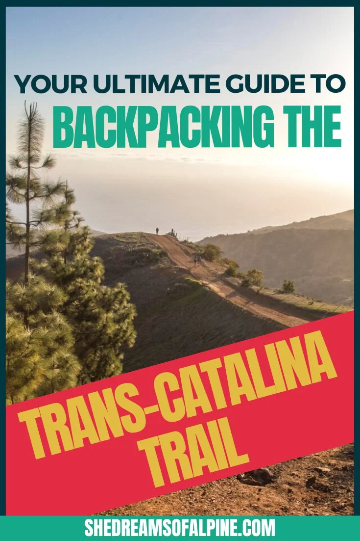
TRANS CATALINA TRAIL HIKE
Trans Catalina Trail Hike Quick Facts:
Trail Name: Trans Catalina Trail
Trailhead: Avalon or Two Harbors
Type of Trail: Point to Point
Total Mileage: 38.5 miles
Total Elevation Gain: 8,329
High Point Elevation: 1,748 feet
Difficulty: Extremely Challenging
Permit Required: Yes

The Trans-Catalina Trail is a unique trek across the entire length of Catalina Island, about an hour ferry ride off the coast of Los Angeles. This makes for a unique and challenging Southern California hike that is best done as a backpacking trip over the course of a few days.
You can start the Trans-Catalina Trail in either Avalon or Two Harbors, then spend about 3-5 days traversing the island. While you will be close to civilization near the beginning and end of the trail, you will also find seclusion as the trail winds along the beach. Spending a night at camp with a beachside sunset is definitely an unforgettable experience.
Campground reservations are required for each night of your trip, and you should book these ahead of time since this is a popular trail. You will also have to do some planning for your ferry rides to and from Catalina Island. Luckily, there are ferry ports at both Avalon and Two Harbors, since the trail is point to point, so you will start at one and end at the other.
Don’t forget to be on the lookout for bison along the trail! A free-roaming herd of them calls Catalina home, and it is pretty cool to see them in the wild. That’s just part of what makes the Trans-Catalina such an amazing hike in Southern California.
Check out my ultimate guide to the Trans-Catalina Trail here!
What to Bring on Southern California Hikes

Below are some of the essential items to bring on any hike in Southern California. This is not a comprehensive list, so be sure to consider the terrain and check the weather where you’ll be hiking to pack appropriately.
*Please note that some of the below links and in this post are affiliate links.
Be sure to check out my ultimate hiking gear packing list for all of my gear recommendations!
GRAB MY DAY HIKING PACKING LIST
Check out what we recommend as essential day hiking gear to have with you on day hikes, including our favorite trekking poles, hiking boots, water filters and more!
Hiking in California Resources:
If you are looking for some inspiration or goal summits to work towards while completing these best hikes in Southern California, then be sure to check out our trail guides on these popular California 14ers:
A Full List of All the California 14,000 Foot Peaks
Mount Whitney Trail – California 14er
Mount Langley Hike – California 14er
Split Mountain Hike – California 14er
Mount Shasta Hike – California 14er
Also be sure to check out these essential hiking resources!
Which Southern California hike are you excited to attempt? Let us know in the comments!
Cheers,
Allison


Related Posts:


The 19 Best Hikes in Southern California | Southern California is a hiker’s paradise, and there are loads of great hiking trails in SoCal. To help you narrow it down, here is a list of the 19 very best hikes in Southern California. From easier hikes like the Hollywood Sign to multi-day backpacking excursions like the Trans-Catalina Trail, there’s something for everyone in Southern California! | shedreamsofalpine.com