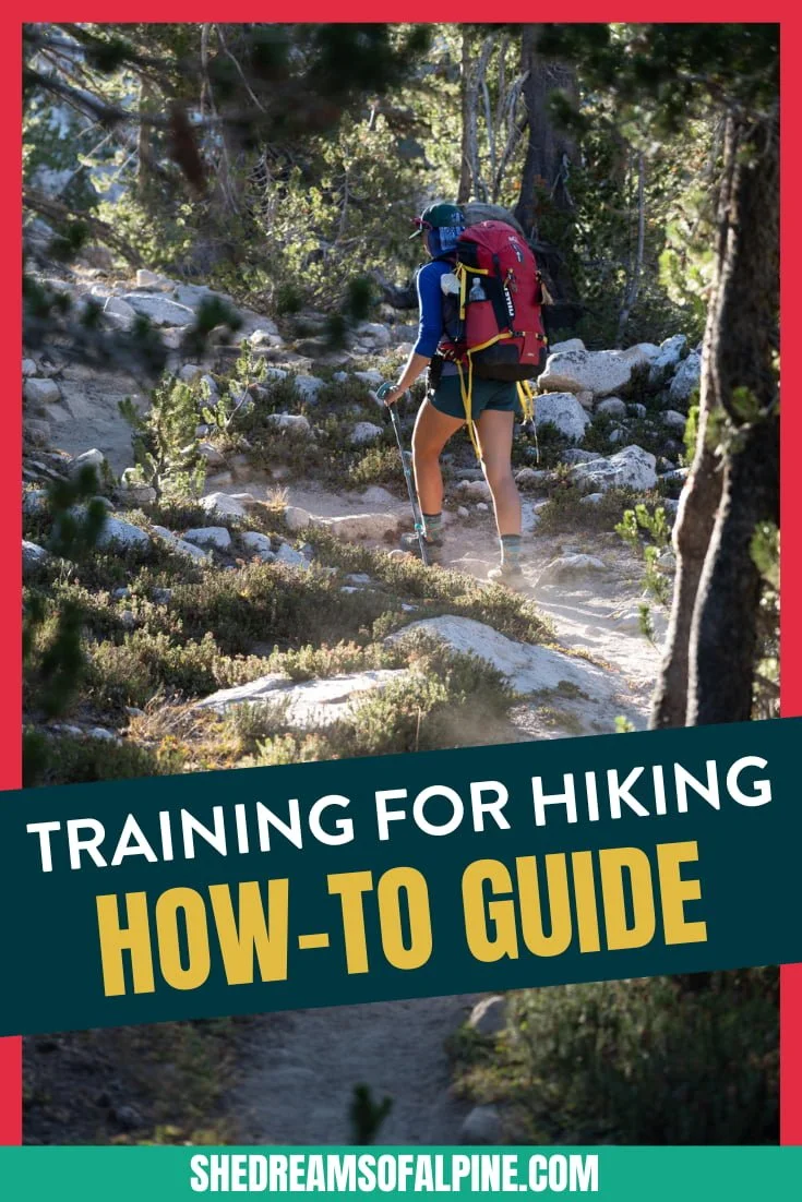
The 13 Best Great Basin National Park Hikes

Hiking in Great Basin National Park in Nevada might fly under the radar compared to other more famous national parks in the United States, but that means you can find solitude and escape the crowds while exploring a ruggedly beautiful landscape. Hiking Great Basin National Park provides a variety of options to challenge yourself to summit a peak or simply go for a stroll among ancient trees.
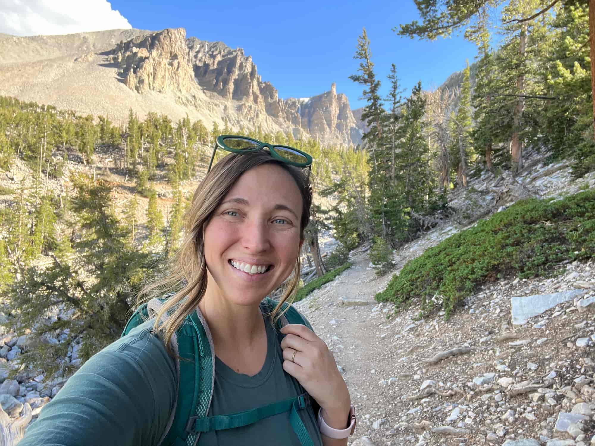
The first time I ever visited Great Basin National Park was when I flew out to Lake Tahoe in California to meet up with my best friend for her bachelorette party. Afterward, our plan was to drive back to Colorado together on a mini road trip and take "The Loneliest Road in America" through Nevada so we could go visit Great Basin National Park.
I'll be honest, I had never heard of Great Basin National Park before my friend suggested that we go there on our drive home. I guess that's not overly surprising because there are 62 national parks here in the states, and I definitely haven't seen them all yet. But visiting Great Basin gave me a pleasant surprise!
Driving across the Loneliest Road in America we passed through small town after ghost town after small town. We were often driving for long stretches at a time without seeing any other cars in sight.
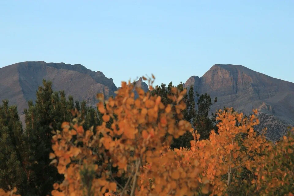
As we got closer to Great Basin, we wondered what it would be like compared to the rest of the desolate stretch of road we had been driving on in Nevada. Soon we found ourselves driving into a beautiful forested oasis, filled with pine trees, ancient bristlecone trees, giant rock formations, peaks, trails, and underground caves!
Unlike most national parks, there is no fee to enter Great Basin because it doesn’t get enough yearly visitors (yet!), and when we made it to the trailhead, we mostly had the place to ourselves. We hiked all around Great Basin and explored the famous Lehman Caves. The weather was amazing (despite it being the middle of summer in Nevada), and I absolutely loved it.
So, suffice it to say, it is a hidden gem and is definitely worth a visit if you can manage it!

In this guide we will cover a variety of hikes in Great Basin National Park, and there really is something for everyone. The hikes are sorted by difficulty to make it easy to find the perfect hike for you!
Enjoy the best hikes in Great Basin National Park, and I hope you find exploring this beautiful place just as magical as I did!

ABOUT THIS GREAT BASIN NATIONAL PARK HIKING GUIDE
In this Great Basin National Park best hikes guide I’ve split up the list of hikes by difficulty, starting with the easiest. Since everyone has a different gauge of “difficult” and “easy” hiking, here is how I’ve defined it:
1. Best Easy Hikes in Great Basin National Park - If a trail is under 3 miles long OR under 1,000 feet of total elevation gain, I rated this hike as “easy.”
2. Best Moderate Hikes in Great Basin National Park - If the trail is within the 3-6 mile range OR between 1,000 to 2,000 feet of total elevation gain, I rated this hike as “moderate.”
3. Best Difficult Hikes in Great Basin National Park - If a trail is over 6 miles long OR over 2,000 feet of total elevation gain, I rated this hike as “difficult.”
4. The Caves That Are More An Attraction Than a Hike - Finally, you shouldn’t miss exploring the Lehman Caves during your visit to Great Basin so I’ve included them here. But please note that they require a guided tour (totally worth it in my opinion) that you should reserve in advance if you can.
the 13 best hikes in Great Basin National Park
Here’s a quick list of all the Great Basin hikes we’ll cover here in this post. If there’s a specific hike in Great Basin you’re looking for, just jump to that number!
Sky Islands Forest Trail (0.4 miles round trip, no elevation gain, easy)
Alpine Lakes Loop (2.7 miles round trip, 600 ft gain, easy)
Bristlecone Trail (2.8 miles round trip, 600 ft gain, easy)
Serviceberry Loop (3 miles round trip, 725 ft gain, easy)
Bald Mountain (3 miles round trip, 1,600 ft gain, moderate)
Bristlecone & Glacier Trail (4.6 miles round trip, 1,100 ft gain, moderate) - my TOP pick!
Lexington Arch Trail (5.4 miles round trip, 820 ft gain, moderate)
Pole Canyon Trail: (7 miles round trip, 1580 ft gain, moderate)
Lehman Creek Trail (6.8 miles round trip, 2,050 ft gain, difficult)
Wheeler Peak (8.6 miles round trip, 2,900 ft gain, difficult)
Johnson Lake Trail via Snake Creek (7.4 miles round trip, 2,420 ft gain, difficult)
Snake Creek Divide (10.7 miles round trip, 2,550 ft gain, difficult)
Baker Lake Loop (13.1 miles round trip, 3,300 ft gain, difficult)
Plus, there’s a separate section about the Lehman Caves tour at the end of this list!
GRAB MY [FREE] OUTDOOR BACKPACKER STARTER KIT:
I created the Ultimate Outdoor Backpacker Starter Kit for you (and it's FREE)! This starter kit is filled with 14 pages of my best hiking and backpacking tips to help you learn what it takes to become a safe, confident, and self-sufficient outdoor backpacker!
GREAT BASIN NATIONAL PARK HIKING MAP
Great Basin encompasses a large area, so you’ll want to get the lay of the land before your chosen hike. Several of the Great Basin National Park hikes (especially most of the easier ones) begin at the Bristlecone Parking Area, which is located at the end of Wheeler Peak Scenic Drive. Other hikes begin at different areas in the park, and the Lexington Arch Trail is actually accessed from outside the park itself.
Below is a Great Basin National Park hiking map showing the location of most of the best hikes in Great Basin National Park that are included in this post. Click the map to be taken to an interactive Google Map to explore the locations further.

Great basin MAPS & guidebooks
If you’re planning an extended visit to Great Basin National Park, I definitely recommend grabbing a Great Basin National Park map and maybe a more extensive guidebook to exploring the area. Here are a few recommended resources for your visit to Great Basin:
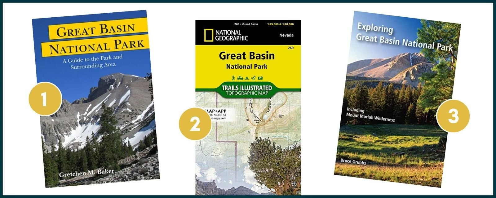
Note: This list contains affiliate links.
Now that you’ve got the lay of the land, here are the 13 best hikes in Great Basin National Park!
BEST EASY HIKES IN GREAT BASIN NATIONAL PARK
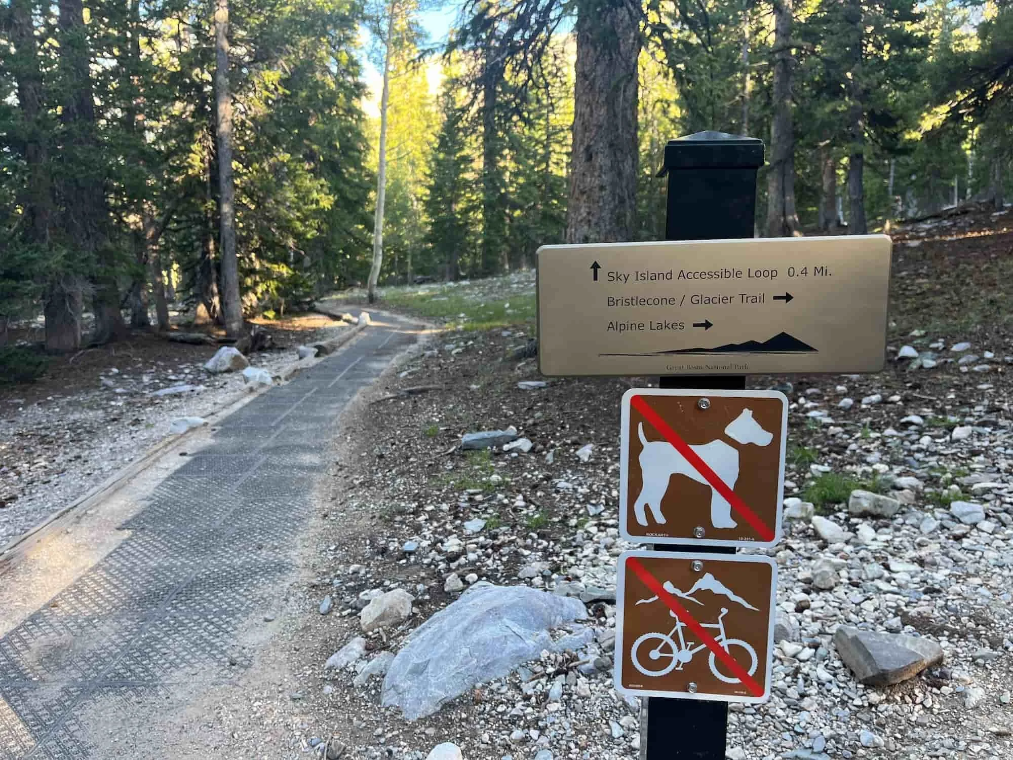
1. SKY ISLANDS FOREST TRAIL
Sky Islands Forest Trail Quick Facts:
Type of Trail: Loop
Total Mileage: 0.4 miles
Total Elevation Gain: Virtually none
Difficulty: Easy (wheelchair-accessible)
Crowd Rank: Tends to be a little more crowded because of the easy access
Scenery Rank: While it doesn’t boast the most spectacular views in the park, the conifer forest is quite pretty, and you can see Wheeler Peak.
Best Place to Park to Access Trailhead: Bristlecone Parking Lot, located at the end of Wheeler Peak Scenic Drive
Sky Islands Forest Trail is a very short loop that leads through a high alpine conifer forest. Signs along the way provide information about how this forest came to be.
What makes this Great Basin hike special? This trail is wheelchair-accessible, so everyone can appreciate the conifers and views of Wheeler Peak.
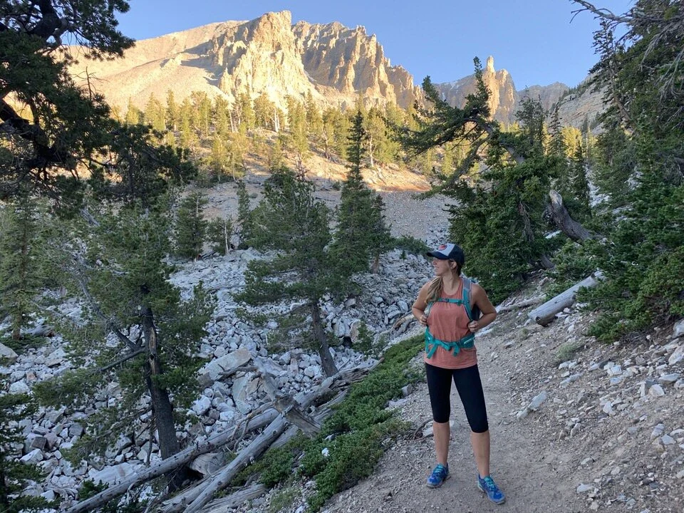
2. Alpine Lakes LooP TrAIL

This was part of my friend’s bachelorette party excursion, hence why we had the blow-up fiance with us on the hike. We were just having a bit of fun. :)
Alpine Lakes Loop Trail Quick Facts:
Type of Trail: Loop
Total Mileage: 2.7 miles
Total Elevation Gain: 600 feet
Difficulty: Easy
Crowd Rank: Popular but doesn’t feel too crowded
Scenery Rank: Excellent views of two alpine lakes for the price of one hike!
Best Place to Park to Access Trailhead: Bristlecone Parking Lot, located at the end of Wheeler Peak Scenic Drive
If you take the loop counterclockwise, you will begin in a forest and then encounter Stella Lake, with crystal clear water and great views of Wheeler Peak in the distance.
When you’re ready to continue on, make your way through another forest, then along a burbling creek lined with wildflowers until you find yourself at Theresa Lake. If the water level is high, you can soak in the aquamarine water while admiring more views of Wheeler Peak.
What makes this Great Basin hike special? The two alpine lakes are the clear stars of the hike, but you might also see wildflowers, butterflies, and tiny waterfalls along the way.
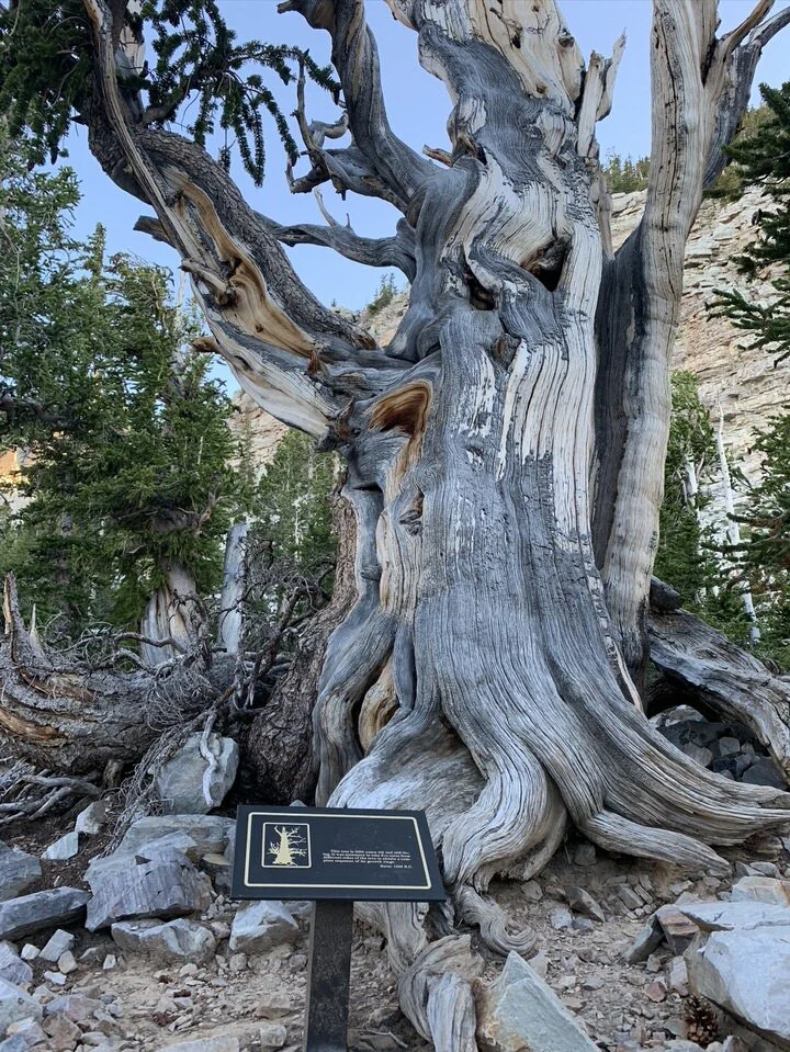
3. BRISTLECONE TRAIL
Bristlecone Trail Quick Facts:
Type of Trail: Out & Back
Total Mileage: 2.8 miles
Total Elevation Gain: 600 feet
Difficulty: Easy
Crowd Rank: One of the most popular trails in Great Basin
Scenery Rank: Fascinating ancient forest along with some views of the surrounding peaks
Best Place to Park to Access Trailhead: Bristlecone Parking Lot, located at the end of Wheeler Peak Scenic Drive
Bristlecone Trail takes you through a forest of some of the oldest trees in the world. In fact, the bristlecone pines you’ll pass as you hike could be as old as 4,000 years old.
This trail actually starts the same way as the clockwise version of the Alpine Lakes loop, and you’ll branch off towards the forest just before you get to Theresa Lake.
What makes this Great Basin hike special? The enduring bristlecone pine trees are clearly the highlight of this hike, and it’s amazing to see pieces of nature that have adapted to survive harsh conditions for so long.
4. SERVICEBERRY LOOP
Serviceberry Loop Trail Quick Facts:
Type of Trail: Loop
Total Mileage: 3 miles
Total Elevation Gain: 728 feet
Difficulty: Easy
Crowd Rank: Low – in fact, you might not see anyone else on this trail
Scenery Rank: Lots of amazing views in different directions along the whole trail along with beautiful trees and flowers.
Best Place to Park to Access Trailhead: Small area for a few cars at the trailhead. The road up to it is dusty gravel and narrow in spots, so a 4WD is helpful, but not necessary.
Serviceberry Loop is a lovely hike in the Snake Creek area of Great Basin. The trail heads up a hillside through aspen groves to meadows and offers a wide view of the park from the top. You can do this trail in either direction, but most people choose to go clockwise to avoid climbing up some steep switchbacks.
What makes this Great Basin hike special? This trail features a ton of variety in vegetation, from aspen and mountain mahogany to sage and serviceberry to wildflower meadows, along with wide open views of the landscape of Great Basin.

BEST MODERATE HIKES IN GREAT BASIN NATIONAL PARK
5. BALD MOUNTAIN
Bald Mountain Quick Facts:
Type of Trail: Out & Back
Total Mileage: 3 miles
Total Elevation Gain: 1,600 feet
Difficulty: Moderate
Crowd Rank: Very low, especially after the saddle
Scenery Rank: The best views you’ll find of Wheeler Peak
Best Place to Park to Access Trailhead: Bristlecone Parking Lot, located at the end of Wheeler Peak Scenic Drive
Bald Mountain makes a perfect choice if you don’t want to take on the challenge of summitting Wheeler Peak. The trail is well-signed and straightforward and takes you up to the same saddle for Wheeler Peak. Once at the saddle, you’ll head north to ascend a mile to the summit of Bald Mountain over relatively easy terrain.
What makes this Great Basin hike special? You really can’t beat Bald Mountain for an easy summit with phenomenal views of Wheeler Peak.
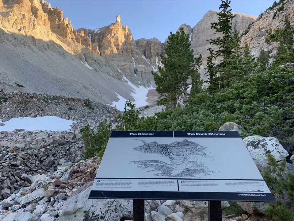
6. BRISTLECONE & GLACIER TRAIL
Bristlecone & Glacier Trail Quick Facts:
Type of Trail: Out & Back
Total Mileage: 4.6 miles
Total Elevation Gain: 1,100 feet
Difficulty: Moderate
Crowd Rank: The Bristlecone section of the trail is very popular, but some of the crowds turn around after that
Scenery Rank: Breathtaking views of Wheeler Peak from the foot of a glacier
Best Place to Park to Access Trailhead: Bristlecone Parking Lot, located at the end of Wheeler Peak Scenic Drive
This is an extension of Bristlecone Trail, so you begin your hike through a grove of ancient bristlecone trees. From there, you continue on the trail to reach the foot of Wheeler Peak Glacier, the only glacier in Nevada.
This was probably my FAVORITE trail in Great Basin because it gives you a taste of a lot of different things. You start with the same trails as the alpine lakes and Bristlecone Trail, and on your way up you can even make a side trip to one of the alpine lakes.
As you keep hiking up the trail you’ll eventually come to the Bristlecone Trail (which is short and worthwhile visit), and then you continue on for a longer hike to the Rock Glacier, a stunning piece of rock that almost reminds you a little bit of Yosemite’s Half Dome.
If you only have time to hike one trail in the park, I’d recommend this one.
What makes this Great Basin hike special? Gazing up the glacier toward Wheeler Peak is a stunning sight that is worth the extra mileage on this hike.
7. LEXINGTON ARCH TRAIL
Lexington Arch Trail Quick Facts:
Type of Trail: Out & Back
Total Mileage: 5.4 miles***
Total Elevation Gain: 820 feet
Difficulty: Moderate
Crowd Rank: Very secluded
Scenery Rank: Super cool views of a rare limestone arch formation
Best Place to Park to Access Trailhead: ***The trailhead is located outside of the park. Due to wildfire damage, the road to the trailhead has been washed out approximately 0.5-1 mile before the actual trailhead. There is now no official parking lot, so you should drive as far as you feel comfortable, then park and walk the rest of the way (which will add mileage to your hike). The entire road to Lexington Arch is very rough and requires a high-clearance 4WD vehicle.
Most natural arches in the western United States are formed from sandstone, but Lexington Arch is made of limestone. It is believed that the arch might either have once been part of a cave system or be a natural bridge (formed by water flowing under it).
You’ll find lots of lovely wildflowers along the somewhat steep trail. Once you reach the arch itself, you can marvel at it from a bench and even hike directly under the arch.
What makes this Great Basin hike special? While it can be a hassle to get to due to the rough road leading to the trailhead, the up-close views of this unique limestone arch make the trek worth it.
8. POLE CANYON TRAIL
Pole Canyon Trail Quick Facts:
Type of Trail: Loop
Total Mileage: 7 miles
Total Elevation Gain: 1,581 feet
Difficulty: Moderate
Crowd Rank: Low, this is a more remote area of the park that doesn’t see a lot of visitors
Scenery Rank: Beautiful views of the Snake Valley along the trail, but no specific scenic destination.
Best Place to Park to Access Trailhead: Small parking area near Grey Cliffs Campground.
The Pole Canyon Trail is a great moderate loop when combined with the Timber Creek and Baker Creek Trails. You’ll hike along Pole Creek for much of the way. The trail runs through aspen groves, so it’s gorgeous in the fall, and it’s a good trail for snowshoeing in the winter as well.
What makes this Great Basin hike special? This is a wonderful trail any time of year, and it provides excellent views of a less-visited section of Great Basin.

BEST DIFFICULT HIKES IN GREAT BASIN NATIONAL PARK
9. LEHMAN CREEK TRAIL
Lehman Creek Trail Quick Facts:
Type of Trail: Out & Back
Total Mileage: 6.8 miles
Total Elevation Gain: 2,050 feet
Difficulty: Difficult
Crowd Rank: Fairly popular, but not overly crowded
Scenery Rank: A great way to see the variety of landscapes that make up Great Basin National Park.
Best Place to Park to Access Trailhead: Park near either the Wheeler Peak Campground or the Lehman Creek Campground
Lehman Creek is a long trail where you can explore meadows and forests and the different natural habitats of Great Basin, as well as lots of little waterfalls along the creek. This is an out and back trail, and you can actually start at either end. The trail can be snow-covered very late into the season, and you can borrow snowshoes from the park visitors center when necessary.
What makes this Great Basin hike special? Lehman Creek Trail provides a good overview of everything that makes up Great Basin.
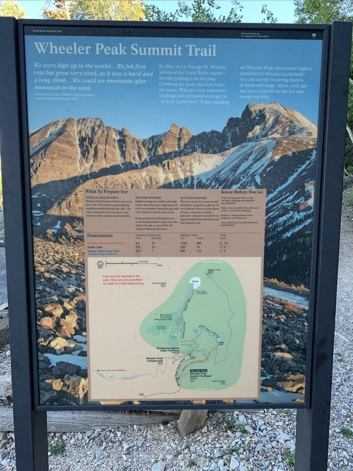
10. WHEELER PEAK
Wheeler Peak Quick Facts:
Type of Trail: Out & Back
Total Mileage: 8.6 miles
Total Elevation Gain: 2,900 feet
Difficulty: Difficult
Crowd Rank: While it’s very popular, the difficulty keeps the crowds away
Scenery Rank: Absolutely stunning views from the top of the peak!
Best Place to Park to Access Trailhead: Summit Trail parking lot
Wheeler Peak is the crowning summit of Great Basin National Park. This classic hike takes you up the second highest peak in Nevada at 13,044 feet. While the trail is not technically difficult, it does get steep near the top and is quite challenging especially with the altitude.
What makes this Great Basin hike special? Wheeler Peak is the reason many people visit Great Basin, and if you are in good shape, it is definitely a worthwhile hike to attempt. You will be rewarded with spectacular views of Great Basin from the summit.
11. JOHNSON LAKE TRAIL VIA SNAKE CREEK
Johnson Lake Trail Quick Facts:
Type of Trail: Out & Back
Total Mileage: 7.4 miles
Total Elevation Gain: 2,420 feet
Difficulty: Difficult
Crowd Rank: Not too crowded
Scenery Rank: A pretty alpine lake plus a unique abandoned mining area make for very cool photo opportunities
Best Place to Park to Access Trailhead: At the end of Snake Creek Road
This steep trail provides great views of Snake Creek along the way to a nice alpine lake. Johnson Lake Trail offers good wildflowers and wildlife as well.
What makes this Great Basin hike special? The unusual thing about Johnson Lake Trail is the historic Johnson Lake mining area located up near the lake. Some of the old abandoned structures still remain and are fun to explore (but don’t go inside any of the buildings).
12. SNAKE CREEK DIVIDE
Snake Creek Divide Trail Quick Facts:
Type of Trail: Out & back
Total Mileage: 10.7 miles
Total Elevation Gain: 2,552 feet
Difficulty: Difficult
Crowd Rank: Extremely secluded, so you might have the trail all to yourself
Scenery Rank: Stunning views and bristlecone groves make this a very worthwhile trail.
Best Place to Park to Access Trailhead: Limited parking at Snake Creek Trailhead, which is 12 miles down Snake Creek Road.
The Snake Creek Divide hike starts on a forested trail and then runs along a ridge as you head uphill. On the upper part of the ridge, you’ll get amazing views of Snake Creek basin. Plus, this trail goes through two unique bristlecone pine groves in the backcountry.
What makes this Great Basin hike special? This hike is worth the effort to see the bristlecone pine groves and incredible views along the ridge.
13. BAKER LAKE/JOHNSON LAKE LOOP
Baker Lake/Johnson Lake Loop Quick Facts:
Type of Trail: Loop
Total Mileage: 13.1 miles
Total Elevation Gain: 3,300 feet
Difficulty: Difficult
Crowd Rank: Moderately crowded since people can hike either trail without connecting the two
Scenery Rank: Excellent panoramic views from the ridgeline between the trails.
Best Place to Park to Access Trailhead: In a small parking area at the end of Baker Creek Road
Combining Johnson Lake Trail with Baker Trail makes for the longest day hike in Great Basin and one of the best. Great Basin National Park hiking trails. It provides an amazing sampling of everything that makes Great Basin special, from wildflowers to alpine lakes to views of Pyramid Peak and Wheeler Peak.
What makes this Great Basin hike special? The ridgeline that connects Baker and Johnson trails offers fantastic views in all directions.
LEHMAN CAVES
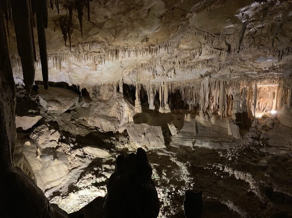
Though they are not exactly a hiking trail, the Lehman Caves are one of the main attractions in Great Basin National Park. These limestone caves feature different rooms full of striking stalactites, stalagmites, and other fascinating formations.
In my opinion, you would be REALLY missing out if you did not go on a tour of the Lehman Caves while you are visiting and hiking in Great Basin National Park. It is a such a unique experience, and the guided tour is really well done!
The caves can only be explored as part of a guided tour with a park ranger. Reservations are highly recommended and can be booked at recreation.gov. The fee for adults is $12 for the 60-min Lodge Room Tour or $15 for the 90-min Grand Palace Tour.
GREAT BASIN NATIONAL PARK HIKING PACKING LIST
Here are some of the essential items to bring when you’re hiking in Great Basin. This is definitely NOT a comprehensive list, so also be sure to consider the terrain of the trail and check the weather to pack appropriately for the conditions.
Note: The list below contains affiliate links.
Again, this is NOT your full day hiking packing list (just some of the super important items to remember), so check out my day hiking checklist below for my full gear recommendations.
DOWNLOAD OUR HIKING PACKING CHECKLIST:
So that you can hit the trails with peace of mind knowing that you didn’t leave anything essential behind!
GREAT BASIN NATIONAL PARK CAMPING
If you want to spend a few days in the park and try a few of these Great Basin hikes, you have many options for camping, especially during the summer season.
CAMPGROUNDS IN GREAT BASIN NATIONAL PARK
Great Basin has 5 developed campgrounds, but Lower Lehman Creek is the only campground open year-round. All the other campgrounds are closed seasonally.
Note: Lower Lehman Creek Campground will have intermittent closures for rehabilitation projects in 2023 so it is first-come, first-serve during this time. Check for updates on the campground at the Great Basin NP site.
Camping fees are $20/site each night for the developed campgrounds, and most can be reserved at recreation.gov (except for Baker Creek which is first-come/first-serve). There is also one primitive campground, Snake Creek, which is free and first-come/first-served.
Lower Lehman Creek Campground - The only campground that is open year-round. 11 sites along Lehman Creek near the caves.
Upper Lehman Creek Campground - Located 3 miles up Wheeler Peak Scenic Drive with 24 sites. Typically open from June to October, and closes after the first snow of the season.
Wheeler Peak Campground - High elevation campground at 9,500ft. Closes each year after the first snow of the season and opens around July 1.
Baker Creek Campground - 37 available on a first-come/first-serve basis. Typically open Memorial Day to Labor Day.
Grey Cliffs Campground - 13 sites set among pinion pines near limestone cliffs. Typically open Memorial Day to Labor Day.
DISPERSED CAMPING NEAR GREAT BASIN NATIONAL PARK
There is also one primitive campground nearby, Snake Creek, which is free and first-come/first-served.
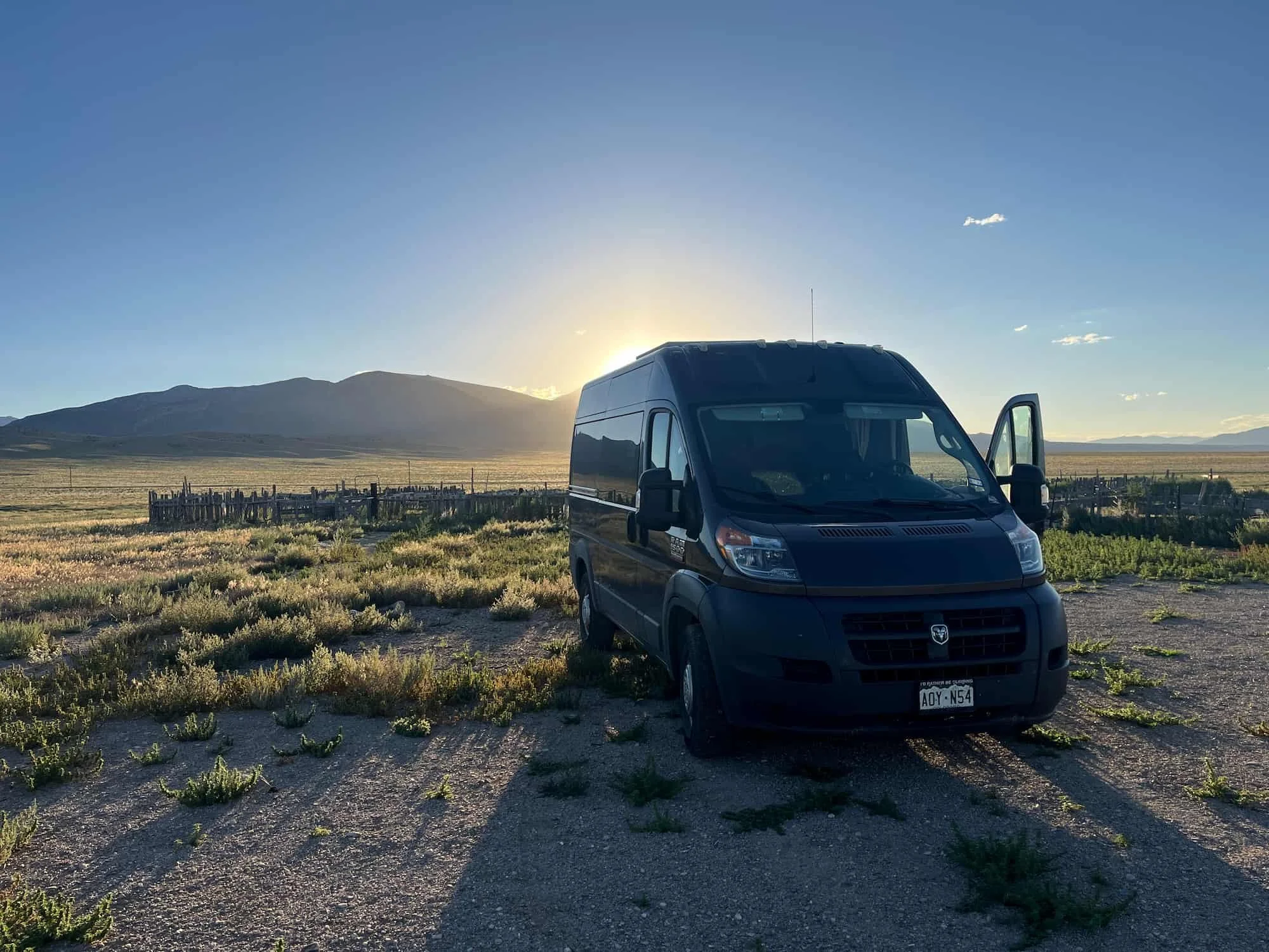
I camped here on my most recent trip to Great Basin, and it’s basically a big open field near an old sheep pen. It’s very easy to get to – I just to drive down a dirt road for a short bit, and any kind of car will make it no problem.
Snake Creek campground is close to the town and Great Basin, and I'd definitely stay there again when I’m in the area.
Have you ever gone hiking in Great Basin National Park? Which Great Basin hike was your favorite – or which one are you adding to your hiking bucket list? Did we miss any of your favorite Great Basin National Park trails? Let us know in the comments below!
LOOKING FOR MORE NATIONAL PARK ADVENTURES?
If you’re looking for more national park hiking adventures, check out our resources below:
ESSENTIAL HIKING RESOURCES
Also be sure to check out these essential hiking resources!
9 Must-Know Backpacking Safety Tips - Particularly if You Want to Go Solo
Backpacking for Beginners: 15 Rookie Mistakes to Avoid Your First Time Backpacking
And if you’re looking for some more “Best Hikes In” blog posts, be sure to check these out:
Cheers,
Allison - She Dreams of Alpine


Related Posts:


Travel Alone – 57 Quotes to Inspire Your Solo Travels | There’s something magical about traveling alone or going on solo adventures. Traveling alone forces us to grow and test what we are really made of and maybe even go through a transformation of self-discovery. These 57 travel alone quotes celebrate the beauty in going solo. | shedreamsofalpine.com