The Ultimate Guide to Hiking Humphreys Peak Trail in Arizona

Today's post is all about day hiking Humphrey's Peak Trail in Arizona. This post is a guest post from another awesome outdoor blogger, Timmothy, so if you enjoyed this post be sure to check out his bio at the bottom of this post to learn more about him and see where you can connect with him further.
I'm really excited about this one, Humphrey's Peak Trail has been on my list for quite some time now because it is the tallest peak in Arizona. I sort of have this dream that one day I will climb all the high points in the 50 states... only time will tell! Right now it's not my focus, because I'm trying to grab more of the California Fourteeners, but if I ever find myself in Arizona, I will definitely put this on the plan!
If you’re looking for some more epic hikes in Arizona, be sure to check out our Best Hikes in Sedona Arizona blog post!
Without further ado:
Humphreys peak- Quick Info:
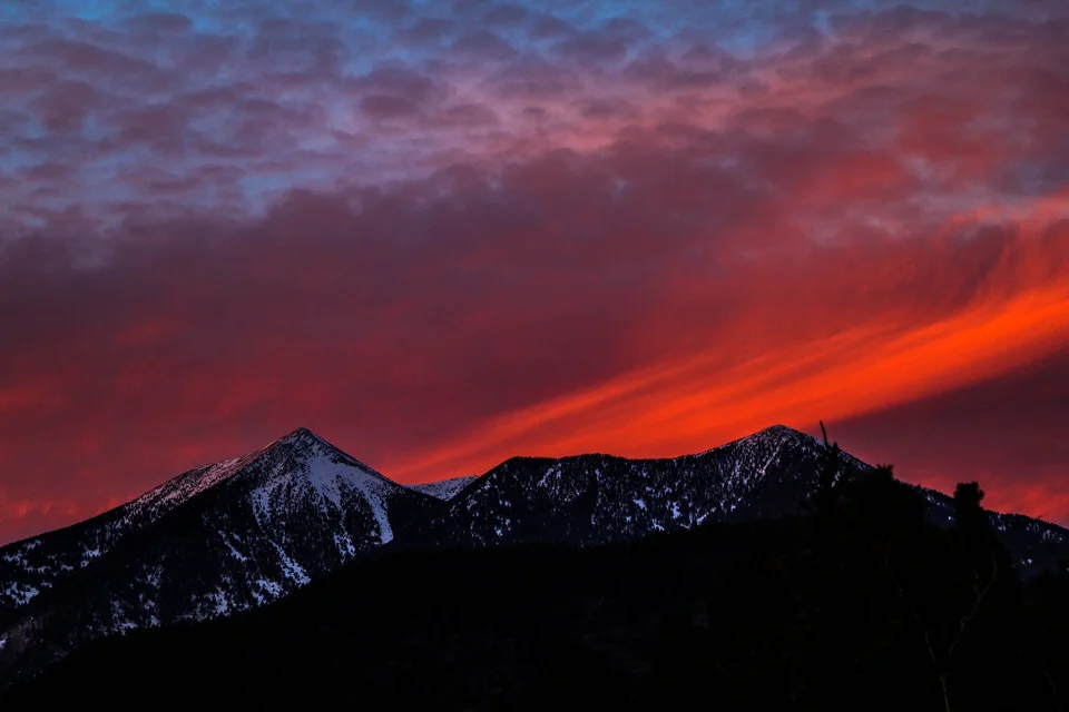
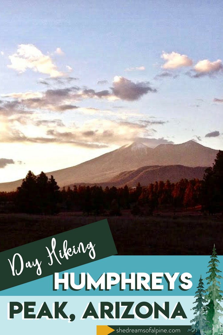
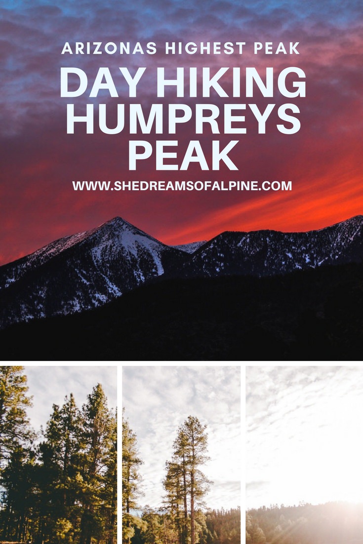
The Humphreys Peak Trail, located just north of the city of Flagstaff, Arizona, is one of the most popular hiking trails in the entire state. At 12,633 feet, the summit of Mt. Humphreys marks the highest point in all of Arizona. During its peak hiking season, the hiker traffic on the Humphreys Peak Trail likely rivals that of nearby well known trails such as Havasu Falls, and the Grand Canyon’s Bright Angel and Kaibab trails. After all, the allure of climbing the highest peak around draws many to this strenuous hike.
Humphreys Peak is the highest point in Arizona’s San Francisco Peaks. The San Francisco Peaks, often referred to as a mountain range, are actually the exploded remains of a large Stratovolcano that once towered over the Colorado Plateau. At its zenith, this volcano is estimated to have risen to nearly 16,000 feet in elevation. 200,000 years ago, the San Francisco Volcano erupted, blowing the top off the mountain, and creating a giant chasm now known as the Inner Basin. Subsequent periods of glaciation have morphed the mountain into its present state. Today, Humphrey’s Peak marks the highest point of what remains of the ancient caldera.
The San Francisco Peaks, though marred by a violent geologic past, are today an outdoor lover’s playground. The entire mountain is crisscrossed by trails, and the Humphreys Peak trail is the most popular. The trail begins at the Arizona Snowbowl, Arizona’s most popular ski resort, and ascends the west side of the San Francisco Peaks (hereinafter referred to “The Peaks” for short) via winding switchback trails. Along the way, the hiker will climb more than 3,000 feet, and travel through several different ecological zones, including Arizona’s only region of Alpine Tundra.
humphreys peak hike Details:
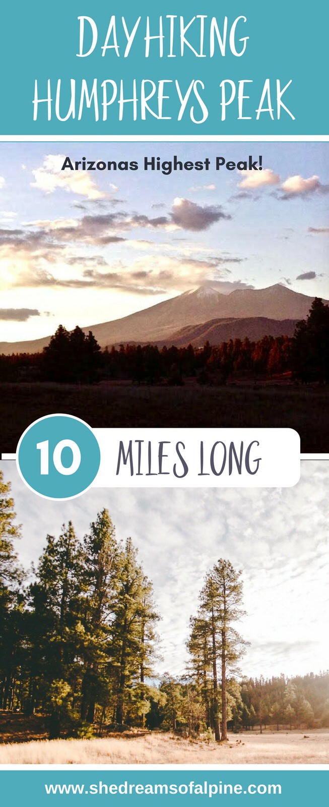
~10 miles round trip
~3,000 feet total elevation gain
Trailhead elevation: 9,300 feet, if starting at the Arizona Snowbowl
Highest Point on the trail: Humphreys Peak, 12,633 feet
Estimated Time to complete: 5-6
No water source along the way, so bring plenty of water.
Dog friendly? Yes! But all dogs are required to be kept on a leash.
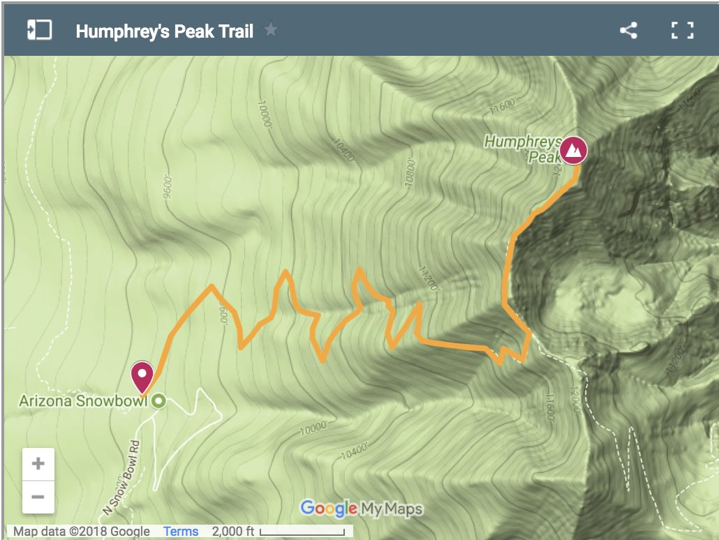
humphreys peak trail map:
Below is a map of the Humphreys Peak hiking trail. If you click on the image below you will be taken to an interactive map that you can further explore
DOWNLOAD THE GPX FILE FOR THIS TRAIL!
Knowledge is power my friend, and I'm a girl who loves data. Get access to this trails GPX file PLUS my library of GPX files with tracks and waypoints for all the trails loaded onto the She Dreams of Alpine blog.
Load this puppy into your trusted GPS and rest easy knowing you have tracks to follow on your next hike or backpacking trip.
DON’T HAVE A GPS? YOU SHOULD.
Look, I believe every hiker and backpacker should be self-sufficient, and that includes knowing how to practice smart navigational skills in the outdoors. This is something I teach in my backpacking program, but I want to give you a couple GPS options to get started. Don’t ever risk getting lost, and don’t rely on other people for your safety. Be empowered, take 100% ownership for yourself my friend. Here’s what I recommend:
1) GAIA GPS Phone App: At a bare minimum, consider getting a premium subscription to GAIA GPS App. This App allows you to download maps in advance and take them offline into the backcountry. You can record your tracks, upload tracks from online to follow (like the one I have above), and so much more with this phone app, and GAIA is offering a special discount to those who subscribe online through my link above, 20% off their normal prices. But even if you don’t use my link... please, at a minimum get a GPS phone app to help you navigate outdoors!
2) Handheld GPS: If you hike often or go backpacking, then I highly recommend you investing in a handheld GPS. I own a Garmin 64st and LOVE this device.
3) Handheld GPS with Satellite Communicator: However, if you have a little bit more money to spend, if I were starting over, I’d get the Garmin inReach Explorer+ which provides not only GPS tracking capabilities, but also an SOS satellite search and rescue communicator. I own the Garmin inReach mini now and I pair it with my Garmin 64st, but you can save weight by getting this all-in-one solution.
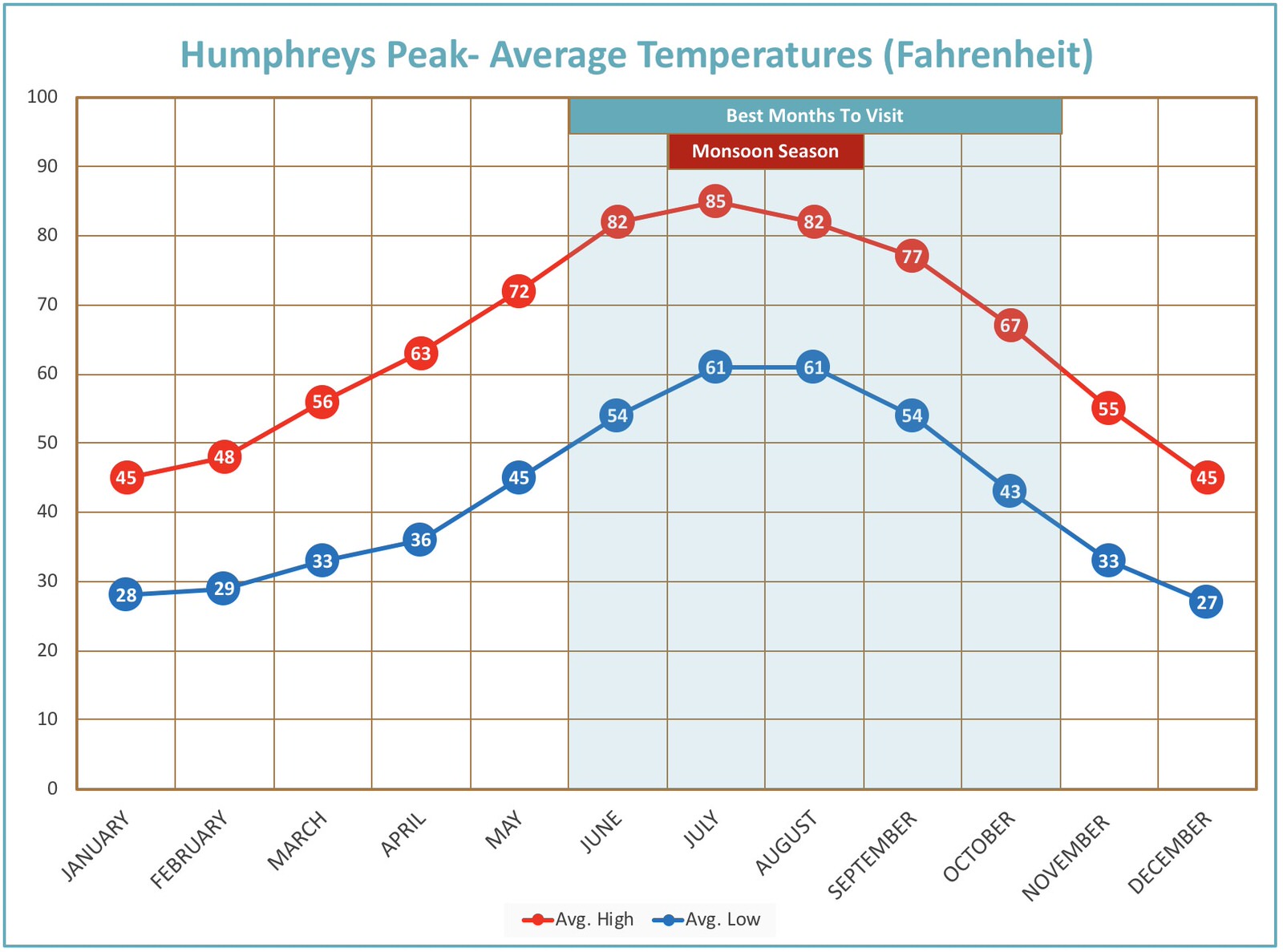
When To hike humphreys peak:
Though Humphreys Peak sees ascents year round, the best and most popular time to go is in the Fall. The Fall provides a pleasant weather window between summer monsoon storms, and the first snows of Winter. Catch the trail in early October to see the Aspen groves in full Autumn regalia.
Getting to humphreys peak:
The Humphreys Peak Trail begins at the Arizona Snowbowl, which is accessed from Highway 180. From downtown Flagstaff, drive North on Humphreys street, and turn left onto Highway 180. Continue on Highway 180 for several miles until you reach the junction with Snowbowl road. Turn right, and follow Snowbowl road until you reach the Arizona Snowbowl ski resort. Park in the Hart Prairie lot, and follow the path across the ski slope to the beginning of the trail.
Hiking Mt. Humphreys can be conveniently combined with a trip to the Grand Canyon, and is easily accessed from the south rim. From the south rim of the Grand Canyon, head south on Highway 180. At the junction with Highway 180, and Arizona Route 64, turn left to stay on Highway 180. Turn Left onto Snowbowl Road, and park at Snowbowl. The total travel time from the South Rim to the start of the Mt. Humphreys Hike is no longer than 1.5 hours.

Camping/Lodging Information:

There are many options for camping or lodging both near the trail, and around Flagstaff. Within Coconino National Forest, you will find several established, pay per night campgrounds, as well as nearly endless free primitive camping. One thing I love about living in Northern Arizona is the mind boggling amount of free camping. Simply pick any Forest Service road, and find a spot. These roads go for miles in every direction, and there are plenty located near the trailhead.
A potential downside for many is that there are few to no amenities. Be prepared to pack in and out all of your food, waste, and water. There are few sources of above ground water in Northern Arizona, so make sure that you have an adequate water supply. Fortunately, Flagstaff is never too far away, so supplies can easily be had.
If you wish to camp at an established campsite, there is no shortage of options. Near the trailhead, there is camping available at the Arizona Nordic Center, which offers Yurts, as well as toilets. Though a little further afield, I would suggest finding a spot at the Lockett Meadow Campground. The Lockett Meadow campground is located in the Inner Basin of the peaks, and is easily the most picturesque campground in the Flagstaff region. From Lockett Meadow, the summit of Mt. Humphreys can be accessed via the Weatherford Trail, although not by the classic Mt. Humphreys Trail detailed in this post.
For more info on camping, visit the camping page on the Coconino National Forest website.
The city of Flagstaff offers plenty of lodging options as well. One can choose to stay in the historic, old west style brick hotels in downtown, or from the dozens of motels lining Route 66.
Permit Information:
No permit is required to hike on the Mt. Humphreys Trail!
Day Hiking Gear Essentials:

Note: This post contains affiliate links.
For a full detailed list on the gear I recommend for day hiking, check out my post on Essential Day Hiking Gear.
There's not a whole lot "extra" you need (besides the basics) for this hike, but I would like to reccommend a couple of things.
Black Diamond Trail Shock Trekking Poles (Womens) - Invest in a good pair of trekking poles and you will have them for a long long time. I've had theses for over 3 years now and they still seem like new. These are my favorite trekking poles, and they definitely come in hand for the really steep portion of this hike. You might be tempted to buy cheaper "twist" to lock poles, but honestly don't bother... they break super easily. I started out with a pair like that and they barely lasted me a year. Definitely just invest in a good pair that will last you a long time to come.
Black Diamond Trail Shock Trekking Poles (Mens) - Michael has the same exact poles as me, but in the "mens" style. He swears by them too, particularly for going downhill since he sometimes has knee problems. You might be tempted to buy cheaper "twist" to lock poles, but honestly don't bother... they break super easily. I started out with a pair like that and they barely lasted me a year. Definitely just invest in a good pair that will last you a long time to come.
Flagstaff Hiking Map- If you know me, I'm always a big fan of carrying a map and this particular map has over 330 miles of hiking trails in it, including Humprey's Peak Trail.
Grab my complete day hiking packing checklist:
Day Hiking Humphreys Peak-Trip Report:

Of all the trails in a region filled with beautiful trails, the Humphreys Peak Trail stands as the quintessential Flagstaff hike. I’ve hiked it twice in my three years living in Flagstaff. Both times were in October, and one was at sunset, and the other was at sunrise. Each time allowed a different experience. This trail report will be a blend of the two experiences.
The trail starts at the Arizona Snowbowl. Park your car at the Hart Prairie lot, and follow the trail across the ski run. The trail begins when the path enters the forest. From here, take gentle switchbacks through mixed conifer forest. After a short while, you enter the Kachina Peaks Wilderness. The wilderness boundary is marked by a sign, and a trail roster.
The Kachina Peaks Wilderness is so named because the San Francisco Peaks are believed to be the home of the Kachinas. In Hopi mythology, the Kachinas are the various gods and deities that make up the Hopi Pantheon. As such, the San Francisco Peaks are considered sacred to the Hopi tribe, as well as many other Native American tribes in Arizona. While recreating in the San Francisco peaks, please be mindful of this, and do not disturb any cultural artifacts that you may come across.
Due to its high elevation, the Humphreys Peak Trail sees itself winding through scattered aspen groves. In the Fall, the aspens turn to their beautiful fall colors. Like the nearby Kachina and Inner Basin Trails, the Humphreys Peak Trail may be one of the best places to see Fall colors in all of Arizona, if not the entire Southwest. As a result, expect to see the peaks choked with tourists crowding to see the leaves change.

Soon, the trail enters a portion of long and steep switchbacks. These switchbacks travel between a talus covered slope on the north ends, and a long, deep glacial carved valley on the south ends. As you come to the end of a switchback, you are afforded stunning views of Northern Arizona. This section can feel like the longest portion of the trail. You are traveling on long switchbacks, and the view is blocked by thick forest cover. Soon though, the switchbacks end, as the trail turns east into a glacial carved valley.
Here, at roughly 11,200 feet in elevation, the alpine transition zone begins. The thick conifer forest that characterized the lower portion of the trail gives way to smaller, hardscrabble, high elevation flora. Now that you are out of the thick forest, you can gaze across the landscape. Kendrick Peak and other cinder cones can be seen to the west, and the impressive massif of Agassiz Peak towers to the South. Below you are the chutes and runs of the Arizona Snowbowl.
While the views may be more impressive, the wind is more aggressive in this section. The topography, combined with less vegetation makes for a high speed wind funnel. This would be a good time to get out your windbreaker, and maybe another layer. As you climb higher, you’ll find that the wind just gets faster, and the temperature drops further.
As you approach the saddle between Humphreys Peak, and Agassiz Peak, the trail begins to steepen, and the path becomes less obvious. It is common to accidentally hike off the trail in this section, so be cognizant of the path that you are using. Luckily, the path is fairly well marked by signs and cairns. If you do lose your way, it shouldn’t be too hard to find your way back to the trail. When in doubt, look up to the saddle (the low point between the two peaks) and follow the path of least resistance.
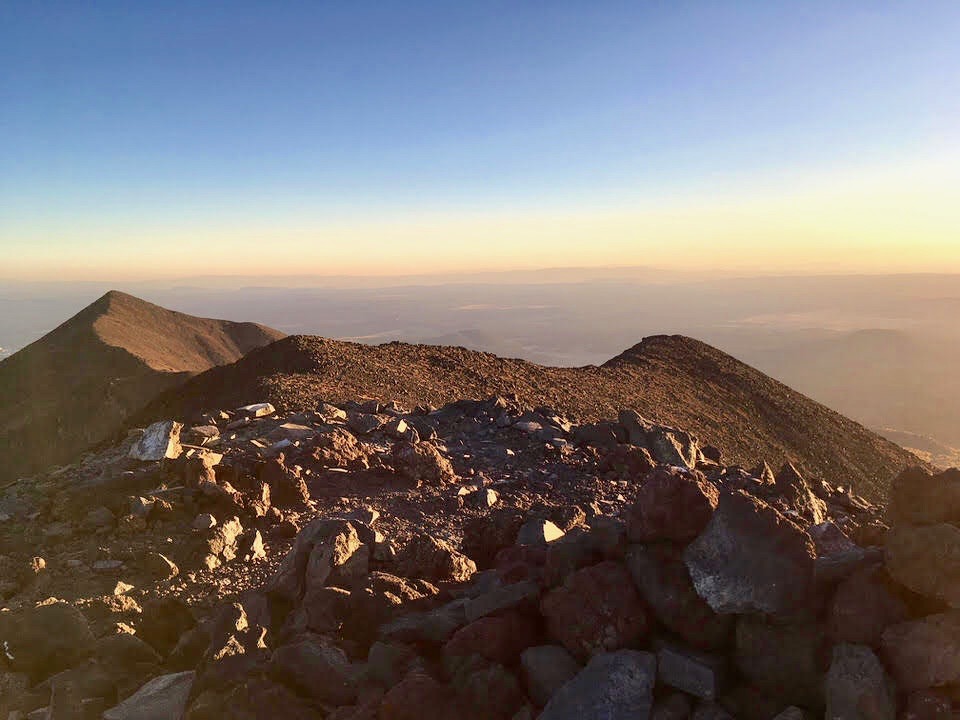
Upon reaching the saddle, the hiker is greeted by expansive views to the east, west, and south. To the east, the hiker can peer down into the inner basin. The Inner Basin is a wide, deep glacier carved valley in the center of the peaks. This is where the mountain erupted, and today it forms a verdant, idyllic mountain valley. If you know what to look for, you can spot unmistakable glacial features, such as moraines, and striations. The view beyond the Inner Basin reveals many recognizable natural features, including Sunset Crater, and the red cliffs of the painted desert. At sunset, the shadow of the mountain can be seen stretching for miles across the landscape.
Enjoy the view, and feel some relief, for the hike is nearly done. From the saddle, it is only one mile of hiking to the Humphreys summit. To me, the saddle marks a clear demarcation between the lush, thick forest below, and the harsh, windswept tundra above. The path to the summit heads north, and follows barely visible path to the summit. In reality, it’s less of a trail, and more of a light scramble across a talus field. The way to the summit is marked by wooden sign posts every few hundred yards. Before you leave the saddle, I like to find some reprieve from the wind by sitting next to a large boulder, and using the opportunity to eat some snacks, drink some water, and add layers.
The final push to the summit can feel harsh. The wind can be very fast, and it is cold at nearly any time of year. There were a few times when the force of the wind almost caused me to lose my balance. Trekking poles come highly recommended in this section. They may save you from falling on your butt, or twisting an ankle. The path also leads you up a few false summits. It can be disheartening when the end is in sight, and it turns out to just be a false summit.

The real summit will be marked by a wooden sign and a small wind shelter. A final uphill push will gain you the summit. Taking pictures at the summit will feel like a priority, but it can prove surprisingly difficult if not crouched beneath the wind break. When you do decide to brave the elements, the view from atop Humphreys Peak offers an impressive 360 degree view of Northern Arizona. To the south, the red rock cliffs of Oak Creek canyon can be seen. On a clear day, even the Grand Canyon can be seen to the north. This is easily the largest view for miles around. Though it does not quite reach the heights of the fourteeners in neighboring states, the 12,633 foot summit of Humphreys Peak is an achievement you can be proud of.

You can learn more about Timmy at his blog, Hike The Planet!
We hope you enjoyed this guest post from Timmothy. I can't wait to try this one out for myself and report back! If you're looking for another adventure out in Arizona, check out our complete guide to hiking the Havasu Falls Trail in Arizona.
Cheers,
Allison - She Dreams of Alpine


Related Posts:


Travel Alone – 57 Quotes to Inspire Your Solo Travels | There’s something magical about traveling alone or going on solo adventures. Traveling alone forces us to grow and test what we are really made of and maybe even go through a transformation of self-discovery. These 57 travel alone quotes celebrate the beauty in going solo. | shedreamsofalpine.com