Lake Isabella Hiking: The Powers Peak Trail in Kernville California

Hi there. If you are a long time reader on the blog, then you'll know that I wrote a post about Power's Peak before back in 2014. Michael and I usually do this hike once a year on Christmas Eve, and so I decided to breathe a bit of new life into that old post and add some more details for anyone who might be interested in doing the hike.
Powers Peak Quick Info:
Powers Peak, in my opinion, is a hidden gem of a hike in Southern California and one of my absolute favorites. It is located in Kernville near the Lake Isabella area, which more people may be familiar with. It is super accessible from Bakersfield, California and can be easily hiked in a day. Kernville is most commonly know for its white water rafting and kayaking on the Kern River, but also has a ton of great hiking, climbing, and mountain biking. I wrote a post a while back on some of the Kern Canyon Rock Climbing. Kernville also has a rich Gold Mining history. One of those old mines, Harley Mine, can actually be found on the trail up to Powers Peak. This peak is named after Bob Powers who authored nine books about the Kern River Valley. The best part about this hike is it's amazing views of Lake Isabella from the summit, and then enjoying a beer at the local Kern River Brewing Company, which is only minutes away from the trailhead!
Powers Peak Trail, Lake Isabella Hiking Details:
~10 Miles Round Trip
~3,200 feet total elevation gain for trip
Trailhead elevation: 2,811 feet
Highest Point on the trail: Powers Peak, 5,778 feet
Estimated Time to complete: 4-5 hours
No water source along the way, so bring plenty of water
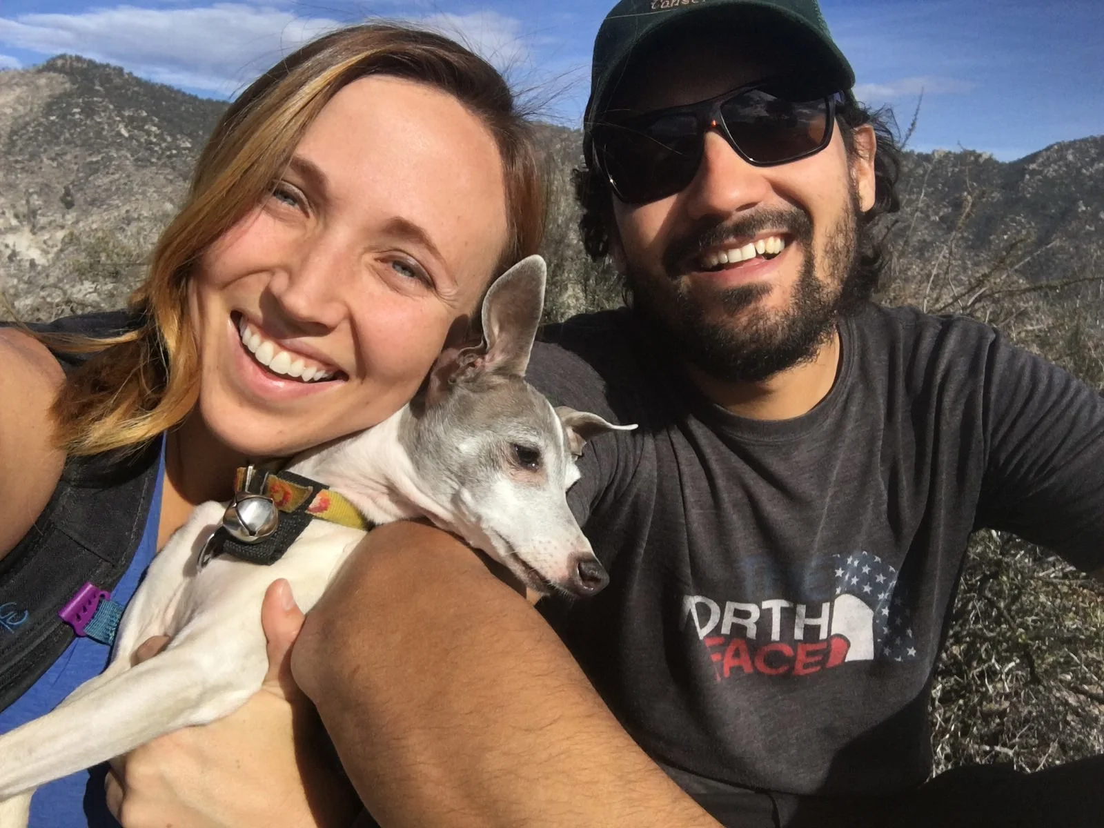
Dog friendly? Yes! We love bringing Lincoln on this hike and there is hardly ever anyone on it
No Permits needed
MAP:
Below is a map of our hiking trail from my GPS. To interact with the map, click the image below and you'll be re-directed to an interactive map.

DOWNLOAD THE GPX FILE FOR THIS TRAIL!
Knowledge is power my friend, and I'm a girl who loves data. Get access to this trails GPX file PLUS my library of GPX files with tracks and waypoints for all the trails loaded onto the She Dreams of Alpine blog.
Load this puppy into your trusted GPS and rest easy knowing you have tracks to follow on your next hike or backpacking trip.
Don’t have a GPS? You Should.
Look, I believe every hiker and backpacker should be self-sufficient, and that includes knowing how to practice smart navigational skills in the outdoors. This is something I teach in my backpacking program, but I want to give you a couple GPS options to get started. Don’t ever risk getting lost, and don’t rely on other people for your safety. Be empowered, take 100% ownership for yourself my friend. Here’s what I recommend:
1) GAIA GPS Phone App: At a bare minimum, consider getting a premium subscription to GAIA GPS App. This App allows you to download maps in advance and take them offline into the backcountry. You can record your tracks, upload tracks from online to follow (like the one I have above), and so much more with this phone app, and GAIA is offering a special discount to those who subscribe online through my link above, 20% off their normal prices. But even if you don’t use my link... please, at a minimum get a GPS phone app to help you navigate outdoors!
2) Handheld GPS: If you hike often or go backpacking, then I highly recommend you investing in a handheld GPS. I own a Garmin 64st and LOVE this device.
3) Handheld GPS with Satellite Communicator: However, if you have a little bit more money to spend, if I were starting over, I’d get the Garmin inReach Explorer+ which provides not only GPS tracking capabilities, but also an SOS satellite search and rescue communicator. I own the Garmin inReach mini now and I pair it with my Garmin 64st, but you can save weight by getting this all-in-one solution.
ELEVATION PROFILE:

WHEN TO GO:
It can be pretty hot in the summer, upwards of 100 degrees F, so the best time to enjoy this hike is in the fall, winter or spring. However, I suppose you could enjoy it in the summer as well... if you are into hot blazing sunshine.
GETTING THERE:
Whether you are driving from the East or the West you will get to Kernville via the 178 highway. You will want to make your way to a road called Sierra Way. The Trailhead is past the Rivernook Campground and there is a big pullout area with a trailhead map. The Trailhead is more commonly know as the Cannell Meadow Trailhead, but this is the same parking area and trail for Powers Peak. The drive is about 2 and half to 3 hours from Lost Angeles and only a little over an hour from Bakersfield. For more driving details, check out google maps.

CAMPING/Lodging INFORMATION:
There are a ton of options for Camping and Lodging in Kernville and the Lake Isabella Area. Honestly, take your pick. We usually only drive in for a day hike so I don't have any personal recommendations, but we pass a lot of campgrounds when we are up there.
GRAB MY [FREE] OUTDOOR BACKPACKER STARTER KIT:
I created the Ultimate Outdoor Backpacker Starter Kit for you (and it's FREE)! This starter kit is filled with 14 pages of my best hiking and backpacking tips to help you learn what it takes to become a safe, confident, and self-sufficient outdoor backpacker!
DAY HIKING Powers PEAK TRIP REPORT:
We enjoy hiking this peak during the winter. It's highest elevation is only 5,778 feet so there isn't usually much (if any) snow in the winter. We went on Christmas Eve this year and it was 70 degrees out! Surprisingly warm for late December! The trailhead is only a short distance from the Kern River Brewing Company, and you'll see a big dirt pullout and a sign (seen below) marking the trailhead. Go through the first gate, but make sure to close it after you have entered.

I love to bring my dog, Lincoln, on this hike because there is never that many people on the trail and its a pretty pup-friendly trail. The trail is easy to follow and mostly dirt the entire way up, great for puppy paws.
The hike is pretty straight forward. You will see a couple of trails that veer off here and there, but they don't look like main trails, they look more like dirt bike trails. Stick to the main trail.

There is one point where you will come to a bigger fork in the trail, but it doesn't matter which way you go. They both lead to the same place. We took the left direction on the way up and took the right portion on the way back.

It's pretty much a steady climb all the way to the summit and definitely a great workout! Even though this peak isn't very high, it almost has much elevation gain as Telescope Peak (whose summit is 11,049 feet) and White Mountain ( A California 14er at 14,246 feet elevation)! Not to mention, this trail has less mileage than those hikes, meaning the elevation gain is steeper. So don't underestimate this little peak. You'll earn that post-hike beer for sure.

You'll finally reach another large gate at about 1.3 miles. Pass through this and continue on your way.

Once you pass through the gate, you will really get a taste of some of the beautiful hike views! The photo below doesn't even truly do it justice. Its absolutely gorgeous looking out and away from the trail. This winter has been pretty dry, so everything is still pretty brown right now, but when it's rained quite a bit, this whole area is beautifully green.

There are also all kinds of cool rock features scattered throughout the hills. Almost makes you want to climb them...

You will hit some switchbacks on the trail at about 2.5 miles into the hike.

Lincoln may look like a tiny little pup, but he has done this 10 mile, 3200 feet elevation gain hike over 3 times now. He is much stronger than he looks, and he loves to hike with us! He is an "all-terrain-pup" for sure. :)


Once you reach the "top" of the switchbacks (around mile 4.2) you will reach another "fork". It will look like the main trail goes left, and yes there is a trail left, but for Power's Peak veer right.
This is the final push for the summit and things will get much steeper at this point. I find it best to have trekking poles with you for the end of this hike primarily. The last 0.7 miles and about 700 feet of elevation gain are very steep and at some points the trail can feel a bit slippery with all the sand. It's not a big deal, just take your time going through this section and wear good shoes and bring some poles.

When you are almost to the summit you will see this abandoned old mine here. I couldn't find a ton of information on the mine online, but from what I gathered, it's name is Harley Mine and it used to be an old gold mine back when the Kern River Valley area was booming from the gold mining rush. It's all blocked off so you can't look inside, but still, kind of neat.

From the mine to the summit there isn't a very clear path. Just head up and when you reach the highest point, you'll see a big rock with the summit register.


Then sit back and enjoy some of the best views in Kernville! We spent about an hour and a half playing on the summit this last hike and enjoying our view of Lake Isabella. There is ironically great cell reception at the top of the summit, so we made a couple of Merry Christmas calls to my family from the summit and face-timed them to show them our view. We ate some lunch and played with the drone a bit.

I also spent some time digging through the summit register to read through peoples summit logs, and I managed to find a bunch of our old signatures from past hikes. The very first time I did this hike was February 8, 2014 with a few of the first friends I ever made when I first moved to California. It made me smile seeing all of our signatures there. We made sure to add a 2017 signature to the list.


If we hadn't spent so much time at the summit, it would have only taken us about 4 hours round trip to do the hike, but it's definitely worth hanging out at the top for a bit.

Then, once you are properly wrecked, drive the short distance down to the Kern River Brewing Company and enjoy some grub and their world-class beer! Such a great way to end a hike in my opinion!

One final pic, to throwback to my first time on Powers Peak with my buddies from work. Here we are, post-hike, celebrating our summit at Kern River Brewing Company.

It's amazing how time flies and that I've been coming back to this peak over and over since 2014. Definitely put this one on your list if you plan to be in the area or want to explore the Kernville/Lake Isabella area. It's a one of a kind hike.
trail video on youtube channel
ADDITIONAL RESOURCES

Note: This post contains affiliate links.
There's not a whole lot "extra" you need for this hike, but I would like to reccommend a couple of things.
Black Diamond Trail Shock Trekking Poles (Womens) - Invest in a good pair of trekking poles and you will have them for a long long time. I've had theses for over 3 years now and they still seem like new. These are my favorite trekking poles, and they definitely come in hand for the really steep portion of this hike. You might be tempted to buy cheaper "twist" to lock poles, but honestly don't bother... they break super easily. I started out with a pair like that and they barely lasted me a year. Definitely just invest in a good pair that will last you a long time to come.
Black Diamond Trail Shock Trekking Poles (Mens) - Michael has the same exact poles as me, but in the "mens" style. He swears by them too, particularly for going downhill since he sometimes has knee problems. You might be tempted to buy cheaper "twist" to lock poles, but honestly don't bother... they break super easily. I started out with a pair like that and they barely lasted me a year. Definitely just invest in a good pair that will last you a long time to come.
The Kern River Sierra Outdoor Recreation Topo Map - Get this map! This map is badass and it has such great information on all the different trails and activities there are in this area. I love looking at this map, I actually have it hanging up in our gear room. It includes details on Giant Sequoia National Monument, Kernville, Lake Isabella, Camp Nelson, Kennedy Meadows, Kern Plateau, Greenhorn Mountains, Plute Mountains, Domeland, South Sierra and South Golden Trout Wilderness. It has details on hiking trails, mountain biking trails, rock climbing areas, kayaking, camping, cross country skiing trails and more! It's really a fantastic map
Cheers,
Allison - She Dreams of Alpine

Did you enjoy this post on Hiking Powers Peak? Please take a moment to share it on Pinterest or other social media!


Related Posts:


15 Incredible Joshua Tree Hikes to Explore the Desert | Entering Joshua Tree National Park is like landing on another planet – the landscape of rock formations and gnarled Joshua trees is simply otherworldly. To fully explore this crazy cool desert landscape, you’ll want to try one of these 15 amazing Joshua Tree hikes in the park. | shedreamsofalpine.com