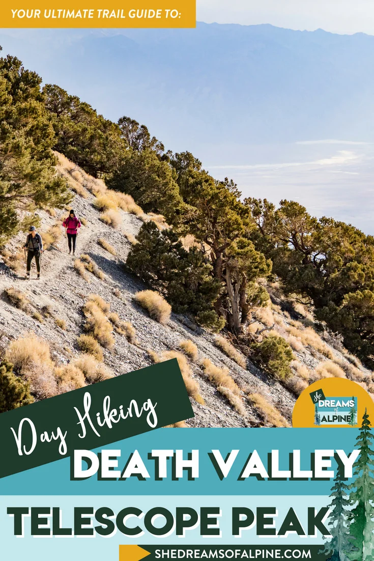
The Ultimate Guide to the Telescope Peak Hike in Death Valley National Park
I honestly can't believe that it's almost the end of 2017. This year flew by so fast! At the beginning of the year my friend, Ashima, and I wanted to try and hike a "big" peak a month together, we called it, A-Peak-A-Month Challenge. Alas, life sort of got in the way, I started focusing a lot more on bouldering, and Ashima moved to a different city and got a new job. So we didn't quite meet our goal of 12 peaks (hiked together). We still got some good mileage in though. We hiked Bastards ridge in the San Gabriel Mountains and bagged two new California 14ers (mountains with an elevation greater than 14,000 feet), White Mountain and Mount Shasta! Then we got to talking a couple of weeks ago and found a weekend that worked for both of us, and decided to grab one more summit before the end of 2017... Telescope Peak.
Telescope peak hike- QUICK INFO
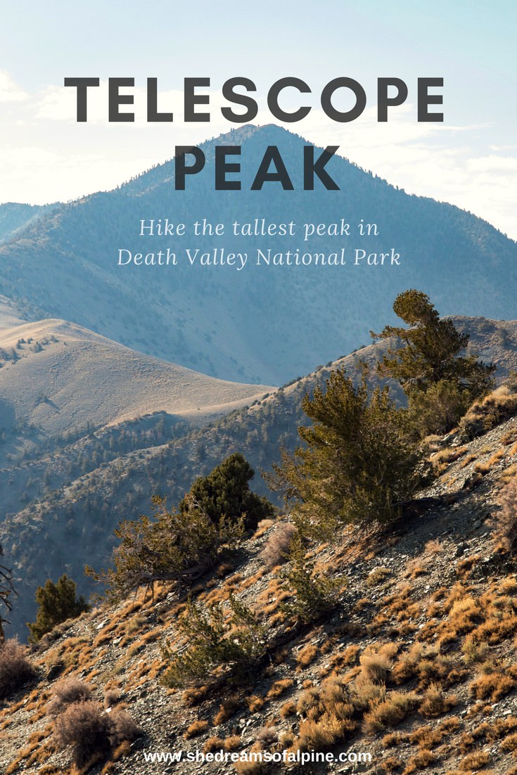
Telescope peak is located in Death Valley and is the highest point in Death Valley National Park. It belongs to the Panamint Mountains and from it's summit (on a clear day) you can see both Badwater Basin (lowest elevation in the United States) and Mount Whitney (highest elevation in the lower 48 states). Death Valley National Park is the largest national park outside of Alaska and is filled with a ton of diverse environments including sand dunes, salt flats, mountains, canyons and more. Hiking Telescope Peak you will be exposed to a lot of the diversity that Death Valley has to offer, including passing ancient bristlecone pine trees. Death Valley contains the lowest elevation in the United States, Badwater Basin at 282 feet below sea level, and it is also has the hottest recorded temperatures in the United States (the hottest temperature recorded to-date was 134F). Don't let that fool you though, it can also get very cold in Death Valley, the lowest temperature recorded was 15F. It has an interesting Native American and silver and gold mine history, however the only profitable commodity mined in the area was borax (a mineral that is used as a component in many of the items we use today). I wrote another post on how to spend a great weekend in Death Valley in a few posts prior to this.
telescope peak Hiking Details
~13 Miles Round Trip (The National Park Website says it is 14 miles, but my GPS said it was less)
~3,300 feet total elevation gain for trip
Trailhead elevation: 8,133 feet if starting at Mahogany Flat Campground
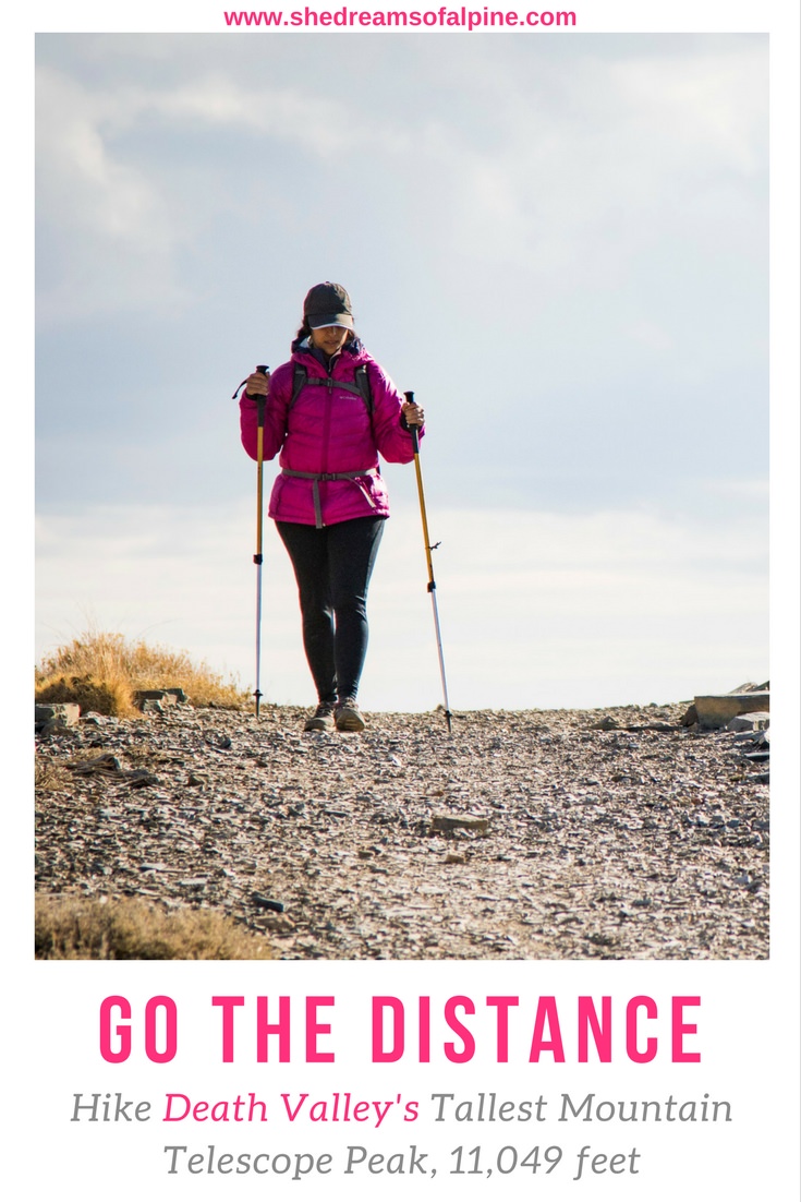
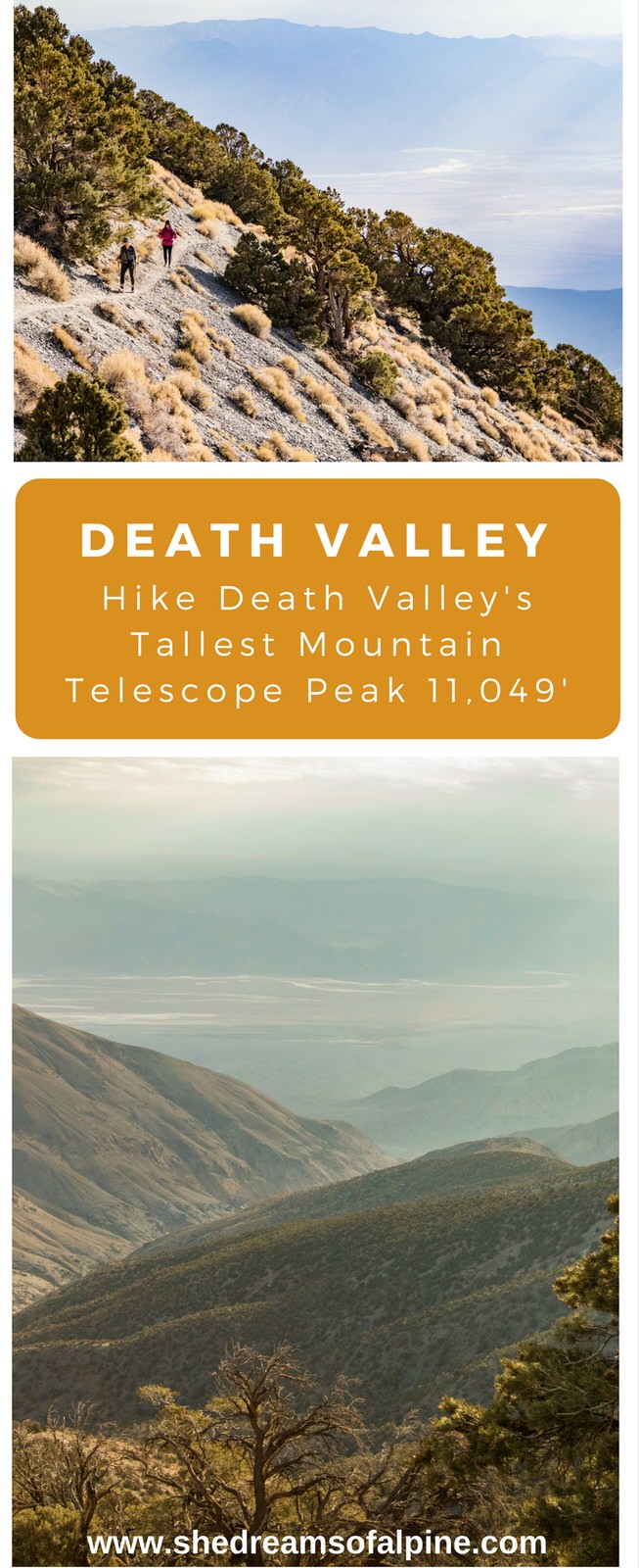
Highest Point on the trail: Telescope Peak, 11,049 feet
Estimated Time to complete: 7-9 hours
No water source along the way, so bring plenty of water for 7-9 hours
Dog friendly? Unfortunately, no dogs allowed on trails in the National Park
telescope peak trail Map
Below is a map of our hiking trail from my GPS that day. If you click on the image below you will be taken to an interactive map that you can further explore

DOWNLOAD THE GPX FILE FOR THIS TRAIL!
Knowledge is power my friend, and I'm a girl who loves data. Get access to this trails GPX file PLUS my library of GPX files with tracks and waypoints for all the trails loaded onto the She Dreams of Alpine blog.
Load this puppy into your trusted GPS and rest easy knowing you have tracks to follow on your next hike or backpacking trip.
Don’t have a GPS? You Should.
Look, I believe every hiker and backpacker should be self-sufficient, and that includes knowing how to practice smart navigational skills in the outdoors. This is something I teach in my backpacking program, but I want to give you a couple GPS options to get started. Don’t ever risk getting lost, and don’t rely on other people for your safety. Be empowered, take 100% ownership for yourself my friend. Here’s what I recommend:
1) GAIA GPS Phone App: At a bare minimum, consider getting a premium subscription to GAIA GPS App. This App allows you to download maps in advance and take them offline into the backcountry. You can record your tracks, upload tracks from online to follow (like the one I have above), and so much more with this phone app, and GAIA is offering a special discount to those who subscribe online through my link above, 20% off their normal prices. But even if you don’t use my link... please, at a minimum get a GPS phone app to help you navigate outdoors!
2) Handheld GPS: If you hike often or go backpacking, then I highly recommend you investing in a handheld GPS. I own a Garmin 64st and LOVE this device.
3) Handheld GPS with Satellite Communicator: However, if you have a little bit more money to spend, if I were starting over, I’d get the Garmin inReach Explorer+ which provides not only GPS tracking capabilities, but also an SOS satellite search and rescue communicator. I own the Garmin inReach mini now and I pair it with my Garmin 64st, but you can save weight by getting this all-in-one solution.
Elevation Profile

When to Go:
In my opinion, the best time to go is in the Winter. However, the Spring and Fall are also great options. Summertime in Death Valley can be very hot. Many people like to visit the park in the Springtime to see the wildflower blooms
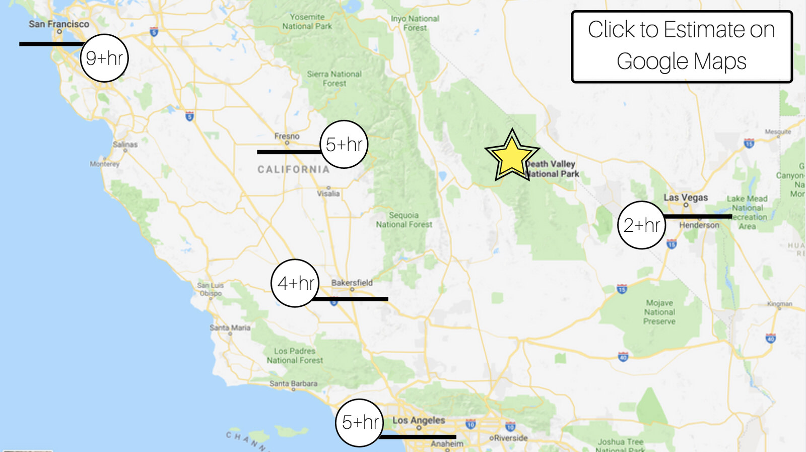
GETTING THERE
Death Valley National Park straddles the border of California and Nevada. If you are coming from the west of the park it is most easily accessed off of the highway 178 (otherwise known as Trona Road). Usually you will end up taking the 190 into the park as this highway bisects the park from the west and east side, but for Telescope Peak we found that it was quicker to continue strait on Trona Wildrose Road. We took this road all the way up to Emigrant Canyon Road, where we then turned right (toward Wildrose Campground). We drove all the way up to Mahogany Flat Campground, but you will definitely need a vehicle with good tires and clearance to get up there. The road get's particularly rough starting at Charcoal Kilns and then 1.5 miles up to Mahogany Flat Campground. Our friends, who didn't have a 4WD car, met us at Charcoal Kilns and then we road up together to Mahogany Flat Campground in Michael's Jeep. Also note that sometimes the gate to get up to Mahogany Flat Campgrounds is closed in the winter, depending on conditions, if this is the case, you can park at Charcoal Kilns and start your hike from there (which adds about another 3 miles to your total hike.
You can see below, depending on where you are coming from you could expect a 2-5 hour drive to the park. Unless you are further away (sorry San Fran), then you might want to plan a bit longer than a weekend to visit... unless you are just hardcore like that. There are some further instructions for directions on the National Park Service website, or click the map below for an estimate on Google Maps.
So again, more simplified, if coming from west of Death Valley:
Continue straight on Trona Wildrose Road
Turn Right on Emigrant Canyon Road
You will pass the Wildrose Campground (or you could potentially camp here too). Note, the road isn't super bad from Wildrose to Charcoal Kilns, but it isn't paved, you'll want to drive very cautiously.
You will come to a gate a Charcoal Kilns.
If gate is open AND you have good 4WD vehicle, continue on 1.5 miles (rought road) to Mahogany Flat Campground. If gate is closed, you will have to park at Charcoal Kilns and hike an extra 3 miles round trip.
Trailhead is at Mahogany Flat Campground
Camping Information
Primarily, there are two camping locations that are relatively close to the trailhead. You could camp at Wildrose Campground or Mahogany Flat Campground. Both of these sites are first-come-first-served campsites. Wildrose is open all year, and on the National Park Website it says that Mahogany flat campground is only open March-November. However, the campground was still open when we went this December, so we stayed there. They haven't really gotten any snow yet this season so I am guessing that is why the campground is still open. There is no camping allowed at Charcoal Kilns.
Permit Information:
The only permit information I could find was, "Climbers are asked to fill out a voluntary backcountry camping permit for backcountry hiking or camping at the Visitor or any ranger station". Since we were just day hiking, we didn't fill out any permit information.
GRAB MY [FREE] OUTDOOR BACKPACKER STARTER KIT:
I created the Ultimate Outdoor Backpacker Starter Kit for you (and it's FREE)! This starter kit is filled with 14 pages of my best hiking and backpacking tips to help you learn what it takes to become a safe, confident, and self-sufficient outdoor backpacker!
Day Hiking Telescope Peak Trip Report

We live about 3 and a half hours drive from Death Valley, so we decided to drive up to Mahogany Flat Campground on Friday night after work. We left around 6PM and (with stops) arrived around 10PM. We were meeting our friends at Charcoal Kilns first (since they didn't have a 4WD vehicle) and then rode the remaining 1.5 miles together in Michael's Jeep to Mahogany Flat Campground.
I had never seen Charcoal Kilns before this trip and when we drove up on Friday it was super dark out. I stepped out to use the bathroom at Charcoal Kilns while we waited for our friends and when I noticed the kilns they looked super creepy in the dark! Not kidding, I was not expecting it, haha! Not as scary in the daytime, we took a photo on our drive back Saturday, shown below. These kilns were built back in 1876 and were used to make charcoal back in the day. Death Valley claims that they are likely the best preserved charcoal kilns in North America. Pretty cool, but I would definitely not want to camp around them at night, they are super creepy + you can't camp there anyways.

When we pulled into Mahogany Flat Campground on Friday night, the campground was pretty empty, so we had no issue finding a spot. Friday night the weather was pretty perfect, even though it is already mid-December.
We woke up with the sun around 6:45 AM and got ready, ate breakfast. We began our hike around 8:00 AM. Saturday morning was pretty cold compared to the night before and at first our hands were freezing and felt like little popsicles, so possibly consider brining warmer gloves if you are going to hike this in the wintertime.


The first couple of miles were all uphill pretty much. I believe we covered about 1300 feet of elevation gain in the first 2 miles. The views though, were majestic AF. Seriously. There was this magical sun-ray views for pretty much the whole hike.

The hike is pretty much exposed the entire time, you don't wander through any forests or anything. This makes it great for views, but make sure to wear plenty of sunscreen. For the first part of the hike you get great views into Badwater Basin, the lowest elevation in the United States. We went there on our last trip to Death Valley.

After 2-3 miles the elevation gain eases up for a while and you traverse along between a couple of other peaks. First you pass Rodgers Peak and then you pass Bennett Peak. If you were feeling extra ambitious, you could add those to your itinerary and get a couple extra peaks in on your day. Ashima and I did this back in May on Bastards Ridge, we went out with plans to summit 5 peaks, but only climbed 2 of them because of calves were wrecked. Regardless, still was fun to try and get multiple summits!

I've also read that some people backpack from Badwater Basin (282 feet below sea level) to Telescope Peak (11,049 feet). That's over 11,000 feet of elevation gain! The only time I've ever hiked that much gain was our backpacking trip from Onion Valley to Whitney Portal, but that was over 4 days! That would be epic though... not as epic as those people who run from Badwater to Whitney Portal for ultramarathon... but i digress.
Check out the cloud coverage and shadows in the photo below. So cool!

And a little close-up below of Badwater Basin. The views were really great from the hike, there was probably a bit of lingering fire smoke from all the fires that have been going on near Los Angeles recently though.

We met a guy on the hike who was telling us about all the different trees there were in this area. I wish I had gotten him on my video (embedded below this post), but I didn't think about it at the time. He told us about the pinyon pine tree which were all over especially near the Mahogany Flat Campground. You can apparently eat the pinyon pine tree nuts. They are similar to pine nuts (that we eat with Italian food) but have a slightly different taste. Back in the day, these were a crucial food source for pre-historic Indians in this region of the United States. Pretty cool stuff. I love meeting people on the trail... If you really want to geek out on pinyon pines, read Death Valley Jims blog post on the pinyon pine tree, I found it very informative!
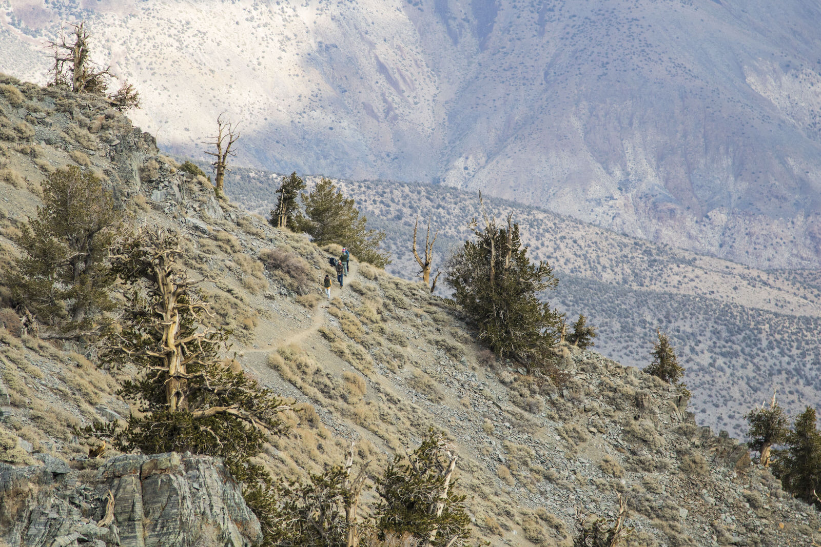
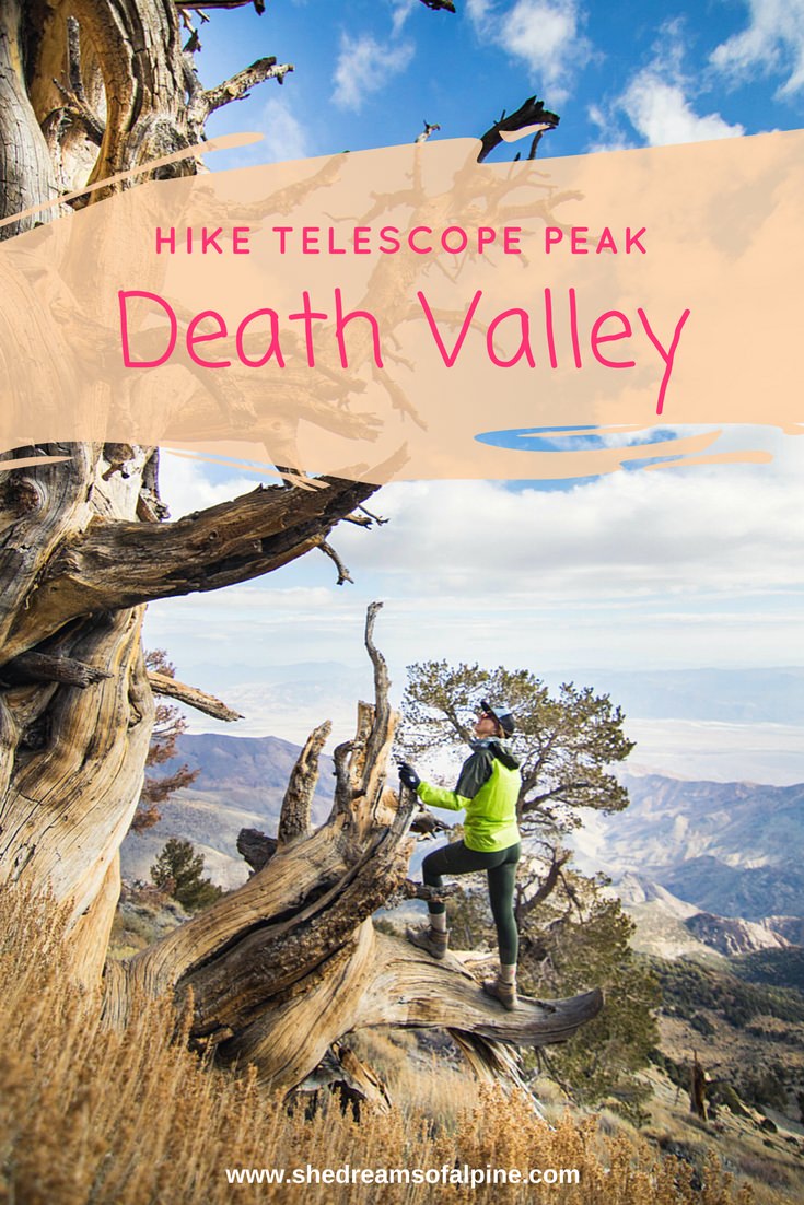
Here are some gnarly ancient bristlecone pine trees right along the trail.

We took our first snack/rest break at these bristlecone pine trees and admired the views and great weather for a bit.


At around 5.3 miles you will hit some switchbacks. This is where you will start going uphill again and is really the "final push" before the summit.
At the top of the switchbacks there is a "saddle" and if you walk around the saddle a bit, you will easily see the summit in the distance. The hike is basically over at that point.

Naturally, when we reached the summit, we had to take our "classic" summit picture. Our final peak-a-month-but-not-really picture.

The views from the top were amazing. It was a 360 view of pretty much everything. You can see Badwater Basin and the Sierra Nevada all at the same time. I'm told, on a very clear day you can even see the summit of Mount Whitney from the top of Telescope Peak.
It was actually even snowing a tiny bit when we got to the top! Pretty crazy, but it looked so magestic!


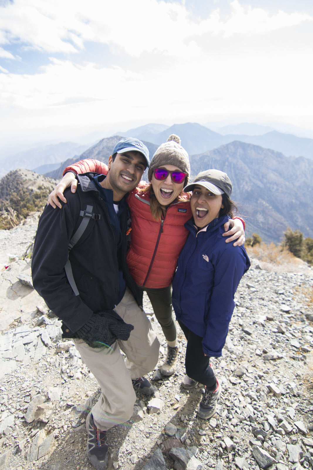
Signed the summit register, ate some grub, and asked a stranger to take a group photo of us. There's Michael, in yellow, the man behind the beautiful photos in this post, my partner in crime. I need to learn to take just as good photos as him so you guys can see more of his beautiful face instead of my same old mug.

All in all, the hike was pretty chill. Definitely a challenge, and I suppose because of the longer distance and elevation gain it might be considered a "difficult" hike, but it's made easier by the fact that the highest elevation is only 11,049'. I definitely did much better than I did on White Mountain, where I got a bit of altitude sickness.
The hike back down to the car though got really really cold! We turned around about noon and then the clouds came in and covered up the sun and made it very chilly. When we got back to the car it said that it was 34 degrees F! We were definitely underdressed for that cold of weather, but we made it back just fine.

We got back to the car around 3:30 PM. Total hiking time probably around 6 and half to 7 hours if you don't include resting time. I think if I had been training more for hiking recently this hike would've gone by even quicker than 7 total hours, but we took our time getting to the top. I'd say if you are in really good shape, you could probably hike this in 4-5 hours no problem. If you are in "medium shape" maybe plan for about 7 hours. If you are not in very good shape, plan for 9 hours. That's just an estimate though.

We decided to drive back all the way home after our hike instead of stay in Death Valley, but you could easily spend another night there and explore more the next day. We had a family event to go to on Sunday and our friends were flying out to Singapore in a couple of days, so we just decided to go home straight away.
Here's a short video from the trip. Subscribe to my Youtube Channel if you're into that kind of thing, I hope to build this site up more in the future with more content, for now it has a smattering of some of our past trips.
Additional Resources
Note: This post contains affiliate links.
For the hiking gear I use regularly, check out my Outdoor Gear page.
For tips on the gear we use to take our outdoor adventure photography. Check out the post that Michael helped me write on the gear we use for taking the photos on our trips (like the ones in today's post!)
This trip was fairly simple and doesn't require a whole lot of extra supplies. Even driving was fairly simple. However, it's always great to have a map, as the cell service isn't the best out there... more like non-existent.

National Geographic Trails Illustrated Maps are my favorite! They've got a ton of great detail, I bought one recently for our Tuolumne backpacking trip.
We also have quite a few Tom Harrison Maps, you can also typically find these in gas stations around the National Parks area too, which can be nice.
There is also this cool photographers guide on Death Valley: Death Valley Photographers Guide
But also, if you liked the photos above, check out our recent post on our Outdoor Adventure Photography Toolkit. Michael took the photos above with the gear on that list.
If you want more information on hiking trails in Death Valley: A Falcon Guide to Hiking Death Valleys Greatest Trails
Also, we were lucky this time, and didn't get a flat tire, but if you read our last post about Death Valley , we DID get a flat tire. We now always come prepared just in case we do get a flat on these back roads. Learn from us, and always be prepared for the worst! Here's what we now carry in our car on all of our adventures for these worst case scenarios:

First, make sure to have a spare tire and tire jack and tire iron if you have the space in your car. Both of our cars have these already standard.
Fix-a-Flat - This stuff has literally saved our butts before when we got a flat on our way back from White Mountain. We always have one in our car now.
Always good to have some standard jumper cables as well. Get a pair with a smaller gauge number like 4 gauge or 6 gauge. These mean that the wire inside the cable is thicker, thus more reliable long term.
My dad also bought me jumper cable battery booster after one trip when I got done with a solo backpacking loop and came back to a car with no battery. I got lucky and was able to still find someone in the parking lot who could give me a jump. However, we now always bring this thing with us too because sometimes on back roads you never know how long it will take you until you run into someone, and this way you can boost your own battery back to life. I carry both this and standard jumper cables.
A jerry can could be nice if you can afford the room.. I'll admit though, we don't carry one of these, but we watch our gas tank very very closely on trips like these.
Lastly, Duct Tape ... seriously though, always good to carry.
This is by no means a comprehensive list of emergency supplies, I'll have to save that for another post, but this would be the bare minimum in my opinion (Besides water, food, and some way to stay warm, but we always have these items already on outdoor trips).
Hope you are able to go check out Telescope Peak. The views were epic and I am really glad we were able to knock this off of our ticklist before the end of 2017! It could be cool to come back and mountaineer this peak if they get more snow... but I'll save that for another trip :)
Cheers,
Allison - She Dreams of Alpine

Did you enjoy this post on Hiking Telescope Peak? Please take a moment to share it on Pinterest or other social media!

Related Posts:


15 Incredible Joshua Tree Hikes to Explore the Desert | Entering Joshua Tree National Park is like landing on another planet – the landscape of rock formations and gnarled Joshua trees is simply otherworldly. To fully explore this crazy cool desert landscape, you’ll want to try one of these 15 amazing Joshua Tree hikes in the park. | shedreamsofalpine.com